

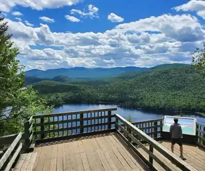
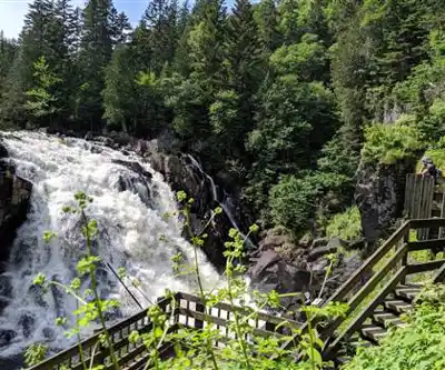
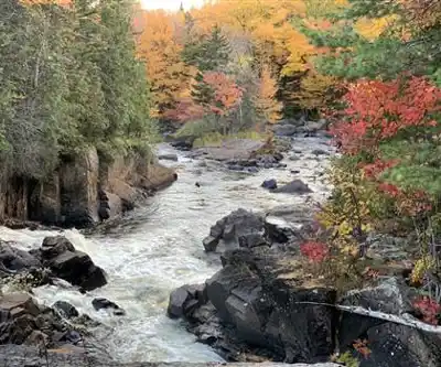
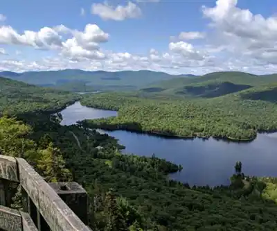
Ready to explore Parc National Du Mont-tremblant? Here's everything you need to know before you go!
Discover the trail
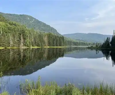
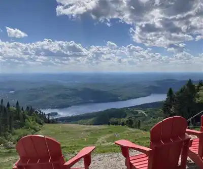
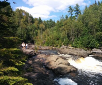
6
community photos
Available trails
| Trails | Distance | Elevation | Duration | Difficulty | GPX |
|---|---|---|---|---|---|
| 2.5 km | 33min | Beginner | |||
| 6.5 km | 1h30 | Beginner | |||
| 2.7 km | 36min | Beginner | |||
| 3 km | 40min | Beginner | |||
| 5 km | 1h | Beginner | |||
| 4.1 km | 180 m | 1h30 | Intermediate | ||
| 1.6 km | 80 m | 29min | Intermediate | ||
| 2.5 km | 220 m | 54min | Intermediate | ||
| 4.4 km | 59min | Intermediate | |||
| 3.3 km | 44min | Intermediate | |||
| 5.5 km | 185 m | 1h30 | Advanced | ||
| 9.2 km | 400 m | 3h | Advanced | ||
| 7.5 km | 400 m | 2h30 | Advanced |
Click a trail to see it on the map
Trail description
Désolé, nous n'avons pas de description pour cet endroit.
Soyez le premier à partager plus d'informations sur cet endroit.
Soyez le premier à partager plus d'informations sur cet endroit.
Recommended gear for this trail
LGPO Pick

Salomon
Elixir Tour Mid WP
Waterproof mid-height boot ideal for rocky terrain
203.38 $


Affiliate links — LGPO may earn a commission at no extra cost to you.
Ready to go?
Everything you need to know before you goAddress
4456, chemin du Lac-Supérieur Lac-Supérieur (Québec) J0T 1P0
GPS coordinates
46.2612, -74.5101
Phone
819 688-2281
Starting Point
The trailhead for Parc National Du Mont-tremblant is located in Saint-Jovite, in the Laurentian region. To access it, take Highway 117 and head north.
When?
Opening hours
From sunrise to sunset
Varies by season
Best season
Fall
Spectacular colors
Best time
Early morning
Less crowded
Weather (next days)
Loading
How much?
Entry fees
Adult
$ 8.5
Child
—
What to bring?
Gear
- Hiking shoes Essential
- → Salomon Elixir Tour Mid WP · 203.38 $
- Layered clothing Essential
- Rain jacket Essential
- Trekking poles
- → Black Diamond Trail Ergo Cork · 69.99 $
- Headlamp
- → Petzl Actik Core 625 · 103.95 $
Water & food
2L minimum
No water point on the trail
Bring energy snacks for a 4h+ hike
Good to know
Park rules
No dogs
Safety
Download the GPX before you go
Limited cellular coverage on the trail
Slippery after rain
Be careful on rocky sections
In an emergency
Emergency
911
Parking GPS
46.2612, -74.5101
Center
819 688-2281
FAQ - Frequently asked questions
Everything you need to knowHard
875.00 M
968.00 M
48h10
No
8.50 $
No
The Parc National Du Mont-tremblant trail covers a distance of 192.3 km. This is a substantial distance that would typically require multiple days to complete.
Parc National Du Mont-tremblant features an elevation gain of 875 meters. This moderate elevation change is spread across the 192.3 km distance.
No, dogs are not allowed on the Parc National Du Mont-tremblant trail. Be sure to make alternative arrangements for your pets before visiting.
No, access to Parc National Du Mont-tremblant is not free. There are entrance fees required to access the park and its trails.
Parc National Du Mont-tremblant is open from sunrise to sunset. Plan your visit accordingly and ensure you exit the park before closing time.
Didn't find your answer?
Free
1 pages
The Essential Hiking Checklist
Everything you need for your next hike. Bilingual, printable, 1 page.
Download the free checklistSimilar hikes nearby
Discover other trails you might enjoy
Favorite
🐕
Dog allowed
Parc De La Rivière Doncaster
Laurentides
9.4 KM
2h45
232 m
Beginner
4.7
(18)

Favorite
Parc Du Domaine Vert
Laurentides
6 KM
1h30
32 m
Beginner
4.6
(26)

Favorite
Parc national d'Oka
Laurentides
30 KM
8h30
100 m
Beginner
4.3
(36)

Favorite
Sommet Saint-Sauveur
Laurentides
2.5 km
1h15
416 m
Beginner
4.1
(33)

🐕
Dog allowed
Mont Condor
Laurentides
2.3 KM
1h15
196 m
Beginner
5.0
(31)

Montagne Du Dépôt Et Montagne Du Caribou
Laurentides
3.2 KM
1h30
180 m
Intermediate
5.0
(24)
Top 10 best hiking in Laurentides
Our ranking based on hiker reviews
Hiking near Laval
97 trails to explore ~96 km away
Did you spot an error?
We work hard to provide the most up-to-date and error-free data possible. If something seems incorrect, let us know! Your contribution helps the whole community.
Hikers' opinions
Be the first to review!
No hiker has shared their experience yet. Share your impressions and help other hikers!