

Ready to explore Parc National Du Mont-Saint-Bruno? Here's everything you need to know before you go!
Discover the trail
Trail description
Description
Parc national du Mont-Saint-Bruno sits in the Montérégie region of Quebec, just southeast of Montreal, and it punches well above its weight for a park this close to a major city. It's a genuine natural refuge — forested hills, quiet lakes, and a trail network that draws everyone from families with young kids to serious hikers looking for a solid half-day outing. The park is managed by the Société des établissements de plein air du Québec (Sépaq), which means well-maintained infrastructure, clear signage, and reliable access year-round.
The Terrain
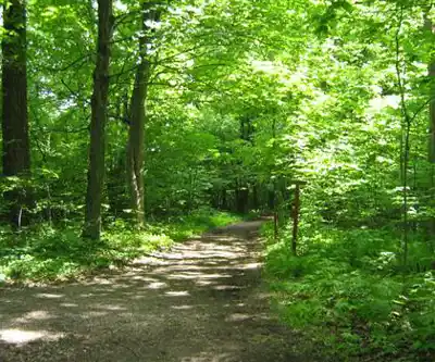
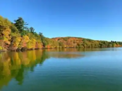
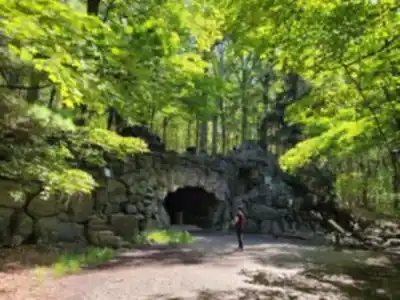
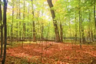
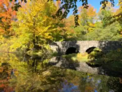
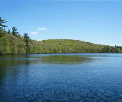
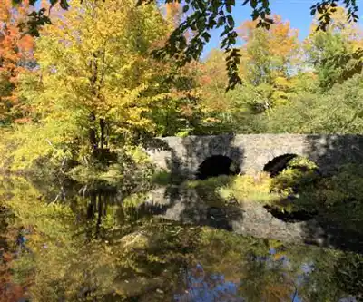
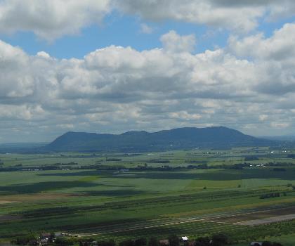
Mont-Saint-Bruno is one of the Montérégie hills — a cluster of isolated volcanic intrusions that rise sharply from the flat St. Lawrence lowlands. The summit isn't dramatic by alpine standards, but the topography creates a surprisingly varied landscape: mixed hardwood and conifer forest, several small lakes, wetlands, and rocky outcrops that give you open views without a brutal climb. The forest here is notably mature, with large sugar maples, yellow birches, and beeches that make it one of the best fall foliage destinations in the greater Montreal area.
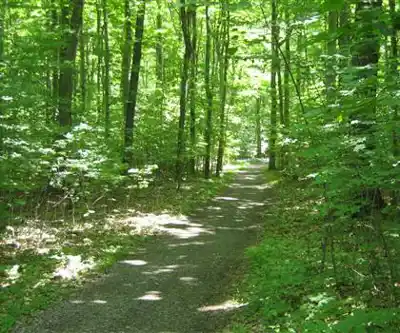
The trail network covers the main hill and loops around the lakes, giving you options depending on how much time and energy you have. Trails are generally well-groomed and clearly marked. Some sections have wooden boardwalks through wetter areas, which keeps your feet dry and protects the ecosystem.
What to Expect on the Trail
The hiking here is accessible without being boring. Most trails involve moderate elevation changes — enough to get your heart rate up and reward you with views, but nothing that requires technical gear or serious fitness. The network is designed so you can combine loops to extend your outing or keep it short if you're with kids or just want a casual walk.
The lakes are a highlight. You'll pass by or loop around several of them, and on a calm day the reflections in the water are worth stopping for. Birdwatching is genuinely good here — the park sits along migratory routes and the habitat diversity supports a wide range of species. Bring binoculars if that's your thing.
Trail surfaces vary: packed earth, roots, some rocky sections near the higher ground, and those boardwalk stretches in the lowland areas. Proper hiking footwear is always a good call, especially after rain when the clay-heavy soil can get slippery.
Facilities and Access
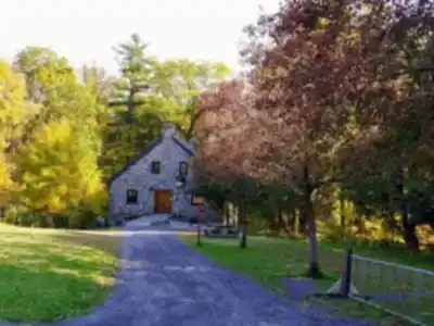
The park has a proper welcome station at the main entrance where you pay your Sépaq daily access fee. Washrooms, picnic areas, and a few rest spots are available on-site. The infrastructure is solid — this isn't a backcountry experience, and that's by design. It's a day-use park built for accessibility and regular use by a large regional population.
Parking is available at the main entrance. On busy weekends — especially during peak fall foliage season — the lot fills up early, so arriving before 9 a.m. is a smart move. The park is also accessible by public transit from the greater Montreal area, which is worth knowing if you'd rather skip the parking situation entirely.
Dogs and Bikes
Check current Sépaq guidelines before you go if you're planning to bring a dog or a bike. Policies on these can vary by season and trail designation, and the park's rules are enforced. The Sépaq website and the welcome station are your best sources for up-to-date information.
Seasons
Parc national du Mont-Saint-Bruno is a four-season park. Summer brings lush green canopy and comfortable hiking temperatures. Fall is arguably the peak season — the hardwood forest turns spectacular, and the park gets busy for good reason. Winter opens up a groomed cross-country ski and snowshoe network, making it one of the more accessible winter trail destinations in the Montérégie. Spring is quieter but can be muddy; trail conditions vary and it's worth checking before you head out.
Why This Park Stands Out in the Region
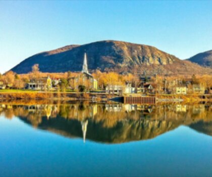
For anyone based in or visiting the greater Montreal area, Parc national du Mont-Saint-Bruno offers something that's genuinely hard to find this close to a major urban centre: a real forest, real elevation change, and a trail experience that feels removed from the city even though you're only a short drive away. The Montérégie hills are a distinctive geological feature of the Quebec landscape, and Mont-Saint-Bruno is one of the most accessible of the group.
- Location: Montérégie region, Quebec, managed by Sépaq
- Terrain type: Mixed hardwood and conifer forest, lakes, wetlands, volcanic hill topography
- Best for: Day hikes, family outings, fall foliage, birdwatching, winter skiing and snowshoeing
- Access: Main entrance with welcome station; daily Sépaq fee applies
- Year-round: Yes, with seasonal trail and activity variations
Whether you're a Montreal local looking for a regular escape or a visitor wanting to experience the Montérégie hills, Parc national du Mont-Saint-Bruno delivers a quality outdoor experience that's well worth the trip.
Services and amenities
This information may vary by season.
Recommended gear for this trail


Ready to go?
Everything you need to know before you goStarting Point
To access the hiking trails, head to the main entrance of the park. The primary parking lot is located at 330 Rang des Vingt-Cinq E, Saint-Bruno-de-Montarville, QC J3V 4P6. This is the main starting point for most of the trails in the area.
When?
How much?
- Hiking shoes Essential
- → Salomon Elixir Tour Mid WP · 203.38 $
- Layered clothing Essential
- Rain jacket Essential
- Trekking poles
- → Black Diamond Trail Ergo Cork · 69.99 $
- Headlamp
- → Petzl Actik Core 625 · 103.95 $
FAQ - Frequently asked questions
Everything you need to knowThe Essential Hiking Checklist
Everything you need for your next hike. Bilingual, printable, 1 page.
Download the free checklistSimilar hikes nearby
Discover other trails you might enjoy

Parc Michel Chartrand
Montérégie
Mont St Hilaire
Montérégie
Parc De La Cité
Montérégie
Rougemont Mount
Montérégie

Parc Régional De Beauharnois - Salaberry
Montérégie

Chouette À Voir
Montérégie
Hiking near Montreal
92 trails to explore ~18 km away
We work hard to provide the most up-to-date and error-free data possible. If something seems incorrect, let us know! Your contribution helps the whole community.
Hikers' opinions