


Ready to explore Mont Saint-Hilaire? Here's everything you need to know before you go!
Discover the trail


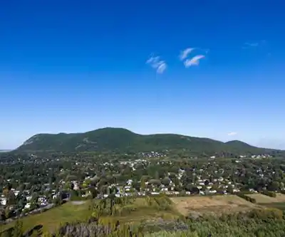
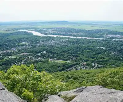
Photos: Julien Paquier-Galliard — Google Maps (Google Maps) Jeangagnon — CC BY-SA (Wikimedia Commons) Panoramio upload bot — CC BY (Wikimedia Commons) meantux — CC BY-NC (Flickr)
Available trails
| TrailTrails | Dist.Distance | GainElevation | TimeDuration | Difficulty | GPX |
|---|---|---|---|---|---|
|
Beginner
|
0.5 km | — | 15min | Beginner | |
|
Beginner
|
4.9 km | — | 1h | Beginner | |
|
Beginner
|
0.4 km | — | 15min | Beginner | |
|
Beginner
|
2.21 km | 160 m | 44min | Beginner | GPX |
|
Intermediate
|
3.7 km | 220 m | 1h30 | Intermediate | GPX |
|
Intermediate
|
2.6 km | 255 m | 58min | Intermediate | GPX |
|
Intermediate
|
8.8 km | 240 m | 2h30 | Intermediate | GPX |
GPX track: © OpenStreetMap contributors — ODbL 1.0
Trail description
Mont Saint-Hilaire is one of the most ecologically significant and rewarding hiking destinations in the greater Montréal area. Rising as a distinctive rounded peak from the flat agricultural landscape of the Montérégie region in Québec, it's the kind of place that earns a permanent spot on any serious hiker's list — not just for the views, but for the rare natural environment you move through on the way up.
A Protected Natural Environment
Mont Saint-Hilaire is part of the Gault Nature Reserve, managed by McGill University. It holds the distinction of being Québec's first UNESCO Biosphere Reserve, a designation that reflects just how exceptional its ecosystems are. The mountain is one of the Montérégie Hills — a group of isolated peaks that formed from ancient volcanic intrusions — and its forests have been protected long enough to develop into some of the most mature and biodiverse woodland in the province.
Because of this protected status, access to the mountain is managed carefully. Visitors must register and pay an entry fee before heading out on the trails. Dogs are not permitted on the reserve, and the trail network is reserved for hikers on foot — no bikes, no motorized vehicles. These rules exist to protect the integrity of the ecosystem, and they're taken seriously by staff on site.
The Terrain and Trail Network
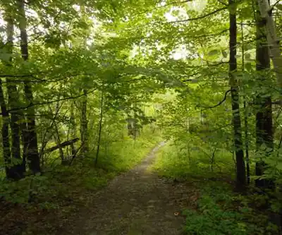
The trail system at Mont Saint-Hilaire winds through a landscape that feels genuinely wild for a mountain this close to a major urban centre. The forest is dense and varied — a mix of hardwoods and conifers that shifts as you gain elevation. The understory is rich, and in spring the forest floor comes alive with wildflowers that take advantage of the light before the canopy closes in.
The trails range from relatively gentle walking paths near the base to steeper, rockier sections as you approach the summit. The footing can be uneven in places, with exposed roots and rocky outcrops that require some attention, especially after rain. Hiking boots with good ankle support are a smart choice here. The network is well-marked, and the reserve provides maps at the entrance to help you plan your route.
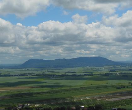
Several distinct summits and viewpoints are accessible within the reserve. The highest point offers an open panorama over the surrounding farmland, the St. Lawrence River valley, and on clear days, the Montréal skyline in the distance. It's a view that puts the mountain's geography into sharp perspective — this isolated peak standing above a broad, flat plain.
Wildlife and Biodiversity
Mont Saint-Hilaire is known among naturalists as one of the richest sites for biodiversity in Québec. The combination of mature forest, wetlands, and varied topography supports an impressive range of plant and animal species. Birdwatchers in particular make regular pilgrimages here — the reserve is a significant stopover point during migration, and the resident bird population is diverse year-round.
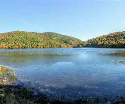
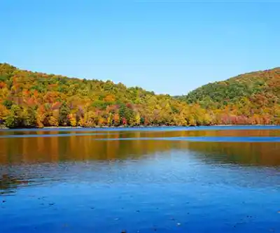
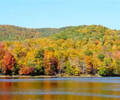
The wetland areas near the base of the mountain, including Lac Hertel, add another dimension to the natural environment. The lake is visible from several points along the trail network and reflects the surrounding forest in a way that makes it a natural rest stop and landmark during a hike.
Practical Information
The Gault Nature Reserve has a staffed entrance where visitors check in, pay the entry fee, and pick up a trail map. It's worth arriving early, especially on weekends and during peak fall foliage season, when the reserve draws significant crowds. Parking is available on site, but it fills up quickly on busy days.
- Entry fee: Required for all visitors — check the Gault Nature Reserve website for current rates
- Dogs: Not permitted anywhere in the reserve
- Bikes: Not permitted on the trails
- Trail maps: Available at the entrance
- Managed by: McGill University's Gault Nature Reserve
- UNESCO designation: Québec's first Biosphere Reserve
What Makes Mont Saint-Hilaire Stand Out
What separates Mont Saint-Hilaire from other accessible hikes in the Montérégie is the quality of the natural environment itself. This isn't a groomed park trail through second-growth forest — it's a mature, protected ecosystem that has been left largely undisturbed for decades. The result is a hiking experience that feels more remote and ecologically rich than the mountain's proximity to Montréal would suggest.
The combination of a genuine summit with open views, a protected old-growth forest, a scenic lake, and a well-managed trail network makes this one of the most complete hiking destinations in the region. Whether you're coming for the views, the wildlife, the fall colours, or simply a few hours away from the city in a genuinely wild environment, Mont Saint-Hilaire consistently delivers.
Getting There
Mont Saint-Hilaire is located in the Montérégie region of Québec, easily accessible by car from Montréal. The town of Mont-Saint-Hilaire sits at the base of the mountain, and the entrance to the Gault Nature Reserve is well-signposted from the main roads. Public transit options exist from Montréal via commuter rail to the Mont-Saint-Hilaire station, from which the reserve is reachable on foot or by local transport, making it one of the more accessible natural reserves in the province for those without a vehicle.
Services and amenities
This information may vary by season.
The Essential Hiking Checklist
Everything you need for your next hike. Bilingual, printable, 1 page.
Get your free hiking checklistRecommended gear for this trail
As an Amazon Associate I earn from qualifying purchases.


Ready to go?
Everything you need to know before you goStarting Point
From Route 116 in Mont-Saint-Hilaire, take Fortier Street, which becomes Ozias-Leduc Road. Then turn left onto Chemin de la Montagne. Then left again on Chemin des Moulins through which you access the Gault Nature Reserve.
When?
All year round, from 8 a.m. to 6 p.m. * Hours may vary by season.
Check the Reserve's website.
How much?
As an Amazon Associate I earn from qualifying purchases.
Affiliate links — LGPO may earn a commission at no extra cost to you.
- Hiking shoes Essential
- → Salomon Elixir Tour Mid WP · 203.38 $
- Layered clothing Essential
- Rain jacket Essential
- Trekking poles
- → Black Diamond Trail Ergo Cork · 69.99 $
- Headlamp
- → Petzl Actik Core 625 · 103.95 $
FAQ - Frequently asked questions
Everything you need to knowAlternatives and suggestions
Mont Saint-Grégoire offers a shorter and easier hike with a similar elevation gain, perfect for those looking for a quick adventure close to Mont Saint-Hilaire.
Parc Nature Bois Robert provides a moderate hike with a higher elevation gain, ideal for those seeking a more challenging experience in the Montérégie region.
Centre Écologique Fernand-seguin is a moderate trail with a shorter distance, suitable for hikers who prefer a quicker yet still engaging outing.
Similar hikes nearby
Discover other trails you might enjoy

Parc Michel Chartrand
Montérégie
Parc De La Cité
Montérégie
Mont Saint Bruno National Park
Montérégie
Rougemont Mount
Montérégie

Parc Régional De Beauharnois - Salaberry
Montérégie

Friends of the Lake Saint-François National Wildlife Area
Montérégie
Hiking near Montreal
92 trails to explore ~31 km away
We work hard to provide the most up-to-date and error-free data possible. If something seems incorrect, let us know! Your contribution helps the whole community.
Hikers' opinions
Be the first to review!
No hiker has shared their experience yet. Share your impressions and help other hikers!