

Ready to explore Mont Buet? Here's everything you need to know before you go!
Discover the trail
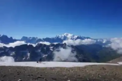
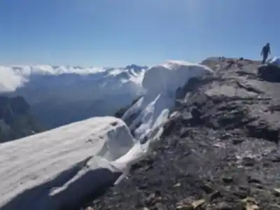
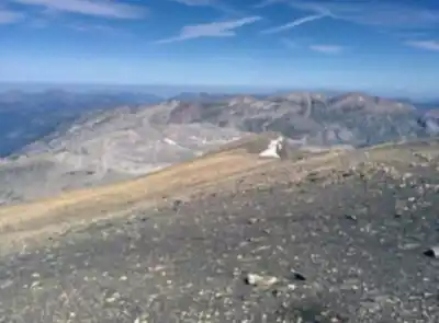
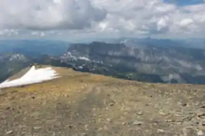
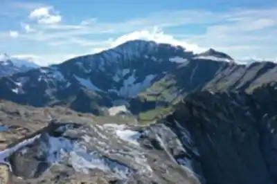
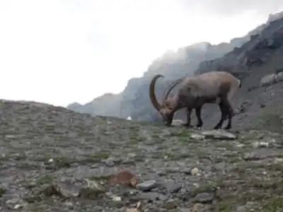
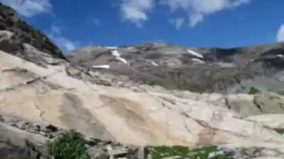
7
community photos
Available trails
| Trails | Distance | Elevation | Duration | Difficulty | GPX |
|---|---|---|---|---|---|
| 18.9 km | 1870 m | 7h | Expert |
Click a trail to see it on the map
Trail description
Désolé, nous n'avons pas de description pour cet endroit.
Soyez le premier à partager plus d'informations sur cet endroit.
Soyez le premier à partager plus d'informations sur cet endroit.
Recommended gear for this trail
LGPO Pick

Salomon
Elixir Tour Mid WP
Waterproof mid-height boot ideal for rocky terrain
203.38 $


Affiliate links — LGPO may earn a commission at no extra cost to you.
Ready to go?
Everything you need to know before you goStarting Point
Take off near the Chalet-hotel du Buet and the Gare du Buet, on the road from Chamonix to the Col de la Forclaz.
On the first part of the climb, follow the signs to the Refuge de la Pierre à Bérard.
(D/A) Head west toward the Chalets de la Poya.
When?
Opening hours
From sunrise to sunset
Varies by season
Best season
Fall
Spectacular colors
Best time
Early morning
Less crowded
Weather (next days)
Loading
How much?
Entry fees
Adult
Not available
Child
—
What to bring?
Gear
- Hiking shoes Essential
- → Salomon Elixir Tour Mid WP · 203.38 $
- Layered clothing Essential
- Rain jacket Essential
- Trekking poles
- → Black Diamond Trail Ergo Cork · 69.99 $
- Headlamp
- → Petzl Actik Core 625 · 103.95 $
Water & food
2L minimum
No water point on the trail
Bring energy snacks for a 4h+ hike
Good to know
Park rules
No dogs
Safety
Download the GPX before you go
Limited cellular coverage on the trail
Slippery after rain
Be careful on rocky sections
In an emergency
Emergency
911
Parking GPS
46.024804, 6.8523
Center
Not available
FAQ - Frequently asked questions
Everything you need to knowHard
1870.00 m
3096.00 m
7h45
No
No
The Mont Buet trail is rated as Easy difficulty. However, with 18.9 km distance and 1870 m of elevation gain, it still requires good physical preparation and hiking experience.
The Mont Buet trail covers 18.9 km with an elevation gain of 1870 m. This makes it a substantial day hike despite its Easy difficulty rating.
No, dogs are not allowed on the Mont Buet hiking trail. Plan accordingly if you typically hike with your pet.
No, parking is not free at the Mont Buet trailhead near Chalet-hotel du Buet and Gare du Buet. Budget for parking fees when planning your visit.
Yes, access to the Mont Buet trail is not free. Check current fees and payment methods before your visit.
Didn't find your answer?
Free
1 pages
The Essential Hiking Checklist
Everything you need for your next hike. Bilingual, printable, 1 page.
Download the free checklistSimilar hikes nearby
Discover other trails you might enjoy

Cirque Du Fer A Cheval
Haute-Savoie
3.2 km
2h30
272 m
Intermediate
4.8
(12)
Cascade de Bérard
Haute-Savoie
4.2 km
1h30
300 m
Beginner
4.8
(9)
Cascade du Rouget
Haute-Savoie
4.5 km
1h30
600 m
Beginner
4.7
(18)
Cascade d'Angon
Haute-Savoie
8.5 km
2h30
313 m
Intermediate
4.6
(20)
Col du Pré Vernet
Haute-Savoie
8.5 km
3h15
770 m
Intermediate
4.6
(13)
Lac Vert
Haute-Savoie
4.5 km
2h15
300 m
Intermediate
4.6
(12)
Top 10 best hiking in Haute-Savoie
Our ranking based on hiker reviews
Hiking near Sydney
22 trails to explore ~5023 km away
Did you spot an error?
We work hard to provide the most up-to-date and error-free data possible. If something seems incorrect, let us know! Your contribution helps the whole community.
Hikers' opinions