
By
lydia.crawford
•
Mont Sainte-Anne Statistics
Difficulty |
Moderate |
Distance |
33 KM |
Height |
803 meters |
Elevation gain |
625 meters |
Dog allowed |
What are the activities ?)
Hiking
Skiing
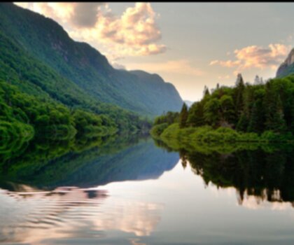
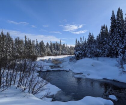
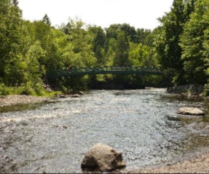
See photos of hiking


Why choose a trail at Mont Sainte-Anne?
No description
What are the services on site?
Parking
Reception
Toilet
Belvedere
Lodging
Restaurant
Bridge
Interpretation Center
Shuttle
Picnic table
Camping
Mont Sainte-Anne trails list and map ?
| Trails | Distance | Elevation | Type | Difficulty |
|---|---|---|---|---|
| Tour du lac | 2 km | 0 m | Loop | Beginner |
| Le Chemin des belvédères | 1.6 km | 0 m | Loop | Beginner |
| Le Panorama | 0.7 km | 0 m | Linear | Beginner |
| La Pichard | 3.9 km | 610 m | Linear | Intermediate |
| Sentier des Chutes Jean-Larose | 3.9 km | 100 m | Loop | Intermediate |
| Le Sentier des pionniers | 3 km | 610 m | Linear | Intermediate |
| L'Express | 1.7 km | 460 m | Linear | Intermediate |
| La Libériste | 8.8 km | 540 m | Linear | Advanced |
| La Crête | 3.8 km | 590 m | Linear | Advanced |
| La Gondoleuse | 2.7 km | 610 m | Linear | Advanced |
| Boucle du mont Sainte-Anne | 7.1 km | 625 m | Loop | Advanced |
Rate & open hour
Access fee
$ 8.00
/ $ 6.00 (Child)
Schedule
Monday: 9:00 AM – 4:00 PM
Tuesday: 9:00 AM – 4:00 PM
Wednesday: 9:00 AM – 4:00 PM
Thursday: 9:00 AM – 4:00 PM
Friday: 9:00 AM – 4:00 PM
Saturday: 9:00 AM – 4:00 PM
Sunday: 9:00 AM – 4:00 PM
Coordinates
-70.923666
47.08370739999999
47.08370739999999
What are the coordinates and address ?
Mont-Sainte-Anne
(418) 827-4561
2000 Boulevard du Beau Pré, Beaupré, QC G0A 1E0, Canada
Let’s Answer Your Questions - FAQ
-
Moderate
-
625.00 M
-
803.00 M
-
Monday: 9:00 AM – 4:00 PM
Tuesday: 9:00 AM – 4:00 PM
Wednesday: 9:00 AM – 4:00 PM
Thursday: 9:00 AM – 4:00 PM
Friday: 9:00 AM – 4:00 PM
Saturday: 9:00 AM – 4:00 PM
Sunday: 9:00 AM – 4:00 PM -
Yes
-
No
-
8.00 $
-
Yes
What is the level of difficulty of Mont Sainte-Anne ?
What is the elevation of Mont Sainte-Anne?
What is the height of Mont Sainte-Anne ?
What are the opening hours?
Are dogs allowed?
Is the place are families friendly?
How much does a ticket cost?
Is there an information center / service center / reception?

Shared by
Lydia Crawford, an extraordinary woman with an insatiable zest for life, has become an inspirational figure to many through her adventures and infectious good humor. Born and raised in a small town nestled in the mountains, Lydia developed a love for the outdoors at an early age. Her childhood was filled with hiking, camping, and exploring the wilderness, experiences that shaped her into the avid outdoorswoman she is today.
She life was a celebration of adventure, joy, and the great outdoors. She lived with a fierce determination to enjoy every moment and to share that joy with others. Her legacy is one of laughter, exploration, and an unwavering love for the natural world. Lydia's spirit continues to inspire those who knew her and those who discover her story, reminding us all to embrace life with open arms and a heart full of joy.
She life was a celebration of adventure, joy, and the great outdoors. She lived with a fierce determination to enjoy every moment and to share that joy with others. Her legacy is one of laughter, exploration, and an unwavering love for the natural world. Lydia's spirit continues to inspire those who knew her and those who discover her story, reminding us all to embrace life with open arms and a heart full of joy.


Hiker reviews
4 out of 5 stars
Based on 26 reviews
Recent reviews
5 out of 5 stars
Staying here for a conference. Great hotel and amenities. We fle into Quebec City and rented a car. Easy to find. Hotel service is amazing and so is the food.
5 out of 5 stars
We go every year for the DH world cup race. It's got something for everyone! Beautiful views, hikes, whatever you're into.
4 out of 5 stars
You need to try this place.
4 out of 5 stars
Superb