
Other trails to discover in Montérégie
Even though Mont Yamaska is no longer accessible, the Montérégie area is full of great hiking trails worth visiting. Here are our suggestions nearby.
Similar hikes nearby
Discover other trails you might enjoy

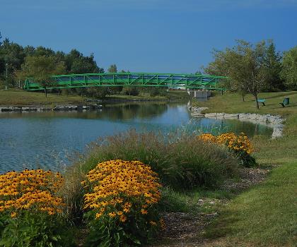
Parc Michel Chartrand
Montérégie
Parc De La Cité
Montérégie
Mont Saint Bruno National Park
Montérégie
Mont St Hilaire
Montérégie
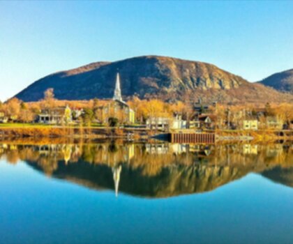
Rougemont Mount
Montérégie

Parc Régional De Beauharnois - Salaberry
Montérégie
Learn more about Mont Yamaska
The information below predates the closure and is kept for reference purposes.
Trail description
Description
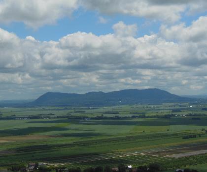
Mont Yamaska rises 410 meters above the Saint-Paul-d'Abbotsford landscape as one of Quebec's nine distinctive Monteregian Hills. This ancient volcanic formation, created 125 million years ago by an underwater magma eruption that never broke the surface, offers hikers a unique geological experience wrapped in accessible terrain. When glaciers carved away the surrounding softer sedimentary rock, they left behind the harder metamorphic core we see today—a testament to the powerful forces that shaped southern Quebec's topography.
What makes Mont Yamaska particularly appealing is its combination of easy accessibility and rewarding summit views. The 2.1-kilometer trail gains 261 meters of elevation over approximately 2.5 hours, making it an ideal choice for families, casual hikers, or anyone seeking panoramic vistas without technical challenges. The breathtaking views from the top are genuinely impressive for such a modest peak, offering sweeping perspectives across the Montérégie region that feel disproportionate to the mountain's size.
Access and Trail Conditions
Here's where Mont Yamaska differs significantly from typical hiking destinations: most of the mountain sits on private property, requiring advance permission for access. This isn't a trail you can simply show up to and start hiking. The primary access route runs through Les petits cailloux vineyard, and you'll need to contact them directly for authorization and current access information.
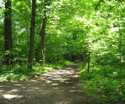
Once you've secured permission, the "trail" itself is actually a paved private road that winds through beautiful maple groves toward the summit. This makes for unusually comfortable footing compared to traditional hiking paths, though it also means you're walking on pavement rather than natural terrain for much of the journey. The road becomes progressively bumpier as you approach the top, adding some character to the final approach.
At the main junction partway up, you'll encounter a decision point. Turning right leads to a small lake that serves as Saint-Pie's aqueduct—a worthwhile detour if you have extra time. To reach the summit, bear left and follow the signs directing you toward the antenna installation at the peak. This final section becomes noticeably rougher as the road climbs more steeply.
Summit Experience
The summit of Mont Yamaska delivers an experience that consistently surprises visitors. Weather permitting, you're likely to encounter paragliders and hang gliders taking advantage of the mountain's favorable thermals and launch conditions. Watching these colorful wings drift across the valley below adds an unexpected dynamic element to your hiking experience.
The panoramic views stretch across the surrounding Montérégie countryside, offering perspectives that feel remarkably expansive given the mountain's modest elevation. On clear days, the vista encompasses rolling agricultural lands, distant mountain ridges, and the patchwork of communities that define this region of Quebec. The summit's open character ensures unobstructed sightlines in multiple directions.
Natural and Cultural Context
Mont Yamaska's geological significance extends beyond its volcanic origins. As one of the Monteregian Hills, it shares a common formation story with more famous peaks like Mount Royal in Montreal and Mont-Saint-Hilaire. These scattered hills represent the visible remnants of ancient magma intrusions, each one a window into the region's deep geological past.
The mountain's location in Saint-Paul-d'Abbotsford places it within a community that actively celebrates its natural heritage. The local municipal administration has worked to maintain the area's appeal for outdoor enthusiasts while preserving the cultural and historical elements that make this region distinctive. The municipality's commitment to maintaining clean, welcoming outdoor spaces—including services like animal waste collection—reflects a broader dedication to sustainable outdoor recreation.
The maple groves you'll walk through represent some of Quebec's classic forest ecosystems, particularly beautiful during autumn when the canopy transforms into brilliant displays of red, orange, and gold. These same trees likely contribute to local maple syrup production, connecting your hiking experience to one of Quebec's most iconic traditions.
Planning Your Visit
The private land access requirement makes advance planning essential for Mont Yamaska. Don't expect to make this a spontaneous hiking decision—contact Les petits cailloux vineyard well ahead of your intended visit date to arrange access and understand any current restrictions or requirements.
The easy difficulty rating and paved surface make this mountain accessible to a wide range of fitness levels and ages. The 2.5-hour duration includes time for enjoying the summit views and potentially watching paragliding activity. Consider bringing a camera to capture both the panoramic vistas and any aerial sports you might witness.
Given the unique access situation and the mountain's popularity among both hikers and paragliders, weekday visits may offer a quieter experience than weekends. The paved road surface means weather conditions are less likely to create muddy or slippery conditions, though ice in winter would obviously present challenges.
Mont Yamaska represents an unusual hiking opportunity—a geologically fascinating peak with excellent views, accessible terrain, and a distinctive access arrangement that sets it apart from Quebec's more conventional hiking destinations.
FAQ - Frequently asked questions
Everything you need to knowHiking near Montreal
92 trails to explore ~55 km away
We work hard to provide the most up-to-date and error-free data possible. If something seems incorrect, let us know! Your contribution helps the whole community.
Hikers' opinions