

Ready to explore Lac Vert? Here's everything you need to know before you go!
Discover the trail
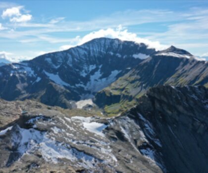
Oh no! We don't have any photos 😢
This trail hasn't been captured yet. Be the first to share your adventure!Trail description
Désolé, nous n'avons pas de description pour cet endroit.
Soyez le premier à partager plus d'informations sur cet endroit.
Soyez le premier à partager plus d'informations sur cet endroit.
Ready to go?
Everything you need to know before you goAddress
Lac Vert, 74480 Passy, France
GPS coordinates
45.9499316, 6.7531206
Phone
Not available
Starting Point
The Lac Vert trailhead is located in Saint-Étienne-de-Cuines, in the Auvergne-Rhône-Alpes region. To get there, take the D1091 in the direction of Saint-Étienne-de-Cuines and park in the parking lot at the entrance of the village.
When?
Opening hours
From sunrise to sunset
Varies by season
Best season
Fall
Spectacular colors
Best time
Early morning
Less crowded
Weather (next days)
Loading
How much?
Entry fees
Adult
Not available
Child
—
What to bring?
Gear
- Hiking shoes Essential
- Layered clothing Essential
- Rain jacket Essential
- Trekking poles
- Headlamp
Water & food
2L minimum
No water point on the trail
Bring energy snacks for a 4h+ hike
Good to know
Park rules
No dogs
Safety
Download the GPX before you go
Limited cellular coverage on the trail
Slippery after rain
Be careful on rocky sections
In an emergency
Emergency
911
Parking GPS
45.9499316, 6.7531206
Center
Not available
FAQ - Frequently asked questions
Everything you need to knowModerate
300.00
2h30
No
No
The Lac Vert trail takes approximately 2h30 to complete. This duration is based on the 6 km distance and 300 m elevation gain at a moderate hiking pace.
The Lac Vert trail covers a total distance of 6 km. Combined with the 300 m elevation gain, this makes for a moderate hiking experience.
Yes, the Lac Vert trail is rated as moderate difficulty, making it accessible to beginner hikers with basic fitness levels. The 300 m elevation gain over 6 km provides a manageable challenge for those new to hiking.
Didn't find your answer?
Free
1 pages
The Essential Hiking Checklist
Everything you need for your next hike. Bilingual, printable, 1 page.
Download the free checklistSimilar hikes nearby
Discover other trails you might enjoy
Favorite
Mont Buet, France
Haute-Savoie
18.9 KM
7h45
1870 M
Advanced
5.0
(12)

Cirque Du Fer A Cheval
Haute-Savoie
14 km
6h30
2000 m
Advanced
4.8
(3)
Cirque Du Fer A Cheval
Haute-Savoie
3.2 km
2h30
700 m
Intermediate
4.8
(12)
Cascade de Bérard
Haute-Savoie
4.2 km
1h30
260 m
Beginner
4.8
(9)
Cascade du Rouget
Haute-Savoie
4.5 km
1h30
200 m
Beginner
4.7
(18)
Cascade d'Angon
Haute-Savoie
8.5 km
2h30
500 m
Intermediate
4.6
(20)
Top 10 best hiking in Haute-Savoie
Our ranking based on hiker reviews
Hiking near Sydney
22 trails to explore ~5020 km away
Did you spot an error?
We work hard to provide the most up-to-date and error-free data possible. If something seems incorrect, let us know! Your contribution helps the whole community.
Hikers' opinions