


Ready to explore Mont Pinacle - Parc Harold F. Baldwin? Here's everything you need to know before you go!
Discover the trail
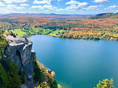
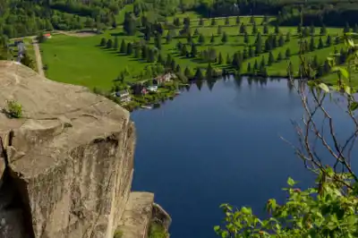
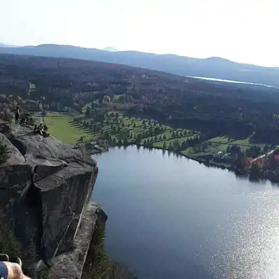
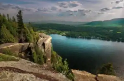
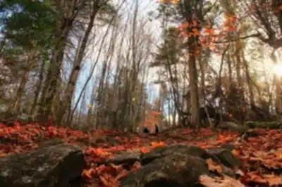
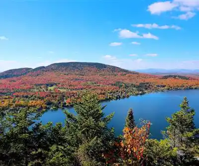
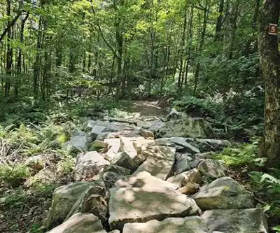
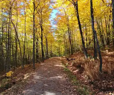
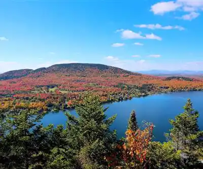
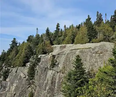
Photos: Jimmy Wang — Google Maps (Google Maps) Maya — Google Maps (Google Maps) Tim Forest — Google Maps (Google Maps) Martin Roy — Google Maps (Google Maps)
Available trails
| TrailTrails | Dist.Distance | GainElevation | TimeDuration | Difficulty | GPX |
|---|---|---|---|---|---|
|
Beginner
|
1.91 km | — | 25min | Beginner | |
|
Beginner
|
0.55 km | — | 15min | Beginner | |
|
Beginner
|
0.26 km | — | 15min | Beginner | |
|
Beginner
|
0.51 km | — | 15min | Beginner | |
|
Beginner
|
1 km | — | 15min | Beginner | |
|
Beginner
|
0.5 km | — | 15min | Beginner | |
|
Intermediate
|
4.41 km | 212 m | 1h30 | Intermediate |
Trail description
Mont Pinacle is one of those summits in the Eastern Townships that quietly earns a reputation among hikers who know the region well. Rising above the surrounding farmland and forest, it offers a genuine wilderness feel without requiring a multi-day expedition. Whether you're looking for a solid half-day outing or want to take your time exploring the trails, Mont Pinacle delivers a rewarding experience in the heart of Estrie.
The Mountain and Its Setting
Mont Pinacle sits in the Estrie region of Quebec, part of the Appalachian chain that runs through the Eastern Townships. The mountain's name refers to its distinctive rocky peak, which rises sharply above the surrounding mixed forest. The landscape here is classic Eastern Townships: rolling hills, hardwood and softwood forest, and open rocky outcrops that reward the effort of the climb.
The area around Mont Pinacle is managed as a nature reserve, which means the natural environment is a priority. You'll notice the difference — the trails feel less manicured than a provincial park, and the forest has a more untouched character. That's part of the appeal for hikers who want something a bit more raw than a groomed trail system.
The Trail Experience
The trails at Mont Pinacle wind through a mix of mature hardwood forest and rocky terrain as you gain elevation. Lower sections of the trail pass through stands of maple, beech, and yellow birch — the kind of forest that turns spectacular in fall. As you climb higher, the vegetation shifts and the trail becomes more rugged, with exposed roots and rocky footing that keeps you paying attention.
The final approach to the summit involves some steeper, rockier terrain. This is where Mont Pinacle earns its name — the pinacle, or pinnacle, is a genuine rocky high point that requires a bit of scrambling to reach. It's not technical climbing, but you'll want to use your hands in a few spots. The effort is worth it.
At the top, you're rewarded with open views over the Eastern Townships. On a clear day, the panorama stretches across the patchwork of farms, forests, and lakes that define this corner of Quebec. It's the kind of view that makes you want to sit down, eat your lunch slowly, and take it all in before heading back down.
What Makes Mont Pinacle Stand Out
A few things set Mont Pinacle apart from other hiking destinations in Estrie. First, the summit itself — that rocky pinnacle gives the mountain a distinct character and a genuine sense of arrival when you reach the top. Many hills in the region have forested summits with limited views; Mont Pinacle is not one of them.
Second, the nature reserve status means the area is managed with conservation in mind. You're hiking in a protected environment where wildlife and plant communities are given priority. This translates to a quieter, more natural experience on the trail.
Third, the trail system offers options. Whether you want a direct push to the summit or a longer loop that takes in more of the mountain's terrain, there are routes to match different goals and energy levels. It's a good mountain for hikers who want to build up their experience with more technical terrain without committing to something overwhelming.
Practical Information
Mont Pinacle is located in the Estrie region of Quebec. Access to the trailhead is by car, and there is a parking area at the site. As with many nature reserves in Quebec, it's worth checking current access conditions and any fees before you go — these details can change seasonally.
- Terrain: Mixed forest, rocky outcrops, exposed summit with scrambling near the top
- Best seasons: Spring through fall; the summit can be icy in shoulder seasons — check conditions before heading out
- Footwear: Hiking boots with ankle support are strongly recommended given the rocky, rooted terrain
- Dogs: Check current regulations with the managing organization before bringing pets
- Leave No Trace: As a nature reserve, pack out everything you bring in and stay on marked trails
Getting the Most Out of Your Visit
Give yourself enough time to reach the summit without rushing. The rocky terrain near the top rewards a steady, unhurried pace — both for safety and because the views open up gradually as you climb. Bring more water than you think you'll need, especially in warmer months when the exposed upper sections of the trail offer no shade.
Fall is a particularly strong time to visit Mont Pinacle. The hardwood forest on the lower slopes puts on a serious colour show, and the cooler temperatures make the climb more comfortable. The summit views over the Eastern Townships take on a different quality when the hills are covered in red, orange, and gold.
If you're visiting from outside the region, Mont Pinacle pairs well with other destinations in Estrie. The Eastern Townships have a strong network of hiking areas, and Mont Pinacle fits naturally into a longer outdoor weekend in the region.
Who This Hike Is For
Mont Pinacle is a good fit for hikers who are comfortable on uneven, rocky terrain and want a genuine summit experience. The scrambling near the top means it's not ideal for very young children or anyone uncomfortable with exposed rocky footing. That said, it's not a technical route — fit hikers with some trail experience will find it very manageable.
For hikers based in the Eastern Townships or visiting from Montreal, Mont Pinacle is the kind of destination that earns repeat visits. The summit views, the quality of the forest, and the character of the rocky peak make it one of the more memorable hikes in Estrie.
Services and amenities
This information may vary by season.
The Essential Hiking Checklist
Everything you need for your next hike. Bilingual, printable, 1 page.
Get your free hiking checklistRecommended gear for this trail
As an Amazon Associate I earn from qualifying purchases.


Ready to go?
Everything you need to know before you goStarting Point
Mount Pinnacle is just a few kilometers from the Nature Discovery Park. Hike 3 kilometers to the top of the mountain, the top of the mountain is 675 m (2,215 feet) above sea level, and you can enjoy the spectacular scenery.
There are several options of 2 to 3 km for the return trip.
Other starting point option:
You can park your car at Nature Discovery Park, and follow the Mills Trail to Baldwin Village, then follow the Pinnacle Mountain Trail. From there, it's a 7 km round trip.
When?
How much?
As an Amazon Associate I earn from qualifying purchases.
Affiliate links — LGPO may earn a commission at no extra cost to you.
- Hiking shoes Essential
- → Salomon Elixir Tour Mid WP · 203.38 $
- Layered clothing Essential
- Rain jacket Essential
- Trekking poles
- → Black Diamond Trail Ergo Cork · 69.99 $
- Headlamp
- → Petzl Actik Core 625 · 103.95 $
FAQ - Frequently asked questions
Everything you need to knowAlternatives and suggestions
Similar hikes nearby
Discover other trails you might enjoy

Mount Brome (Bromont)
Eastern Townships
Sutton Natural Environment Park
Eastern Townships

Parc De La Gorge De Coaticook
Eastern Townships

Mount Orford National Park
Eastern Townships

Parc national de Frontenac
Eastern Townships

Promenade du Lac-des-Nations
Eastern Townships
Hiking near Sherbrooke
53 trails to explore ~41 km away
We work hard to provide the most up-to-date and error-free data possible. If something seems incorrect, let us know! Your contribution helps the whole community.
Hikers' opinions
Be the first to review!
No hiker has shared their experience yet. Share your impressions and help other hikers!