


Ready to explore L'escapade - Les Sentiers Du Mont Rigaud? Here's everything you need to know before you go!
Discover the trail

Available trails
| TrailTrails | Dist.Distance | GainElevation | TimeDuration | Difficulty | GPX |
|---|---|---|---|---|---|
|
Beginner
|
1.2 km | — | 16min | Beginner | |
|
Intermediate
|
2.7 km | 120 m | 47min | Intermediate | |
|
Intermediate
|
2.6 km | 105 m | 44min | Intermediate | |
|
Intermediate
|
13.6 km | 100 m | 3h30 | Intermediate |
Trail description
Nestled in the rolling hills of Montérégie, Escapade — Les Sentiers du Mont Rigaud is one of the more rewarding trail networks in the greater Montreal area. Mont Rigaud isn't a towering summit by any measure, but what it lacks in raw elevation it more than makes up for in character — a genuine mix of forested terrain, varied trails, and a sense of getting away from it all without driving half a day to do it.
The Setting
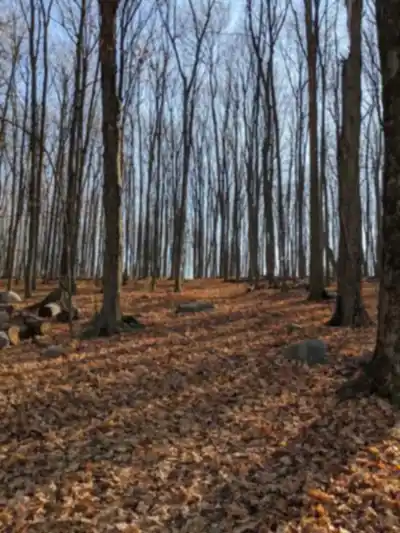
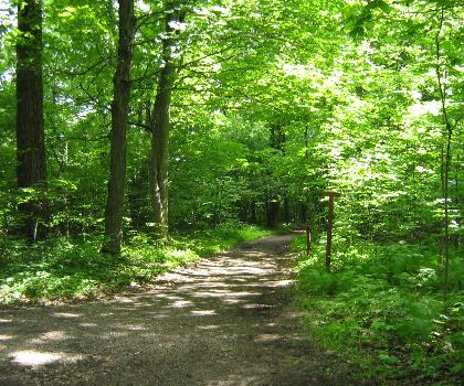
Mont Rigaud rises as a distinct natural landmark in the western reaches of Montérégie, standing apart from the flat agricultural landscape that surrounds it. The hill is largely forested, and the trail network here takes full advantage of that — you're walking through mature mixed forest for most of your time on the trails, with the canopy providing solid shade in summer and a striking display of colour come fall.
The area has a long history of outdoor recreation, and the trails reflect that. They've been developed and maintained with care, offering a network that works for a range of hikers — from families looking for a manageable outing to more experienced walkers who want to string together a longer loop and actually feel their legs at the end of it.
The Trails
The trail system at Les Sentiers du Mont Rigaud is a proper network — not just a single out-and-back path. Multiple routes wind through the forested slopes, giving you options depending on how much time you have and how hard you want to push. The terrain shifts as you move through the network: some sections are relatively gentle and well-groomed, while others get more rugged underfoot, with roots, rocks, and steeper pitches that ask a bit more of you.
The forested environment is the real draw here. The trails move through a mix of deciduous and coniferous trees, and the forest feels dense and alive in a way that's genuinely satisfying to walk through. You're not just passing through a thin strip of trees with subdivisions on either side — this is actual forest, and it shows.
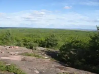
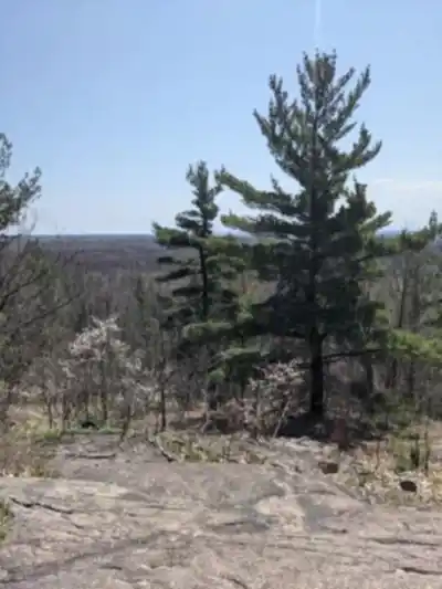
Elevation change is present throughout the network, even if Mont Rigaud isn't a high-altitude destination. The climbs are real enough to give the hike some physical substance, and the views from higher points on the hill offer perspective on the surrounding Montérégie landscape — the kind of open, agricultural lowlands that make a forested hilltop feel like a genuine escape.
What to Expect on the Ground
Trail conditions at Mont Rigaud vary by season, as you'd expect from a forested hill in Quebec. Spring can bring muddy stretches, especially on shadier sections where snowmelt lingers. Summer is lush and green, with the canopy keeping things cooler than you might expect. Fall is arguably the best time to visit — the mixed forest puts on a serious show, and the cooler temperatures make for ideal hiking conditions. Winter use is possible depending on conditions, though the network is primarily a three-season destination.
The trails are generally well-marked, which matters in a network with multiple intersecting routes. That said, it's always worth having a trail map on hand before you head out — knowing the layout of the network helps you plan your route and avoid any unnecessary backtracking.
Footwear matters here. Trail runners or light hiking boots are a solid choice for most conditions. In wet or early-season conditions, something with a bit more grip and waterproofing will serve you better on the rooted and rocky sections.
Getting There and Practical Info
Mont Rigaud is located in the town of Rigaud, in the western part of Montérégie — close enough to Montreal to make it a realistic day trip, and far enough to feel like you've actually left the city behind. The drive out is straightforward, following the highway west before dropping into the quieter roads around Rigaud itself.
Parking is available at the trailhead access point for the network. It's worth arriving earlier in the day on weekends, particularly in fall when the area draws more visitors looking to catch the foliage.
The Escapade designation reflects the managed nature of this trail network — this isn't a wild backcountry area, but a well-organized outdoor destination with maintained infrastructure. That's a good thing for most visitors: the trails are accessible, the signage is functional, and the overall experience is set up to work well for a day out.
Who It's For
- Families with older kids who are ready for real trails with some elevation change and varied terrain
- Hikers from the Montreal area looking for a forested hill experience without a long drive
- Fall foliage seekers — the mixed forest here delivers a strong autumn display
- Anyone wanting a genuine forest walk in a network with enough variety to keep things interesting
A Few Things Worth Knowing
Mont Rigaud sits in a part of Quebec that doesn't always get the same attention as the Laurentians or the Eastern Townships, but that's part of what makes it worth visiting. It's a local gem in the best sense — well-used by people who know it, and genuinely rewarding for those who make the trip out for the first time.
The network is managed under the Escapade program, which is worth looking into before your visit for current access information, any applicable fees, and seasonal updates on trail conditions. Checking in with the local organizers or the official site before heading out is always a good move, especially early or late in the season when conditions can shift quickly.
Bring water, wear layers if you're going in shoulder season, and give yourself enough time to explore more than just the first trail you hit — the network rewards a bit of wandering.
Services and amenities
This information may vary by season.
The Essential Hiking Checklist
Everything you need for your next hike. Bilingual, printable, 1 page.
Get your free hiking checklistRecommended gear for this trail
As an Amazon Associate I earn from qualifying purchases.


Ready to go?
Everything you need to know before you goStarting Point
The trails of Mont Rigaud are open from 9 a.m. every day, all year long. Access to the trails and parking lots is free. The itinerary is presented on a reception panel, with a trail map. There are also several parking lots located at different locations: L'escapade chalet, Bourget Road, Léry-MacDonald Park and the Sucrerie de la Montagne...
When?
How much?
As an Amazon Associate I earn from qualifying purchases.
Affiliate links — LGPO may earn a commission at no extra cost to you.
- Hiking shoes Essential
- → Salomon Elixir Tour Mid WP · 203.38 $
- Layered clothing Essential
- Rain jacket Essential
- Trekking poles
- → Black Diamond Trail Ergo Cork · 69.99 $
- Headlamp
- → Petzl Actik Core 625 · 103.95 $
FAQ - Frequently asked questions
Everything you need to knowSimilar hikes nearby
Discover other trails you might enjoy

Parc Michel Chartrand
Montérégie
Parc De La Cité
Montérégie
Mont Saint Bruno National Park
Montérégie
Mont St Hilaire
Montérégie
Rougemont Mount
Montérégie

Parc Régional De Beauharnois - Salaberry
Montérégie
Hiking near Laval
97 trails to explore ~48 km away
We work hard to provide the most up-to-date and error-free data possible. If something seems incorrect, let us know! Your contribution helps the whole community.
Hikers' opinions
Be the first to review!
No hiker has shared their experience yet. Share your impressions and help other hikers!