


Ready to explore Mont Rougemont? Here's everything you need to know before you go!
Discover the trail
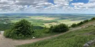
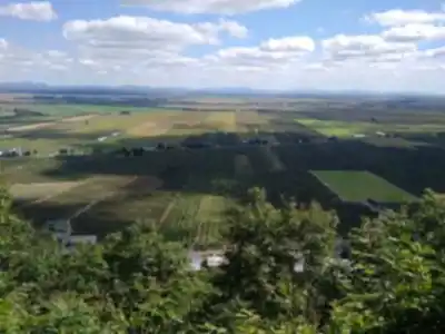
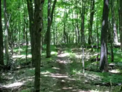
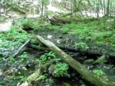
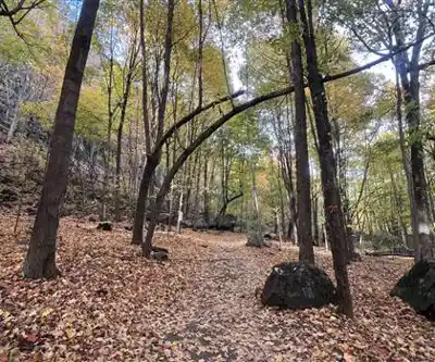
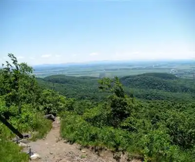
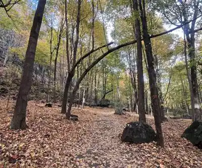
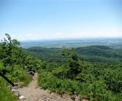
Photos: Sharon Lea — Google Maps (Google Maps) Eric Dupuis — Google Maps (Google Maps)
Available trails
| TrailTrails | Dist.Distance | GainElevation | TimeDuration | Difficulty | GPX |
|---|---|---|---|---|---|
|
Intermediate
|
5.25 km | 260 m | 1h30 | Intermediate |
Trail description
Mount Rougemont rises approximately 370-390 meters above the Montérégie plains, making it one of the most prominent Monteregian Hills southeast of Montreal. This ancient volcanic intrusion offers hikers a moderately challenging climb through diverse terrain, from dense hardwood forests to rocky outcrops with panoramic views across the St. Lawrence Valley. The mountain's unique position in the agricultural heartland of Quebec creates a striking contrast between summit trails and the orderly apple orchards that blanket the surrounding countryside.
The main trail network covers 3.2 kilometers with 330 meters of elevation gain, creating a moderate-rated hike that typically takes 2 hours and 45 minutes to complete. The trail winds through mixed forest with several sections requiring careful foot placement over roots and rocks. The reward comes at the summit, where cleared viewpoints reveal sweeping vistas of the Richelieu Valley and the surrounding Montérégie landscape.
Trail Experience and Terrain
The sentier rougemont begins gently through mixed forest dominated by sugar maple, yellow birch, and American beech. Early sections wind through relatively flat terrain, allowing hikers to warm up before the mountain reveals its true character. As you gain elevation, the trail becomes increasingly rocky and steep, with several sections requiring careful foot placement over loose stones and exposed roots.
The middle portion of the climb presents moderate technical challenges, where the path cuts through the mountainside. The forest composition shifts noticeably with altitude, transitioning from rich lowland species to more hardy mountain varieties adapted to the exposed conditions near the summit.
Multiple trails within the rougemont network offer different approaches and loop options, allowing hikers to vary their routes on return visits. The trail rougemont system connects several viewpoints, each offering distinct perspectives of the surrounding Montérégie landscape.
Wildlife and Natural Features
Mount Rougemont supports diverse wildlife populations that reflect both its forested habitat and proximity to agricultural lands. White-tailed deer are commonly spotted, particularly during early morning or late afternoon hikes. The mountain's varied elevations and forest types attract numerous bird species, including pileated woodpeckers, various warbler species during migration, and year-round residents like chickadees and nuthatches.
Spring hiking reveals spectacular wildflower displays as the forest floor comes alive with trilliums, bloodroot, and wild leeks before the canopy fully leafs out. Summer brings lush green foliage that provides welcome shade during the climbs, while autumn transforms the mountain into one of the region's premier fall color destinations. The mix of maple, birch, and oak creates a particularly vibrant display of reds, oranges, and yellows that peaks typically in late September to early October.
The mountain's geological history as a Monteregian Hill—formed by ancient igneous intrusions—becomes evident in the rocky outcrops encountered along the upper trails. These exposed sections provide interesting contrast to the surrounding sedimentary landscape of the St. Lawrence Lowlands.
Apple Orchard Country
Mount Rougemont sits at the heart of Quebec's premier apple-growing region, where numerous commercial orchards take advantage of the area's ideal microclimate and well-drained soils. The mountain's slopes and surrounding farmland produce numerous apple varieties, from traditional McIntosh and Cortland to newer cultivars developed specifically for Quebec's growing conditions.
The trailhead begins at Cidrerie Michel Jodoin, where visitors can enjoy free cider tastings and tours of the cidery after their hike. Many local orchards welcome visitors for pick-your-own experiences and seasonal festivals that celebrate the harvest. These working farms provide an authentic glimpse into Montérégie's agricultural heritage and offer perfect post-hike refreshment opportunities.
Timing visits during apple season—typically August through October—allows hikers to experience both mountain hiking and harvest activities in the orchards. Many farms also produce artisanal ciders, jams, and other apple-based products that make excellent souvenirs of your Rougemont adventure.
Planning Your Visit
Mount Rougemont's location just 45 minutes southeast of Montreal makes it an ideal day trip destination for outdoor enthusiasts. The mountain is easily accessible from Highway 10, with clear signage directing visitors to the trailhead at Cidrerie Michel Jodoin (100 Rang de la Montagne, Rougemont, QC J0L 1M0).
The facility includes designated parking (fee: $3 CAD), washroom facilities, and trail maps. Hikers should come prepared with water, snacks, and proper hiking boots with good tread for the rocky sections. Trekking poles can be helpful during steeper sections.
Trail conditions vary significantly with seasons, so checking current status before departure is essential. Spring hiking may encounter muddy conditions, while summer offers the most predictable conditions. The cidery operates daily from 9 am to 4 pm, which should guide your timing for the hike and post-hike refreshments.
Weather can change quickly on the mountain, particularly near the summit where exposure increases wind effects. Carrying extra layers and rain protection is recommended even on seemingly stable days.
Services and amenities
This information may vary by season.
Recommended gear for this trail
As an Amazon Associate I earn from qualifying purchases.


Ready to go?
Everything you need to know before you goStarting Point
To access the hiking trails, you can start at the main trailhead located at 100 Rang de la Montagne, Rougemont, QC J0L 1M0. There is a parking lot available at this address for visitors.
When?
How much?
As an Amazon Associate I earn from qualifying purchases.
Affiliate links — LGPO may earn a commission at no extra cost to you.
- Hiking shoes Essential
- → Salomon Elixir Tour Mid WP · 203.38 $
- Layered clothing Essential
- Rain jacket Essential
- Trekking poles
- → Black Diamond Trail Ergo Cork · 69.99 $
- Headlamp
- → Petzl Actik Core 625 · 103.95 $
FAQ - Frequently asked questions
Everything you need to know
25 hikes under 2 hours from Montreal
Distance, elevation, parking and season for each one. The ones we go back to ourselves.
Get the guideSimilar hikes nearby
Discover other trails you might enjoy

Parc Michel Chartrand
Montérégie
Parc De La Cité
Montérégie
Mont Saint Bruno National Park
Montérégie
Mont St Hilaire
Montérégie

Parc Régional De Beauharnois - Salaberry
Montérégie

Friends of the Lake Saint-François National Wildlife Area
Montérégie
Hiking near Montreal
92 trails to explore ~39 km away
We work hard to provide the most up-to-date and error-free data possible. If something seems incorrect, let us know! Your contribution helps the whole community.
Hikers' opinions
Be the first to review!
No hiker has shared their experience yet. Share your impressions and help other hikers!