
Other trails to discover in Montérégie
Even though Mont Yamaska is no longer accessible, the Montérégie area is full of great hiking trails worth visiting. Here are our suggestions nearby.
Similar hikes nearby
Discover other trails you might enjoy

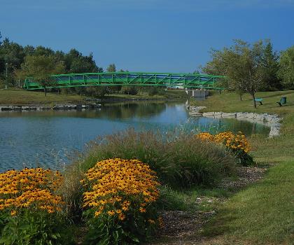
Parc Michel Chartrand
Montérégie
Parc De La Cité
Montérégie
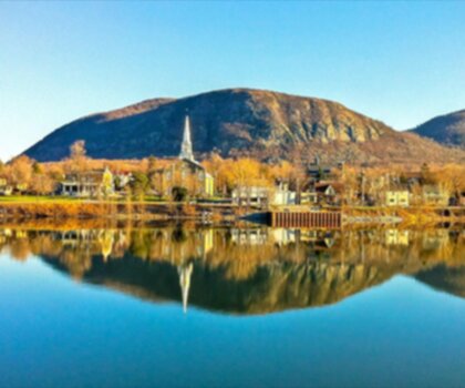
Mont Saint Bruno National Park
Montérégie
Mont St Hilaire
Montérégie
Rougemont Mount
Montérégie

Parc Régional De Beauharnois - Salaberry
Montérégie
Learn more about Mont Yamaska
The information below predates the closure and is kept for reference purposes.
Trail description
Description
Mont Yamaska is one of the most rewarding hikes in the Montérégie region of Quebec. Rising above the surrounding flatlands, this isolated hill — one of the famous Montérégie Hills — offers a hiking experience that feels surprisingly wild for how accessible it is from the greater Montreal area. Whether you're looking for a solid workout, a panoramic view, or just a good reason to get outside, Mont Yamaska delivers.
The Terrain
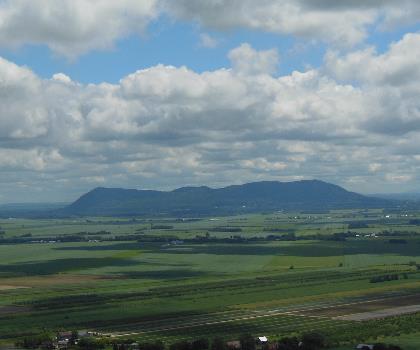
What makes Mont Yamaska stand out in the Montérégie is its topography. The Montérégie Hills are ancient igneous intrusions — essentially the hardened cores of old volcanoes that resisted erosion while the surrounding land wore down over millions of years. The result is a series of abrupt, forested hills rising dramatically from the St. Lawrence Lowlands, and Mont Yamaska is one of the most prominent among them.
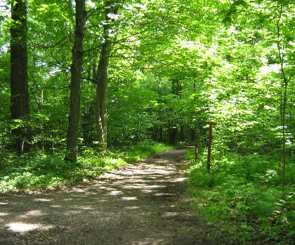
The trails wind through a mixed forest that shifts character as you gain elevation. Lower sections tend to be shaded and rooted, with the kind of uneven footing that keeps you paying attention. As you climb, the canopy opens up and the rock becomes more exposed. The summit area rewards the effort with open views over the surrounding agricultural plains and, on a clear day, a sweeping panorama that stretches well beyond the immediate region.
What to Expect on the Trail
The hiking at Mont Yamaska is managed within a provincial park setting, which means the trails are well-maintained and clearly marked. That said, the ascent has real elevation gain — this isn't a flat nature walk. Expect rocky sections, some steeper pitches, and terrain that asks a bit more of your legs and your footing than a typical lowland trail.
The network offers options for different energy levels and interests. Some routes take you directly toward the summit, while others loop through the forested flanks of the mountain, giving you more time in the trees before the big views open up. It's worth checking the current trail map at the park entrance before heading out, as conditions and access points can vary by season.
The Views
The payoff at the top is real. Because the Montérégie Hills rise so sharply from flat terrain, the visual contrast from the summit is striking. You're looking out over a patchwork of farmland, small towns, and waterways — a landscape that reads very differently from up high than it does at ground level. On a clear day, the horizon extends far, and the sense of elevation feels greater than you might expect given the region's overall geography.
This is also a great spot for watching weather systems move across the lowlands. If you time your hike right, the light in the late afternoon can be exceptional.
Wildlife and Nature
Mont Yamaska sits within a provincial park, and the protected status of the land means the forest is in good shape. The mixed hardwood and conifer cover supports a healthy bird population, making this a worthwhile destination for birders, especially during migration seasons. The varied habitat — from the wetter lower slopes to the drier, rockier summit zone — creates conditions for a range of species throughout the year.
The park also protects a lake and surrounding wetlands at its base, which adds ecological diversity to the area and gives the landscape a different character depending on which part of the trail network you're exploring.
Practical Information
Mont Yamaska is located within Parc national du Mont-Yamaska, managed by Sépaq (Société des établissements de plein air du Québec). As a provincial park, there is an entrance fee to access the trail network. Current rates are available directly through Sépaq, as fees are subject to change.
- Parking: There is a designated parking area at the park entrance. Arriving early on weekends and holidays is recommended, as the park draws visitors from the greater Montreal area and lots can fill up.
- Facilities: The park has washroom facilities near the entrance and picnic areas. Check with Sépaq for current amenity availability.
- Dogs: Pet policies in Sépaq parks can vary by trail and season — confirm current rules before bringing your dog.
- Seasons: The park operates across multiple seasons. Winter hiking and snowshoeing are possible when conditions allow. Check Sépaq's website for seasonal opening dates and any trail closures.
- Reservations: During peak periods, Sépaq may require or recommend reservations for park access. Worth checking ahead of time.
Getting There
Mont Yamaska is located in the Montérégie region of Quebec, making it a practical day trip from Montreal and surrounding communities. The park is accessible by car, and the route is straightforward from the main regional roads. GPS navigation to Parc national du Mont-Yamaska will get you to the entrance without issue.
Who It's Good For
Mont Yamaska works well for hikers who want more than a flat walk but aren't looking for a full-day alpine sufferfest. The elevation gain is meaningful, the terrain is engaging, and the summit views make the effort feel worth it. It's a solid choice for:
- Hikers based in the Montreal area looking for a genuine climb without a long drive
- Families with older kids who are ready for a real trail with some challenge
- Anyone wanting to experience the distinctive Montérégie Hills landscape up close
- Birders and nature observers interested in the park's varied ecosystems
Wear proper footwear with grip — the rocky sections on the upper trail are not the place for running shoes with worn soles — and bring enough water for the full outing, especially in warmer months.
FAQ - Frequently asked questions
Everything you need to knowHiking near Montreal
92 trails to explore ~55 km away
We work hard to provide the most up-to-date and error-free data possible. If something seems incorrect, let us know! Your contribution helps the whole community.
Hikers' opinions