

Ready to explore Parc Régional De Beauharnois-salaberry? Here's everything you need to know before you go!
Discover the trail
Trail description
Description
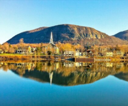
The Parc régional de Beauharnois-Salaberry is a regional park located in the Montérégie region of Quebec, offering a natural escape within reach of the greater Montreal area. Managed at the regional level, this park serves as a green corridor where locals and visitors alike can connect with the natural landscapes that define this part of southwestern Quebec.
The Setting
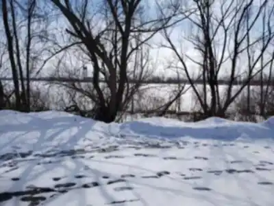
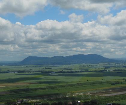
Beauharnois-Salaberry sits in a part of Quebec where the land is relatively flat and shaped by the St. Lawrence Lowlands. The terrain here is characterized by wetlands, woodlands, and agricultural edges — a mosaic that supports a surprising variety of wildlife and plant life. This isn't a mountain park with dramatic elevation changes, but that's precisely what makes it accessible and welcoming for a wide range of hikers, from families with young kids to older adults looking for a peaceful outing in nature.
The park draws its identity from the Beauharnois-Salaberry MRC (municipalité régionale de comté), and its trails and natural areas reflect the ecological character of the Montérégie — a region often overlooked in favor of the Laurentians or the Eastern Townships, but one that holds genuine natural value for those willing to explore it.
What to Expect on the Trail
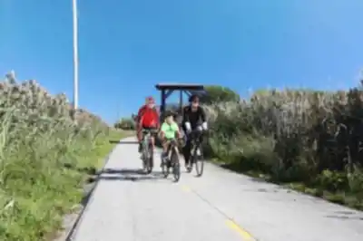
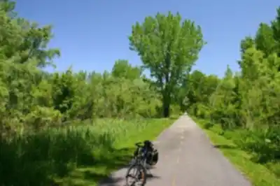
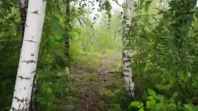
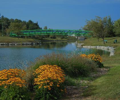
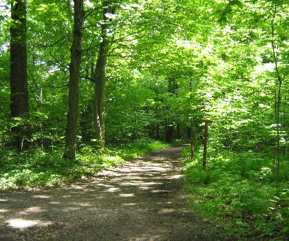
Hiking in Parc régional de Beauharnois-Salaberry means walking through a landscape that blends forest corridors, open fields, and wetland edges. The trails are generally well-suited for hikers who prefer a more relaxed pace — the kind of outing where you're paying attention to birds, wildflowers, and the quiet sounds of the natural environment rather than pushing your physical limits.
The flat to gently rolling terrain makes navigation straightforward, and the paths are typically accessible to most fitness levels. This is a great park for building a habit of getting outside regularly, or for introducing younger hikers to trail walking without the intimidation of steep climbs or technical footing.
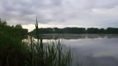
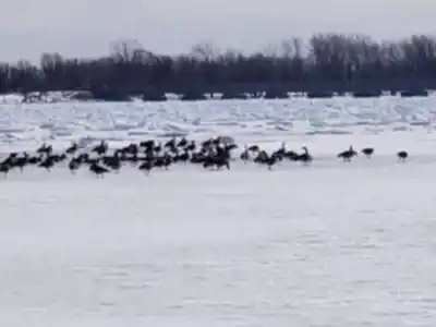
Wetland areas within the park are particularly worth slowing down for. These zones are often rich with birdlife, especially during migration seasons, and the transition zones between forest and open water create the kind of biodiversity that rewards patient observers.
Flora and Fauna
The Montérégie is one of Quebec's most ecologically diverse regions despite its modest elevation, and Beauharnois-Salaberry reflects that. The park's mix of habitats — deciduous forest, wetlands, and meadow edges — supports a range of species typical of the St. Lawrence Lowlands ecosystem.
Birdwatchers will find the park particularly rewarding. Wetland species, forest songbirds, and raptors are all part of the picture depending on the time of year. The park's position within the broader Montérégie landscape also means it functions as part of a larger ecological network, making it relevant not just for recreation but for regional conservation efforts.
In terms of vegetation, expect a mix of hardwood species common to southern Quebec — maple, ash, and oak — alongside the cattails and sedges that line the wetter sections of the trail network.
Practical Information
The Parc régional de Beauharnois-Salaberry is managed through the regional county municipality, which means access policies, fees, and seasonal hours can vary. Before heading out, it's worth checking directly with the park or the Beauharnois-Salaberry MRC for the most current information on:
- Access points and parking: Entry points and parking areas are distributed across the park's territory — knowing which access point best matches your planned route will save time on arrival.
- Trail conditions: Wetland-adjacent trails can be soft or muddy in spring and after heavy rain. Waterproof footwear is a smart call for much of the year.
- Dogs and bikes: Policies on pets and cycling vary by trail section — confirm current rules before your visit.
- Fees: Check with the park directly for any applicable access or parking fees.
Getting There
The park is situated in the Beauharnois-Salaberry MRC in Montérégie, Quebec — a region that lies southwest of Montreal. Its location makes it a realistic day trip or even a quick after-work outing for people based in the greater Montreal area. The relatively easy drive from the city, combined with the park's accessible terrain, is a big part of its appeal for urban residents looking to decompress in a natural setting without committing to a long road trip.
Who This Park Is For
Parc régional de Beauharnois-Salaberry is a strong fit for:
- Families with children who want a manageable, low-stress introduction to hiking and nature exploration.
- Birdwatchers and naturalists drawn to the wetland and forest edge habitats of the St. Lawrence Lowlands.
- Casual hikers looking for a peaceful walk without significant elevation gain.
- Montreal-area residents seeking a nearby green space that feels genuinely removed from the urban environment.
- Anyone interested in regional ecology who wants to understand the natural character of the Montérégie beyond its agricultural reputation.
A Note on the Region
Montérégie doesn't always get the same attention as Quebec's more dramatic natural landscapes, but that's part of what makes parks like Beauharnois-Salaberry worth knowing about. The region's lowland ecosystems are ecologically significant, and the regional park network here plays a real role in preserving green space in one of Quebec's most densely populated and agriculturally active areas. Hiking here is as much about understanding the landscape you're in as it is about the physical act of walking — and that's a perspective that tends to make the experience more rewarding.
Services and amenities
This information may vary by season.
Recommended gear for this trail


Ready to go?
Everything you need to know before you goStarting Point
To access the hiking trails, you can start at several trailheads. One option is to head to the parking lot located at 2495 Boulevard Edgar-Hébert, Salaberry-de-Valleyfield, QC J6S 4V6. Another starting point is the parking area at 450 Chemin du Canal, Beauharnois, QC J6N 0H5. Both locations provide convenient access to the trails in the area.
When?
Tuesday: 7:00 AM – 9:00 PM
Wednesday: 7:00 AM – 9:00 PM
Thursday: 7:00 AM – 9:00 PM
Friday: 7:00 AM – 9:00 PM
Saturday: 7:00 AM – 9:00 PM
Sunday: 7:00 AM – 9:00 PM
How much?
- Hiking shoes Essential
- → Salomon Elixir Tour Mid WP · 203.38 $
- Layered clothing Essential
- Rain jacket Essential
- Trekking poles
- → Black Diamond Trail Ergo Cork · 69.99 $
- Headlamp
- → Petzl Actik Core 625 · 103.95 $
FAQ - Frequently asked questions
Everything you need to knowTuesday: 7:00 AM – 9:00 PM
Wednesday: 7:00 AM – 9:00 PM
Thursday: 7:00 AM – 9:00 PM
Friday: 7:00 AM – 9:00 PM
Saturday: 7:00 AM – 9:00 PM
Sunday: 7:00 AM – 9:00 PM
The Essential Hiking Checklist
Everything you need for your next hike. Bilingual, printable, 1 page.
Download the free checklistSimilar hikes nearby
Discover other trails you might enjoy

Parc Michel Chartrand
Montérégie
Parc De La Cité
Montérégie
Mont Saint Bruno National Park
Montérégie
Mont St Hilaire
Montérégie
Rougemont Mount
Montérégie

Friends of the Lake Saint-François National Wildlife Area
Montérégie
Hiking near Montreal
92 trails to explore ~40 km away
We work hard to provide the most up-to-date and error-free data possible. If something seems incorrect, let us know! Your contribution helps the whole community.
Hikers' opinions