

Ready to explore Mont Kaaikop? Here's everything you need to know before you go!
Discover the trail


Trail description
Description
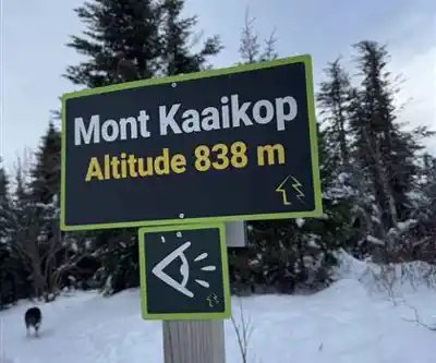
Mont Kaaikop stands as one of the Laurentides' most rewarding hiking challenges, delivering a serious workout and spectacular summit views that justify every step of the 838-meter climb. This Quebec mountain attracts hikers seeking a genuine wilderness experience without the crowds found on more famous Laurentian peaks, making it a favorite among locals who appreciate both the physical challenge and the peaceful forest environment.
The Trail Experience
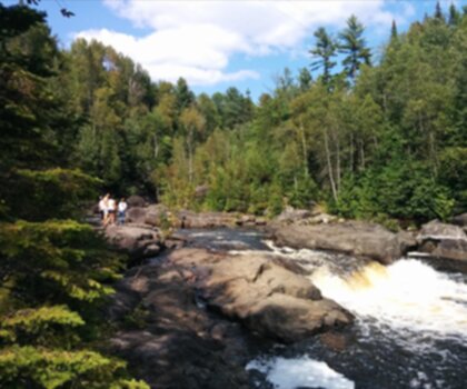
The 6-kilometer round trip to Mont Kaaikop's summit packs substantial elevation gain into a relatively compact distance, creating a steep and demanding ascent that tests your cardiovascular fitness from the start. The trail wastes little time with gentle warm-up sections, instead diving directly into the kind of sustained climbing that gets your heart rate up and keeps it there throughout most of the 4.5-hour journey.
Your ascent begins in thick mixed forest where mature maples and birches create a natural canopy that provides welcome shade during summer climbs. The well-marked trail eliminates navigation concerns, allowing you to focus entirely on the steady rhythm of uphill hiking. As you gain elevation, the forest character gradually shifts, and occasional openings in the canopy offer tantalizing glimpses of the expanding views that await at the summit.
The steepest sections demand careful foot placement and steady pacing, particularly during descent when loose rocks and steep grades can challenge your balance. Many hikers find trekking poles invaluable for both stability and reducing knee stress on the way down. The final approach to the summit pushes through increasingly sparse forest before opening onto the exposed peak area where panoramic views reward your climbing efforts.
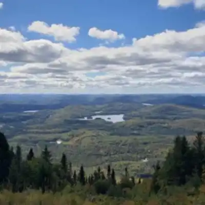
Summit Views and Rewards
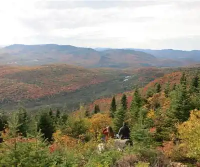
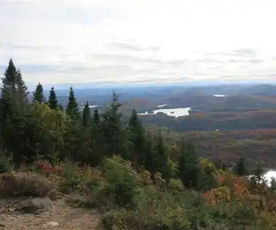
Mont Kaaikop's summit platform provides commanding views across the entire Laurentian landscape, with clear days revealing Mont Tremblant in the distance and countless other peaks rolling toward the horizon in every direction. The elevated perspective showcases the vast forest expanse that defines this region, broken only by occasional lakes glinting in the sunlight and the distant ribbon of valleys cutting through the mountainous terrain.
The summit's exposed position creates a completely different environment from the protected forest below, often featuring steady breezes that provide cooling relief after the demanding climb. This makes the peak area an ideal spot for extended breaks, lunch stops, and photo sessions that capture the full scope of the Laurentian wilderness stretching in all directions.
Wildlife and Forest Ecology
The diverse elevation zones on Mont Kaaikop support rich wildlife populations that change character as you climb higher. White-tailed deer frequently browse in the lower forest areas, particularly during early morning and late afternoon when they're most active. The mixed hardwood forest attracts numerous bird species, from common songbirds filling the canopy with calls to occasional raptors soaring overhead on thermal currents.
Patient hikers often spot woodpeckers working the mature tree trunks, nuthatches spiraling down bark surfaces, and various warbler species moving through the branches during migration periods. The forest floor supports smaller wildlife including chipmunks, red squirrels, and various rodent species that form the base of the local food web.
The mountain's ecological diversity becomes most apparent during seasonal transitions when different elevation zones display varying stages of change. Spring brings fresh leaf emergence and wildflower blooms in forest clearings, while summer offers full canopy development and peak wildlife activity levels.
Seasonal Hiking Conditions
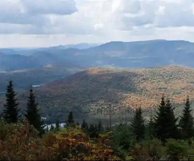
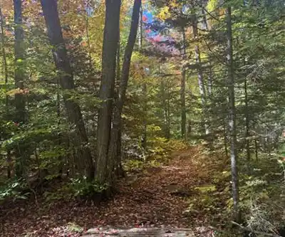
Fall transforms Mont Kaaikop into one of the region's premier autumn hiking destinations when the maple and birch forests explode in brilliant displays of red, orange, and gold that draw photographers from across Quebec. The crisp air and clear skies typical of fall weather often provide the best long-distance visibility from the summit, making this season ideal for capturing the full scope of Laurentian mountain views.
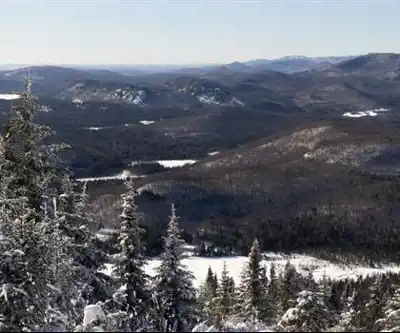
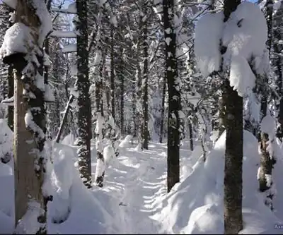
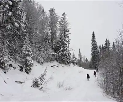
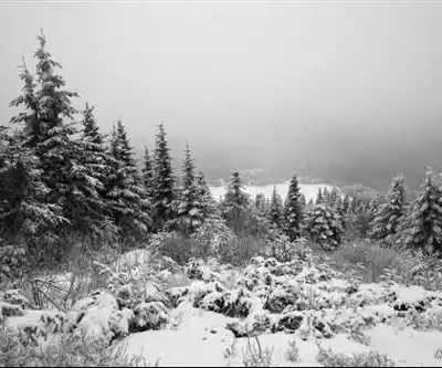
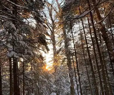
Winter conditions create an entirely different mountain experience, with snow-covered branches and crisp mountain air providing a serene backdrop for cold-weather adventures. Winter hiking requires appropriate gear including microspikes or snowshoes depending on trail conditions, plus additional layers for the exposed and windy summit area.
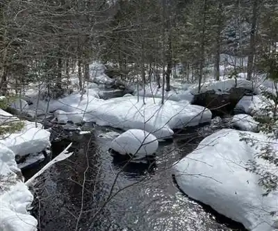
Spring hiking means dealing with muddy trail conditions and potential stream crossings as snowmelt saturates the forest floor, but also offers the unique experience of witnessing the forest's awakening after winter dormancy. Summer provides the most stable weather and longest daylight hours, though the steep terrain and substantial elevation gain make this a challenging climb regardless of season.
Backcountry Camping Experience
Mont Kaaikop offers backcountry camping opportunities for hikers seeking to extend their mountain visit into an overnight wilderness adventure. Designated camping areas allow you to experience the mountain during the quieter evening and dawn hours when wildlife activity peaks and day hikers aren't present on the trails.
The overnight experience provides unique opportunities to observe nocturnal wildlife behavior, from owl calls echoing through the forest to the subtle sounds of small mammals moving through the underbrush. Morning campers often enjoy complete solitude on the summit before day hikers begin arriving, plus the spectacular experience of sunrise views across the Laurentian peaks.
Backcountry camping requires additional preparation including proper camping gear, food storage to prevent wildlife encounters, and adherence to Leave No Trace principles that preserve the pristine mountain environment for future visitors.
Preparation and Safety Considerations
The substantial elevation gain and steep terrain on Mont Kaaikop demand proper preparation and appropriate hiking equipment. Sturdy hiking boots with good ankle support provide essential traction and stability on steep sections and potentially loose terrain. Weather conditions can change rapidly at elevation, making layered clothing and rain protection important regardless of the valley forecast.
Water requirements increase significantly with the demanding climb, so carry more than you think you'll need, especially during warm weather. The exposed summit position creates windy conditions even on calm days at the trailhead, making an extra insulating layer essential for comfortable summit breaks.
Check current weather conditions before departing, as mountain weather often differs dramatically from conditions in the valleys below. Afternoon thunderstorms pose particular risks on exposed summit areas, making early starts advisable during summer months when electrical activity is most common.
Services and amenities
This information may vary by season.
Recommended gear for this trail


Ready to go?
Everything you need to know before you goStarting Point
To get to the Mount Kaaikop trails, you must drive to St. Sauveur. Once you arrive in St. Sauveur, you need to head downtown and take Principale Street. After taking Principale Street, continue straight and take the first left, which is Mount Kaaikop Street. After taking Mount Kaaikop Street, continue straight and take the first left, which is the entrance to the Mount Kaaikop trails.
When?
How much?
- Hiking shoes Essential
- → Salomon Elixir Tour Mid WP · 203.38 $
- Layered clothing Essential
- Rain jacket Essential
- Trekking poles
- → Black Diamond Trail Ergo Cork · 69.99 $
- Headlamp
- → Petzl Actik Core 625 · 103.95 $
FAQ - Frequently asked questions
Everything you need to knowThe Essential Hiking Checklist
Everything you need for your next hike. Bilingual, printable, 1 page.
Download the free checklistSimilar hikes nearby
Discover other trails you might enjoy
Parc De La Rivière Doncaster
Laurentides

Parc Du Domaine Vert
Laurentides

Parc national d'Oka
Laurentides

Sommet Saint-Sauveur
Laurentides

Mont Condor
Laurentides

Montagne Du Dépôt Et Montagne Du Caribou
Laurentides
Hiking near Laval
97 trails to explore ~79 km away
We work hard to provide the most up-to-date and error-free data possible. If something seems incorrect, let us know! Your contribution helps the whole community.
Hikers' opinions