

Ready to explore Parc National Du Mont-Orford? Here's everything you need to know before you go!
Discover the trail

Available trails
| Trails | Distance | Elevation | Duration | Difficulty | GPX |
|---|---|---|---|---|---|
| 1.6 km | 21min | Beginner | |||
| 1.6 km | 21min | Beginner | |||
| 5 km | 1h | Intermediate | |||
| 6.2 km | 1h30 | Intermediate | |||
| 3.8 km | 51min | Intermediate | |||
| 3.7 km | 49min | Intermediate | |||
| 3.8 km | 51min | Intermediate | |||
| 4.1 km | 55min | Intermediate | |||
| 6.5 km | 1h30 | Advanced | |||
| 4.3 km | 57min | Advanced | |||
| 8.5 km | 2h | Advanced | |||
| 4.2 km | 56min | Advanced | |||
| 2.9 km | 39min | Advanced |
Trail description
{
"clarification_needed": "Le terme 'Parc national du Mont-Orford' est le nom officiel du parc, mais il s'agit d'un parc PROVINCIAL géré par Sépaq, non d'un parc national fédéral. Le contenu actuel est techniquement correct car il confirme que Sépaq le gère, mais pourrait bénéficier d'une clarification dès le premier paragraphe pour éviter toute confusion. Recommandation : modifier la première phrase pour préciser 'provincial park' plutôt que de laisser le titre ambig.",
"html_change": "
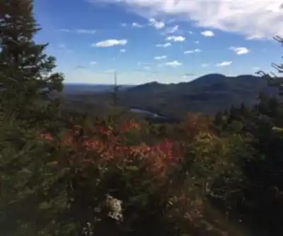
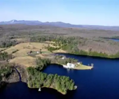
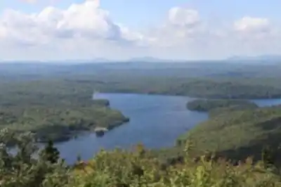
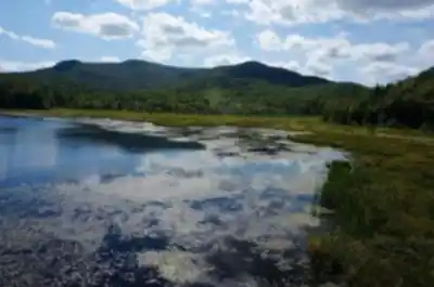
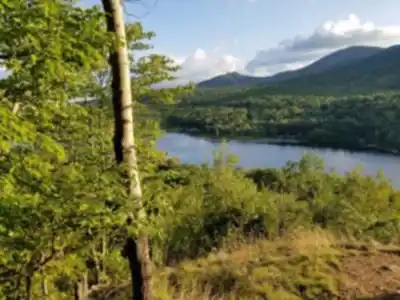
Parc national du Mont-Orford is one of the most visited provincial parks in Quebec, and for good reason. This Quebec provincial park, managed by Sépaq, sits in the heart of the Eastern Townships and combines serious hiking terrain with a landscape that shifts dramatically with the seasons. Whether you're after a challenging summit push or a quieter walk through mature forest, this park delivers the kind of experience that keeps people coming back year after year.
"}
Services and amenities
This information may vary by season.
Recommended gear for this trail


Ready to go?
Everything you need to know before you goStarting Point
To access the hiking trails, you can start at several trailheads. One main entry point is located at 3321 Chemin du Parc, Orford, QC J1X 7A2. Another option is to begin your hike from the parking area at 69 Chemin du Camping, Orford, QC J1X 7A2. Both locations provide convenient access to the trails and have parking facilities available.
When?
How much?
- Hiking shoes Essential
- → Salomon Elixir Tour Mid WP · 203.38 $
- Layered clothing Essential
- Rain jacket Essential
- Trekking poles
- → Black Diamond Trail Ergo Cork · 69.99 $
- Headlamp
- → Petzl Actik Core 625 · 103.95 $
FAQ - Frequently asked questions
Everything you need to knowThe Essential Hiking Checklist
Everything you need for your next hike. Bilingual, printable, 1 page.
Download the free checklistAlternatives and suggestions
Similar hikes nearby
Discover other trails you might enjoy

Mount Brome (Bromont)
Eastern Townships

Mont Pinacle
Eastern Townships

Sutton Natural Environment Park
Eastern Townships

Parc De La Gorge De Coaticook
Eastern Townships

Parc national de Frontenac
Eastern Townships

Promenade du Lac-des-Nations
Eastern Townships
Hiking near Sherbrooke
53 trails to explore ~25 km away
We work hard to provide the most up-to-date and error-free data possible. If something seems incorrect, let us know! Your contribution helps the whole community.
Hikers' opinions