

Ready to explore Mont Sutton? Here's everything you need to know before you go!
Discover the trail


Photos: MontSutton — CC BY-SA (Wikimedia Commons) Océane Carrier — CC BY-SA (Wikimedia Commons) OceanAtoll — CC BY (Wikimedia Commons) -AX- — CC BY-NC (Flickr) DarwIn — CC BY (Wikimedia Commons) Fæ — CC0 (Wikimedia Commons) Mont Sutton — Google Maps (Google Maps) Raj Kumar — Google Maps (Google Maps) Panoramio upload bot — CC BY-SA (Wikimedia Commons) Y.O.T.O — CC BY-NC-SA (Flickr) meantux — CC BY-NC (Flickr) Thabiieschultz — CC BY-SA (Wikimedia Commons)
Available trails
| TrailTrails | Dist.Distance | GainElevation | Est. timeEstimated time | Difficulty | GPX |
|---|---|---|---|---|---|
|
Beginner
|
1.4 km | 110 m | ≈ 29min | Beginner | |
|
Beginner
|
1.8 km | 100 m | ≈ 33min | Beginner | |
|
Beginner
|
1 km | — | Beginner | ||
|
Beginner
|
4.5 km | 230 m | ≈ 1h30 | Beginner | |
|
Intermediate
|
3.9 km | 270 m | ≈ 1h30 | Intermediate | |
|
Intermediate
|
1.1 km | — | Intermediate | ||
|
Intermediate
|
3.1 km | 220 m | ≈ 1h | Intermediate | |
|
Advanced
|
7.3 km | 380 m | ≈ 2h30 | Advanced | |
|
Advanced
|
5.6 km | 332 m | ≈ 2h | Advanced | |
|
Advanced
|
8 km | 335 m | ≈ 2h30 | Advanced | |
|
Advanced
|
6.3 km | — | Advanced | ||
|
Advanced
|
8.12 km | 531 m | ≈ 2h30 | Advanced |
Trail description
Sutton Natural Environment Park has a network of trails in Quebec's Eastern Townships, where conservation-focused management has created one of the region's most authentic wilderness experiences. Located just minutes from Sutton village, this isn't your typical provincial park—it's a carefully preserved natural area where habitat protection takes precedence, resulting in thriving wildlife populations and pristine forest ecosystems that feel genuinely wild.
Trail System and What to Expect
The park's extensive trail network accommodates everyone from families seeking gentle woodland walks to experienced hikers looking for challenging climbs. Across the system, you'll encounter rolling hills, dense forest sections, and occasional steep pitches that open up to rewarding elevated viewpoints. Difficulty varies by route: the park describes the Vieux Chemin loop as one of the easiest in the network, and the Dos d'Orignal loop as a steep climb and descent on fairly wild trails.
Well-marked and consistently maintained trails let you focus on the surroundings rather than navigation. The paths weave through multiple ecosystems, taking you from thick hardwood forests into open meadows and back into coniferous stands. This diversity means your hiking experience shifts dramatically as you move through different sections. Some trails follow gentle contours perfect for a relaxed family outing, while others challenge you with steeper ascents through more rugged terrain where the forest feels untouched.
The rolling topography of the Eastern Townships creates natural vantage points throughout the network. You'll climb through dense canopy, emerge onto ridgelines with sweeping views across the Cantons-de-l'Est, then descend back into intimate forest corridors where wildlife sightings become more likely.
Seasonal Transformations
Each season completely transforms this destination. Spring brings wildflower displays that carpet the meadows in vibrant colors while the forest floor awakens with emerging vegetation. The contrast between open meadow blooms and the delicate greens of budding hardwoods creates some of the year's most photogenic hiking conditions.
Summer offers the richest wildlife viewing opportunities, with the dense canopy providing cool hiking conditions even on warm days. The full leaf cover creates a cathedral-like atmosphere in the hardwood sections, while the meadows buzz with insect life that attracts birds and other wildlife.
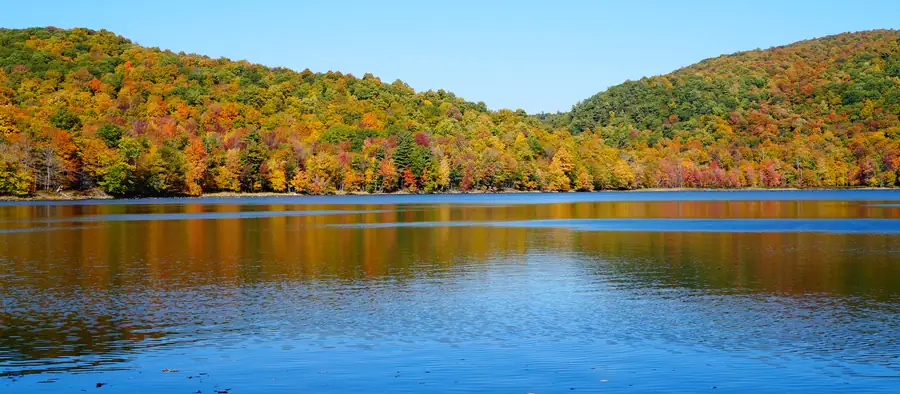
Autumn stands out as particularly spectacular here. The mixed forest creates a tapestry of reds, oranges, and yellows that rivals any fall destination in the Eastern Townships. The park's rolling hills provide multiple vantage points to take in the color display across the broader landscape, making this a premier fall hiking destination.
Winter doesn't shut down access—it opens up new possibilities. The trail network transforms into snowshoeing terrain, offering a completely different perspective on the same landscapes you might have hiked in warmer months. The bare trees reveal distant views that summer's foliage conceals.
Wildlife and Natural Features
The park's commitment to habitat preservation shows clearly in its wildlife populations. Deer are commonly spotted, especially during early morning or late afternoon hikes when they move between feeding areas. Foxes inhabit the area, though they're more elusive and require patience to observe. The bird diversity impresses—the mixed habitats support everything from forest songbirds in the dense canopy to raptors that hunt over the open meadows.
The breathtaking vistas of rolling hills and dense woodlands result from the park's strategic location in the Cantons-de-l'Est, where natural elevation changes create these viewpoints. The preserved forest cover maintains the wild character that makes those views worth the effort to reach them. You'll find yourself pausing frequently, not just to catch your breath on climbs, but to take in landscapes that feel genuinely untouched.
The diverse ecosystems mean you're constantly encountering different natural features. Dense hardwood groves give way to coniferous stands, which open into meadows that might harbor wetland edges. This variety keeps the hiking interesting and increases your chances of wildlife encounters as different species prefer different habitats.
Conservation Focus
What distinguishes this park from purely recreational areas is its active ecological management. Staff work continuously to maintain natural balance, which means the habitat you're hiking through is genuinely healthy rather than just scenic. This approach ensures wildlife populations remain stable and forest ecosystems continue functioning naturally.
Visitors play a crucial role in this conservation effort. The park encourages Leave No Trace principles, and following these guidelines helps protect the environment that makes this place special. The management's dedication to preservation means future visitors will find the same pristine conditions you experience today.
Activities Beyond Hiking
While hiking forms the core activity, the park accommodates other outdoor pursuits. Cycling, skiing and snowboarding are not allowed in the park, so the trails are for people on foot. The winter snowshoeing opportunities use the same trail system, making this a genuine year-round destination.
Strategically placed picnic areas provide spots to rest and refuel during longer trail days. These facilities integrate naturally into the landscape rather than dominating it—you'll find them positioned to complement the hiking experience, often at scenic viewpoints or trail junctions.
Planning Your Visit
The park's suggested routes range from short loops to full-day circuits, and the trail network is extensive enough that you could easily spend a full day or plan multiple visits to explore different sections thoroughly. Some routes are among the easiest in the network, while others, such as the Dos d'Orignal loop, involve steep climbs and descents, so choose a route that matches your fitness level.
Sutton village provides convenient access to accommodations, restaurants, and services, making this park an excellent base for exploring the broader Eastern Townships region. The proximity to the village means you can combine a serious hiking day with the amenities of an established tourist destination—grab breakfast in town, spend the day on the trails, then return for dinner and comfortable lodging.
The park's location in the heart of the Eastern Townships puts you within reach of other outdoor destinations, but the trail network here is extensive enough to keep you busy for multiple visits. The combination of well-maintained trails, diverse terrain, active wildlife populations, and genuine conservation focus makes Sutton Natural Environment Park a standout destination for anyone serious about experiencing Quebec's natural landscapes.
FREE GUIDE • PDF
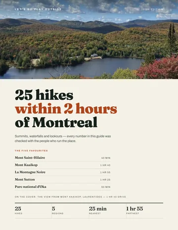
25 hikes under 2 hours from Montreal, with drive time, distance and level.
Get my free guideGuide • checklist • taping videos • Sent by emailNewsletter optional
Photo: Jiaqian AirplaneFan, CC BY 3.0, via Wikimedia Commons
Services and amenities
Recommended gear for this trail
As an Amazon Associate I earn from qualifying purchases.


Ready to go?
Everything you need to know before you goStarting Point
The reception post is at 800 Chemin Réal, Sutton. To get there, turn left from Route 139 in the village onto Maple Street, then left onto Chemin Poissant, right onto Chemin Harold and left onto Chemin Réal. You can park just before the ticket booth on the left, in front of the rocks, or in the large parking lots at the end of Chemin Réal, about 100 metres past the booth.
When?
Reception post
May to early November: 8:30 am to 5:00 pm on weekdays, 8:30 am to 5:30 pm on weekends
Early November until the snow melts: 9:00 am to 4:00 pm every day
Closed during the snow melt, on Christmas Day and on New Year's Day
Trail access: 8:30 am to 5:00 pm in summer, 9:00 am to 3:30 pm in winter
How much?
As an Amazon Associate I earn from qualifying purchases.
Affiliate links — LGPO may earn a commission at no extra cost to you.
- Hiking shoes Essential
- → Salomon Elixir Tour Mid WP · 203.38 $
- Layered clothing Essential
- Rain jacket Essential
- Trekking poles
- → Black Diamond Trail Ergo Cork · 69.99 $
- Headlamp
- → Petzl Actik Core 625 · 103.95 $
FAQ - Frequently asked questions
Everything you need to knowOutings near Mont Sutton
Discover other trails you might enjoy

Lac Spruce
Eastern Townships · 2.9 km away

Mont Echo
Eastern Townships · 6.2 km away

Au Diable Vert
Eastern Townships · 7.0 km away
Jay Peak
Northeast Kingdom · 20.2 km away

Mount Brome (Bromont)
Eastern Townships · 20.6 km away

Station Touristique Mont Owl's Head
Eastern Townships · 21.0 km away
Hiking near Sherbrooke
86 trails to explore ~62 km away
We work hard to provide the most up-to-date and error-free data possible. If something seems incorrect, let us know! Your contribution helps the whole community.
Hikers' opinions
Be the first to review!
No hiker has shared their experience yet. Share your impressions and help other hikers!