

Ready to explore Mont Brome? Here's everything you need to know before you go!
Discover the trail
Available trails
| Trails | Distance | Elevation | Duration | Difficulty | GPX |
|---|---|---|---|---|---|
| 15.1 km | 0 m | 3h30 | Beginner | ||
| 1.8 km | 0 m | 24min | Beginner | ||
| 0.7 km | 0 m | 15min | Beginner | ||
| 2.9 km | 0 m | 39min | Intermediate | ||
| 1 km | 0 m | 15min | Intermediate | ||
| 0.9 km | 0 m | 15min | Intermediate | ||
| 0.6 km | 0 m | 15min | Intermediate | ||
| 0.4 km | 0 m | 15min | Intermediate | ||
| 0.2 km | 0 m | 15min | Intermediate | ||
| 0.6 km | 0 m | 15min | Intermediate | ||
| 1.5 km | 0 m | 20min | Intermediate | ||
| 2 km | 0 m | 27min | Intermediate | ||
| 1.2 km | 0 m | 16min | Intermediate | ||
| 1.2 km | 0 m | 16min | Intermediate | ||
| 1 km | 0 m | 15min | Intermediate | ||
| 0.5 km | 0 m | 15min | Intermediate | ||
| 0.42 km | 0 m | 15min | Intermediate | ||
| 1.5 km | 0 m | 20min | Intermediate | ||
| 0.2 km | 0 m | 15min | Advanced | ||
| 0.7 km | 0 m | 15min | Advanced | ||
| 2.2 km | 0 m | 29min | Advanced |
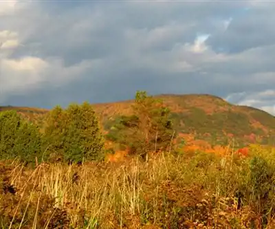
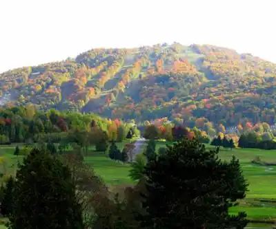
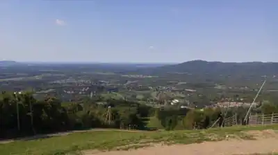
Trail description
Supprimer ou restructurer la section 'Beyond hiking' pour clarifier que le vélo de montagne et l'observation d'oiseaux ne sont pas des composantes de la route principale de 6 km. Optionnel: mentionner brièvement que d'autres sentiers dans la région de Bromont offrent ces activités, mais sans les présenter comme faisant partie de cette randonnée spécifique.
Services and amenities
This information may vary by season.
Recommended gear for this trail


Ready to go?
Everything you need to know before you goStarting Point
To access the hiking trails, head to the main parking lot located at 150 Rue Champlain, Bromont, QC J2L 1A2. This is the primary starting point for most of the trails in the area. Additionally, there are other trailheads available, such as the one at 400 Chemin de Gaspé, Bromont, QC J2L 2P4. Both locations provide convenient access to explore the various trails.
When?
How much?
- Hiking shoes Essential
- → Salomon Elixir Tour Mid WP · 203.38 $
- Layered clothing Essential
- Rain jacket Essential
- Trekking poles
- → Black Diamond Trail Ergo Cork · 69.99 $
- Headlamp
- → Petzl Actik Core 625 · 103.95 $
FAQ - Frequently asked questions
Everything you need to knowThe Essential Hiking Checklist
Everything you need for your next hike. Bilingual, printable, 1 page.
Download the free checklistSimilar hikes nearby
Discover other trails you might enjoy

Mont Pinacle
Eastern Townships

Sutton Natural Environment Park
Eastern Townships

Parc De La Gorge De Coaticook
Eastern Townships

Mount Orford National Park
Eastern Townships

Parc national de Frontenac
Eastern Townships

Promenade du Lac-des-Nations
Eastern Townships
Hiking near Sherbrooke
53 trails to explore ~60 km away
We work hard to provide the most up-to-date and error-free data possible. If something seems incorrect, let us know! Your contribution helps the whole community.
Hikers' opinions