

Ready to explore Utsayantha Mountain, New York? Here's everything you need to know before you go!
Discover the trail
Trail description
Description
Utsayantha Mountain rises to 3,214 feet near Stamford, New York, making it one of the more accessible and rewarding peaks in the western Catskills. It's not the most famous summit in the range, but that's part of the appeal — you get genuine mountain views, a historic fire tower, and a trail that doesn't require you to fight for a parking spot the way you would on busier Catskill destinations.
The round trip covers 3.2 kilometers with about 980 meters of elevation gain, and most hikers complete it in around two and a half hours. The trail is rated easy, which holds true for the majority of the route — the terrain is well-maintained and the grades are steady rather than punishing. That said, the elevation gain is real, so don't let the "easy" rating lull you into leaving your water bottle in the car.
What the Trail Is Actually Like
The hike starts with a gradual climb through mixed hardwood forest — maple, birch, and oak dominate the lower sections, forming a canopy that keeps things cool in summer and puts on a serious show in fall. The trail surface is generally solid, though you'll encounter exposed bedrock and some rocky patches as you gain elevation, particularly in the upper sections. Nothing technical, but worth watching your footing.
The forest shifts character as you climb. The understory opens up a bit, the trees get shorter, and you start getting glimpses of the surrounding ridgelines through the canopy. Wildlife is a consistent presence on this trail — white-tailed deer are common in the early morning and evening, and the bird life is solid throughout the season, with woodpeckers, nuthatches, and warblers showing up regularly. Because this trail sees less foot traffic than the High Peaks area, animals tend to be less spooked, which makes for better sightings if you're moving quietly.
The final push to the summit is the steepest section of the hike, but it's short and the trail surface stays manageable. When you break out of the trees at the top, the fire tower is right there waiting for you.
The Fire Tower
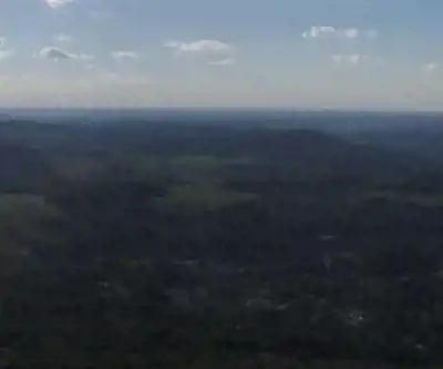
The restored fire tower is the main event at the summit, and it delivers. Climb to the cab and you get a full 360-degree panorama across the rolling Catskill landscape — ridges, valleys, and on clear days, the distant Adirondack Mountains to the north. It's a genuinely impressive view for a hike of this length and difficulty.
The tower itself is worth a moment of attention beyond the view. It's a physical remnant of the era when fire detection in the Catskills depended on human observers posted at high points across the range, watching for smoke. The restoration keeps that history accessible rather than letting it disappear. If you're hiking with kids, the tower climb tends to be a highlight — it's exciting in a way that a standard summit viewpoint isn't.
One practical note: the tower cab can be significantly windier than the surrounding trail, especially during shoulder seasons. Bring a layer you can pull on at the top, even if the hike up felt warm.
Getting There and Parking
The trailhead is located near Stamford, which puts Utsayantha Mountain within reasonable reach for day trips from the Capital Region, the Hudson Valley, or even New York City. The approach involves a stretch of dirt road that's passable for standard vehicles under normal conditions, though spring mud season and winter snow can complicate things. Late spring through fall is the most reliable window for straightforward access.
Parking is available near the trailhead. On peak fall foliage weekends and busy summer days, spaces can fill up, so an early start is worth considering if you're visiting during those windows.
Historical and Cultural Background
The mountain's name reflects its indigenous heritage, and that layer of history adds something to the experience if you take a moment to sit with it. The area around Utsayantha Mountain carries centuries of human connection — Native American history followed by early European settlement — and the landscape itself has been shaped by those successive relationships. The fire tower represents a more recent chapter, but the mountain's significance to the people who lived here long before fire towers existed is woven into the name itself.
The broader area around Utsayantha sits in Delaware County, part of the quieter western Catskills that tends to get overlooked in favor of the more heavily trafficked peaks to the east. That relative obscurity is an asset — the region has genuine character without the infrastructure pressure that comes with high visitor volumes.
What to Bring
Standard day hiking gear covers you well here. Sturdy footwear with decent grip handles the rocky sections and any muddy patches after rain. Carry enough water for the full round trip — there are no reliable water sources on the trail. A snack for the summit is worth it, especially if you plan to spend time at the tower. An extra layer for the exposed summit and tower cab is a smart addition regardless of the forecast, since conditions at elevation can shift quickly.
The trail is well-marked, which keeps navigation straightforward and lets you focus on the hike itself rather than route-finding. Staying on the designated trail is important here — the steady use this mountain sees throughout the season means erosion is a real concern, and cutting switchbacks or wandering off-trail adds up over time.
Recommended gear for this trail


Ready to go?
Everything you need to know before you goStarting Point
To access the hiking trails, you can start at the primary trailhead located near the village of Stamford. The main parking area is at 432 Tower Mountain Road, Stamford, NY 12167. This location provides convenient access to the trail leading up the mountain.
When?
How much?
- Hiking shoes Essential
- → Salomon Elixir Tour Mid WP · 203.38 $
- Layered clothing Essential
- Rain jacket Essential
- Trekking poles
- → Black Diamond Trail Ergo Cork · 69.99 $
- Headlamp
- → Petzl Actik Core 625 · 103.95 $
FAQ - Frequently asked questions
Everything you need to knowThe Essential Hiking Checklist
Everything you need for your next hike. Bilingual, printable, 1 page.
Download the free checklistSimilar hikes nearby
Discover other trails you might enjoy

Old Mill Falls
Catskills
Catskill Scenic Trail
Catskills
Cliff Lake
Catskills
Plattekill Falls
Catskills
Devil's Path Trail
Catskills
Ashokan Reservoir
Catskills
Hiking near Albany
0 trails to explore ~74 km away
We work hard to provide the most up-to-date and error-free data possible. If something seems incorrect, let us know! Your contribution helps the whole community.
Hikers' opinions