
By
lydia.crawford
•
Cascade du Rouget Statistics
What are the activities ?)
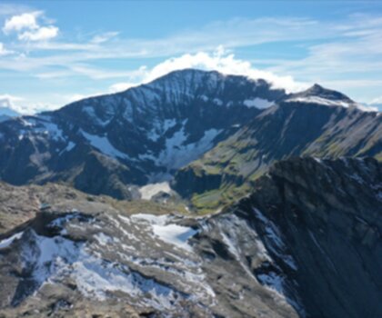
Hiking
See photos of hiking
Why choose a trail at Cascade du Rouget?
Désolé, nous n'avons pas de description pour cet endroit.Soyez le premier à partager plus d'informations sur cet endroit.
What are the services on site?
Rate & open hour
Access fee
$ 0.00
Schedule
No information
Coordinates
6.7718375
46.0271243
46.0271243
What are the coordinates and address ?
Cascade du Rouget
Vallée du Giffre, 74740 Sixt-Fer-à-Cheval, France
Let’s Answer Your Questions - FAQ
-
No
-
No
Is the place are families friendly?
Is there an information center / service center / reception?

Shared by
Lydia Crawford, an extraordinary woman with an insatiable zest for life, has become an inspirational figure to many through her adventures and infectious good humor. Born and raised in a small town nestled in the mountains, Lydia developed a love for the outdoors at an early age. Her childhood was filled with hiking, camping, and exploring the wilderness, experiences that shaped her into the avid outdoorswoman she is today.
She life was a celebration of adventure, joy, and the great outdoors. She lived with a fierce determination to enjoy every moment and to share that joy with others. Her legacy is one of laughter, exploration, and an unwavering love for the natural world. Lydia's spirit continues to inspire those who knew her and those who discover her story, reminding us all to embrace life with open arms and a heart full of joy.
She life was a celebration of adventure, joy, and the great outdoors. She lived with a fierce determination to enjoy every moment and to share that joy with others. Her legacy is one of laughter, exploration, and an unwavering love for the natural world. Lydia's spirit continues to inspire those who knew her and those who discover her story, reminding us all to embrace life with open arms and a heart full of joy.
Hiker reviews
0 out of 5 stars
Based on 0 reviews
Recent reviews