

Ready to explore Gorges du Bès? Here's everything you need to know before you go!
Discover the trail
Trail description
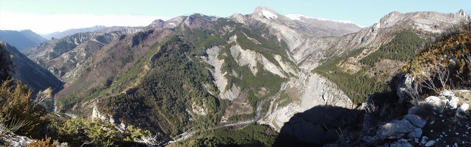
The Gorges du Bès cut through the limestone heart of the Lozère department in Occitanie, carving a narrow, dramatic corridor that rewards hikers with one of the more striking canyon experiences in southern France. The trail covers 8 km with 300 m of elevation gain, making it a moderate outing that most reasonably fit hikers can complete in around 2h30.
The Gorge Itself
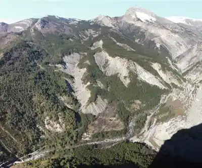
The Bès river has spent an enormous amount of time working through the limestone bedrock here, and the results are hard to miss. The walls close in on both sides, the sound of moving water fills the air, and the light shifts constantly depending on the time of day and the angle of the sun above the canyon rim. It's the kind of place that feels genuinely enclosed — not claustrophobic, but intimate in a way that larger, more open valleys simply aren't.
The limestone throughout the gorge shows the layered stratification typical of this part of Occitanie, with colors shifting from pale cream to warmer ochre tones depending on mineral content and how much moisture is present on the rock face. In the shadier sections, moss and ferns take hold wherever there's enough humidity to support them, adding patches of green against the pale stone.
The Hike
At 8 km with 300 m of elevation gain, this is a trail that asks something of you without being punishing. The moderate rating reflects terrain that includes some uneven footing along the canyon floor, sections where the path follows the river closely, and a few stretches where the elevation gain is more concentrated. Trekking poles can be useful, particularly on the descent if the rock is wet.
The 2h30 estimated duration assumes a steady pace with brief stops. If you're the type to linger at viewpoints or spend time watching the water move through the natural pools and chutes along the way, budget a bit more time. The gorge rewards slower exploration.
Footwear matters here. Trail runners or hiking boots with decent grip are the right call — the limestone can be slippery when wet, and sections near the river involve stepping over and around rocks that don't always sit flat.
Water and Geology
The Bès river is the defining feature of this hike. Depending on the season and recent rainfall, it can range from a lively torrent to a calmer flow threading between exposed rock formations. Either way, it's present throughout the route — audible even when not directly visible, and central to the character of the gorge.
The limestone geology here is the same ancient marine sediment found across much of the Massif Central's southern edge. Tectonic uplift followed by persistent water erosion over geological time created the canyon, and that erosion is still ongoing. Fresh rock falls, newly carved pools, and the gradual reshaping of existing passages are all part of the living landscape you're walking through.
Seasonal Considerations
Spring brings higher water volumes from snowmelt and rainfall, which means more dramatic water features but also faster-moving currents and potentially slippery conditions along the lower sections of the trail. Summer is generally the most accessible season — water levels drop, more of the rock formations are exposed, and the shade provided by the canyon walls makes for a cooler walk than you'd find on the open plateau above.
One important note: the narrow confines of the gorge mean that water levels can rise quickly during heavy rainfall, and conditions inside the canyon don't always reflect what's happening on the plateau above. Check local weather forecasts before heading out, and be aware that a storm upstream can affect conditions in the gorge even if the sky above you looks clear.
What to Bring
- Footwear: Hiking boots or trail runners with solid grip — avoid smooth-soled shoes.
- Water: Carry enough for the full 8 km; don't rely on the river water without treatment.
- Layers: The gorge stays cooler and more humid than the surrounding terrain, so a light layer can be useful even in summer.
- Weather awareness: Check forecasts for the broader Lozère area, not just the immediate trailhead.
Getting There
The Gorges du Bès are located in the Lozère department of Occitanie. Access details and current trailhead conditions are best confirmed locally before your visit, as road and parking situations in canyon areas can vary by season.
This is a trail that earns its place on any Lozère itinerary — not because it's the longest or the most technically demanding route in the region, but because the gorge environment itself is genuinely distinctive, and 8 km is exactly the right distance to experience it properly without rushing.
The Essential Hiking Checklist
Everything you need for your next hike. Bilingual, printable, 1 page.
Get your free hiking checklistRecommended gear for this trail
As an Amazon Associate I earn from qualifying purchases.


Ready to go?
Everything you need to know before you goStarting Point
The trailhead of the Gorges du Bès is located in Saint-Étienne-de-Fontbellon, in the Auvergne-Rhône-Alpes region. To get there, you have to take the D939 in the direction of Saint-Étienne-de-Fontbellon and park in the parking lot located near the trailhead.
When?
How much?
As an Amazon Associate I earn from qualifying purchases.
Affiliate links — LGPO may earn a commission at no extra cost to you.
- Hiking shoes Essential
- → Salomon Elixir Tour Mid WP · 203.38 $
- Layered clothing Essential
- Rain jacket Essential
- Trekking poles
- → Black Diamond Trail Ergo Cork · 69.99 $
- Headlamp
- → Petzl Actik Core 625 · 103.95 $
FAQ - Frequently asked questions
Everything you need to knowSimilar hikes nearby
Discover other trails you might enjoy
Hiking near Sydney
22 trails to explore ~4813 km away
We work hard to provide the most up-to-date and error-free data possible. If something seems incorrect, let us know! Your contribution helps the whole community.
Hikers' opinions
Be the first to review!
No hiker has shared their experience yet. Share your impressions and help other hikers!