
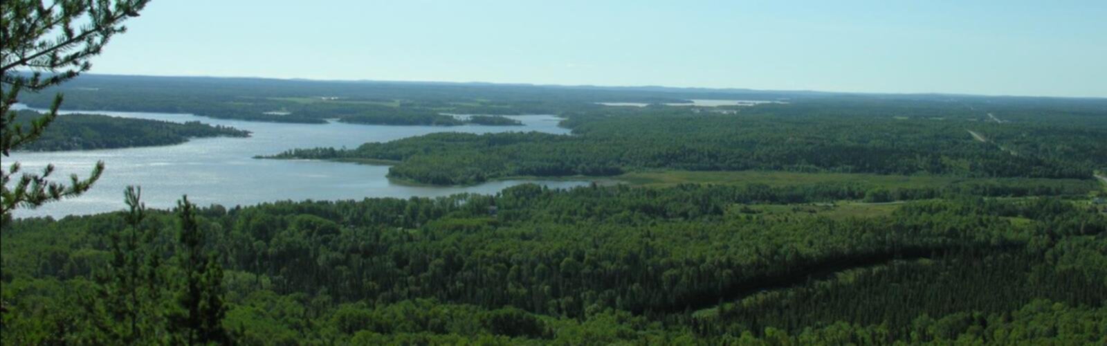
Ready to explore Collines Kékéko? Here's everything you need to know before you go!
Discover the trail


Photos: Access to Outdoors — CC BY (Google Images) Tourisme Rouyn-Noranda — CC BY (Google Images)
Available trails
| TrailTrails | Dist.Distance | GainElevation | Est. timeEstimated time | Difficulty | GPX |
|---|---|---|---|---|---|
|
Beginner
|
1.1 km | — | Beginner | ||
|
Beginner
|
2.2 km | 80 m | ≈ 37min | Beginner | |
|
Beginner
|
1.2 km | — | Beginner | ||
|
Beginner
|
0.8 km | — | Beginner | ||
|
Beginner
|
3.6 km | 50 m | ≈ 53min | Beginner | |
|
Beginner
|
1.3 km | — | Beginner | ||
|
Beginner
|
0.8 km | — | Beginner | ||
|
Beginner
|
2.2 km | — | Beginner | ||
|
Intermediate
|
4.6 km | — | Intermediate | ||
|
Intermediate
|
3 km | — | Intermediate | ||
|
Intermediate
|
15.6 km | — | Intermediate | ||
|
Intermediate
|
2.5 km | — | Intermediate | ||
|
Intermediate
|
1 km | — | Intermediate | ||
|
Intermediate
|
1.6 km | — | Intermediate | ||
|
Intermediate
|
1.4 km | 125 m | ≈ 30min | Intermediate |
Trail description
Collines Kékéko is a small network of hiking options that began in the early 1990s, when a group of volunteers led by Mr. Joseph Jacob opened and marked a series of short trails in the eastern part of the kekeko massif. This section of the massif faces Lake Beauchastel, so the outing has a clear “lake-side” orientation even when you’re walking in the hills. A little later, a longer route was added: the Transkékéko hiking trail. Together, these paths give you choices—short walks on the marked loops, or a longer point-to-point style outing—while keeping the focus on the same landscape of rolling massif terrain above the lake.
Setting and feel
The eastern part of the kekeko massif is the anchor of the experience here. Expect a hillside environment rather than flat lakeshore strolling: the trails were created specifically to let people explore the massif, with Lake Beauchastel as the main landmark “in front of you” in this area. That positioning matters for trip planning because it helps you orient yourself—if you know you’re on the side of the massif that faces the lake, you can generally picture where the terrain drops and where views are likely to open up as you move along the marked routes.
Because the trail system was opened and marked by volunteers, the overall feel is practical and community-built: these are paths intended to be walked, followed, and finished in a reasonable amount of time, not a place where you need to puzzle out complicated navigation. The goal of the site is explicitly to help you prepare and carry out your walk in a way that gets you home before night, so plan your day with that same mindset: choose a route length you can comfortably finish with daylight to spare.
Trail network: short routes plus the Transkékéko
The first set of routes created in the early 1990s were a series of short hiking trails. These are the easiest way to sample the area: short outings tend to work well for families, for anyone new to hiking, or for visitors who want to stay close to the main massif-and-lake setting without committing to a long day. Since they were opened and marked as a group, you can think of them as a small network where the main job is choosing which short trail(s) best match your energy and available time.
After those short routes were established, another option was added: the Transkékéko. It’s described as a hiking trail added “a little later,” which makes it the next step up if you’re looking to spend more time in the massif. In practical terms, it gives you a longer, more continuous way to experience this side of the hills facing Lake Beauchastel rather than doing only quick out-and-back style walks.
For planning, it helps to treat your visit as a menu: start by picking a short marked trail if you’re unsure about conditions, timing, or the group’s pace; choose the Transkékéko when you’re ready for a longer hike and have the daylight and energy for it. Either way, you’re staying within the same eastern section of the kekeko massif that faces Lake Beauchastel, which keeps the landscape consistent across options.
What you’ll experience on the hike
Even without needing technical details, the location tells you a lot about what the walk feels like. A “massif” implies a broader, hilly block of terrain rather than a single peak, so the hiking here is best thought of as moving across and along slopes, ridges, and wooded uplands. Being on the eastern side facing Lake Beauchastel adds a strong sense of direction—your hike is framed by the idea of the lake on one side and the rising hills on the other.
The marked nature of the trails is a major part of the on-the-ground experience. Instead of constantly checking a map at every junction, you can focus on pace, footing, and the scenery. That said, it’s still smart to stay attentive: in a network of short trails, intersections can come quickly, and on a longer trail like the Transkékéko you’ll want to keep track of time so the “home before the night” goal stays realistic.
Why this spot stands out in Abitibi-Témiscamingue
In the Abitibi-Témiscamingue region, it’s not unusual to find big landscapes and plenty of space, but Collines Kékéko stands out for how deliberately it was put together for hikers. The trails weren’t just informal paths—they were opened and marked by an organized volunteer group led by Mr. Joseph Jacob, then expanded with the addition of the Transkékéko. That history matters because it explains why you’ll find a coherent set of routes in one area of the massif, and why the site emphasizes preparation and timing.
It’s also a destination with a clear geographic focus: the eastern part of the kekeko massif, facing Lake Beauchastel. This gives your visit a built-in sense of place. You’re not just wandering in generic forest; you’re hiking a specific side of a specific massif with a named lake as the key reference point.
Planning your day so you’re back before dark
The purpose of the resource offered for this trail system is to help you prepare and carry out your walk so you can go home before the night. Put that into practice by planning backward from sunset: decide when you want to be back at your vehicle or trailhead area, then choose one of the short marked trails or the Transkékéko based on the time you actually have. Build in extra time for slower pacing on hills, for short breaks, and for any route-finding at junctions.
Since the trails are described as short routes plus a longer option, a simple and effective approach is to start with a short hike earlier in the day, then add another short trail only if you’re still comfortably ahead of schedule. If you’re tackling the Transkékéko, commit to an early start so you aren’t rushing your return in the late afternoon.
Terrain and pacing tips
Hiking in a massif usually means you’ll be working with changing grades. Even on “short” trails, hills can slow the group down more than expected. Keep your pace steady, especially on climbs, and be conservative about turnaround times so the goal of getting home before night stays easy rather than stressful. On longer outings like the Transkékéko, consistency matters more than speed—aim for a pace you can maintain without long recovery stops.
Because this is the eastern part of the massif facing Lake Beauchastel, expect the trail to feel like it’s moving along a landscape edge: you’re walking in the hills while being oriented toward the lake. That kind of setting often creates little changes in exposure and wind as the path shifts direction, so it’s worth having an extra layer available and keeping hydration and snacks accessible so you don’t lose time digging through your pack.
History and local stewardship
Collines Kékéko exists as a hiking destination because of the work done in the early 1990s by a group of volunteers led by Mr. Joseph Jacob. They opened and marked the initial series of short hiking trails in the eastern part of the kekeko massif, specifically in the area facing Lake Beauchastel. Later, they added the Transkékéko hiking trail. Knowing this history gives useful context for visitors: the trail system is the result of community effort, with marking and route creation intended to support real people getting out for a walk and returning safely the same day.
When you’re on the trail, treat the markings with respect and stay on the established routes so the work that went into opening and marking the paths continues to pay off for future hikers.
Everything you need for your next hike. Bilingual, printable, 1 page.
Get your free hiking checklistRecommended gear for this trail
As an Amazon Associate I earn from qualifying purchases.


Ready to go?
Everything you need to know before you goWhen?
How much?
As an Amazon Associate I earn from qualifying purchases.
Affiliate links — LGPO may earn a commission at no extra cost to you.
- Hiking shoes Essential
- → Salomon Elixir Tour Mid WP · 203.38 $
- Layered clothing Essential
- Rain jacket Essential
- Trekking poles
- → Black Diamond Trail Ergo Cork · 69.99 $
- Headlamp
- → Petzl Actik Core 625 · 103.95 $
FAQ - Frequently asked questions
Everything you need to knowOutings near Collines Kékéko
Discover other trails you might enjoy

Sentiers pédestres Opasatica
Abitibi-Témiscamingue · 15.2 km away

Les Collines d'Alembert
Abitibi-Témiscamingue · 22.2 km away

Parc-aventure Joannès
Abitibi-Témiscamingue · 34.4 km away

Forêt d'enseignement et de recherche du Lac Duparquet
Abitibi-Témiscamingue · 41.1 km away

Parc national d'Aiguebelle
Abitibi-Témiscamingue · 44.7 km away

Sentier de la roche du millénaire
Abitibi-Témiscamingue · 57.0 km away
Hiking near Gatineau
74 trails to explore ~398 km away
We work hard to provide the most up-to-date and error-free data possible. If something seems incorrect, let us know! Your contribution helps the whole community.
Hikers' opinions
Be the first to review!
No hiker has shared their experience yet. Share your impressions and help other hikers!