

Ready to explore Chutes Wilson – Parc régional de la Rivière-du-Nord? Here's everything you need to know before you go!
Discover the trail


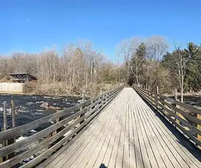
Photos: Luis Bejarano — Google Maps (Google Maps) Parc régional de la Rivière-du-Nord — Google Maps (Google Maps) Yan Delisle — Google Maps (Google Maps) Marie — Google Maps (Google Maps) ClairCanada — CC BY-SA 4.0 (Wikimedia Commons)
Available trails
| TrailTrails | Dist.Distance | GainElevation | Difficulty | GPX |
|---|---|---|---|---|
|
Beginner
|
0.85 km | — | Beginner | |
|
Beginner
|
0.25 km | — | Beginner | |
|
Beginner
|
0.08 km | — | Beginner | |
|
Beginner
|
0.4 km | — | Beginner | |
|
Beginner
|
0.4 km | — | Beginner | |
|
Beginner
|
1.5 km | — | Beginner | |
|
Beginner
|
0.15 km | — | Beginner | |
|
Beginner
|
0.6 km | — | Beginner | |
|
Beginner
|
0.35 km | — | Beginner | |
|
Beginner
|
0.2 km | — | Beginner | |
|
Intermediate
|
1.6 km | — | Intermediate | |
|
Intermediate
|
0.2 km | — | Intermediate | |
|
Intermediate
|
2 km | — | Intermediate |
Trail description
Parc régional de la Rivière-du-Nord is at 750 chemin de la Rivière-du-Nord in Saint-Jérôme, Quebec. The park says it is 45 minutes from Montréal. Wilson Falls are in its Saint-Jérôme sector; the other sector is Prévost, which has its own map.
Before you go
- Hours: daily, 9 a.m. to 5 p.m. The gate closes at 4:30 p.m.
- Dogs: not allowed. The park bans pets on its grounds, along with fires and barbecues.
- Swimming: the Saint-Jérôme sector map shows a no-swimming pictogram.
- Admission, non-residents (taxes included, rates posted by the park on November 9, 2026): age 13 and over, $11.50; ages 6 to 12, $7.00; ages 0 to 5, free.
- Annual passes: family (2 adults and children 0 to 17), $198.00; adult 13 and over, $92.00; age 65 and over, $80.50; child 6 to 12, $46.00.
- Free entry: residents of Saint-Jérôme, Saint-Colomban, Sainte-Sophie, Prévost and Saint-Hippolyte, with valid proof of residence for each person, shown at the gate. Without proof, the non-resident rate applies.
Groups of 15 or more must book at least 4 weeks ahead. Resident free entry does not apply to groups; the rates posted on the group booking page (day access), before taxes, are $10.00 (13 and over), $5.00 (ages 3 to 12) and $0 (ages 0 to 2). The Accès nature program offers free entry with a limited number of tickets, available through the Tout le monde dehors program.
Trails in the Saint-Jérôme sector
The park map (June 2026) numbers 15 trails in this sector. Thirteen are marked for walking; they are the ones in the trail table, with the map's distance and difficulty (easy or intermediate). La Trille (500 m) and Le Chevreuil (1 km) are marked for cycling only. The map gives neither elevation gain nor duration.
The Wilson trail (no. 10) is 2 km long, rated intermediate and open to walkers and cyclists. The two other walking trails over a kilometre are De l'Énergie (1.6 km, intermediate) and Le Faon (1.5 km, easy). All the others are 850 m or shorter.
The map places Wilson Falls (L), the bridge (I) and the viewpoint (M) in the same part of the sector. It also marks the old dam (Q), the penstock (N), the surge chimney (O), the pulp mill shelter (J), a warming hut (R), a four-season washroom block (K) and the access to the P'tit train du Nord (S). Its distance markers read 0 km at the reception building, 0.5 km at the bridge, then 1 km, 1.8 km and 2.5 km.
A historical circuit of 13 interpretive panels tells the story of the park; three of them are titled "Le barrage des Chutes-Wilson", "La conduite forcée" and "La centrale hydroélectrique" (the Chutes-Wilson dam, the penstock and the hydroelectric plant).
Winter
The park is open all year. In winter it offers snow walking, snowshoeing and cross-country skiing. The snow-walking trails can be done in plain boots, and the park says it grooms them mechanically throughout the season. For snowshoeing it publishes a map for each sector (Prévost and Saint-Jérôme) with distances, difficulty levels and access points. For cross-country skiing it describes a network of maintained trails, with equipment rental on site, a heated rest area and trail conditions online. Two huts are open with wood stoves, and a heated washroom block stands right on the trail.
Other activities
- Cycling: trails open from June to October.
- Fishing: a valid fishing licence is required; fishing is allowed in the river only and is prohibited in the pond; no additional fee for this activity at the park.
- Birds: more than a hundred species recorded at the park.
Accessibility
The park holds Kéroul accreditation, has accessible washrooms at the reception building and offers Joëlette rentals for people with reduced mobility.
FREE GUIDE • PDF
25 hikes under 2 hours from Montreal, with drive time, distance and level.
Get my free guideGuide • checklist • taping videos • Sent by emailNewsletter optional
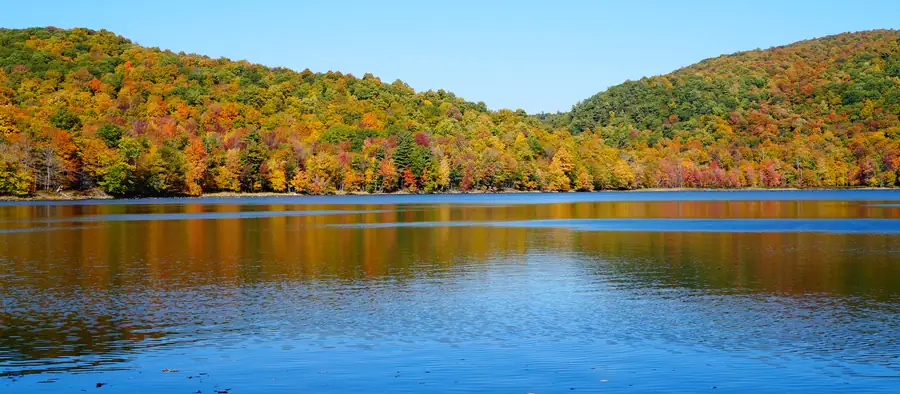
Photo: Jiaqian AirplaneFan, CC BY 3.0, via Wikimedia Commons
Services and amenities
Reception building with accessible washrooms, heated washroom block on the trail, more than 80 picnic tables, 2 communal shelters, 2 huts with wood stoves, equipment rental on site and Joëlette rental. Kéroul accreditation.
Recommended gear for this trail
As an Amazon Associate I earn from qualifying purchases.


Ready to go?
Everything you need to know before you goStarting Point
Park reception: 750 chemin de la Rivière-du-Nord, Saint-Jérôme, Quebec J7Y 5G2. Proof of residence for free entry is shown at the gate. On the Saint-Jérôme sector map, 0 km is at the reception building and Wilson Falls are near the 0.5 km marker.
When?
How much?
As an Amazon Associate I earn from qualifying purchases.
Affiliate links — LGPO may earn a commission at no extra cost to you.
- Hiking shoes Essential
- → Salomon Elixir Tour Mid WP · 203.38 $
- Layered clothing Essential
- Rain jacket Essential
- Trekking poles
- → Black Diamond Trail Ergo Cork · 69.99 $
- Headlamp
- → Petzl Actik Core 625 · 103.95 $
FAQ - Frequently asked questions
Everything you need to knowOutings near Chutes Wilson – Parc régional de la Rivière-du-Nord
Discover other trails you might enjoy

Parc de la Coulée
Laurentides · 4.1 km away

Réserve naturelle Alfred-Kelly
Laurentides · 10.2 km away

Les sentiers écologiques de Saint-Hippolyte
Laurentides · 12.2 km away

Sommet Saint-Sauveur
Laurentides · 13.6 km away

John H. Molson Park
Laurentides · 14.9 km away

Parc des Méandres
Laurentides · 16.4 km away
Hiking near Laval
107 trails to explore ~33 km away
We work hard to provide the most up-to-date and error-free data possible. If something seems incorrect, let us know! Your contribution helps the whole community.
Hikers' opinions
Be the first to review!
No hiker has shared their experience yet. Share your impressions and help other hikers!