


Ready to explore Parc de la Rivière-des-Mille-Îles? Here's everything you need to know before you go!
Discover the trail

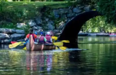




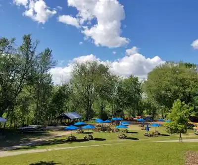
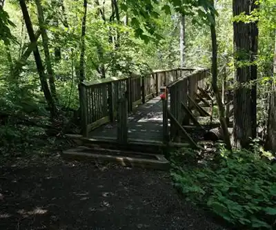
Photos: xiaoyi CCC — Google Maps (Google Maps) Tony Montana — Google Maps (Google Maps) B M — Google Maps (Google Maps)
Available trails
| TrailTrails | Dist.Distance | GainElevation | TimeDuration | Difficulty | GPX |
|---|---|---|---|---|---|
|
Beginner
|
1 km | — | 15min | Beginner | |
|
Beginner
|
0.6 km | — | 15min | Beginner | |
|
Beginner
|
0.7 km | — | 15min | Beginner | |
|
Beginner
|
0.4 km | — | 15min | Beginner | |
|
Beginner
|
2.1 km | — | 28min | Beginner | |
|
Beginner
|
0.5 km | — | 15min | Beginner | |
|
Beginner
|
0.3 km | — | 15min | Beginner | |
|
Beginner
|
0.5 km | — | 15min | Beginner | |
|
Beginner
|
0.6 km | — | 15min | Beginner | |
|
Beginner
|
1 km | — | 15min | Beginner | |
|
Beginner
|
0.9 km | — | 15min | Beginner | |
|
Beginner
|
0.9 km | — | 15min | Beginner | |
|
Beginner
|
1.9 km | — | 25min | Beginner |
Trail description
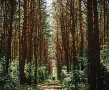
Parc de la Rivière-des-Mille-Îles is one of those places in Laval that lets you step away from the city without needing to travel far. The park feels calm and nature-first, with wooded sections, open views over the water, and plenty of spots where you can slow down and simply watch what’s happening around you. It’s a good fit if you want an easy outdoor day with options—walk for an hour, spend a full afternoon exploring, or mix hiking with time on the river.
Trail network and what the walk feels like
The park has over 42 kilometers of trails that weave through forested areas and along quiet waterways. You’ll move between shaded, tree-lined stretches and more open sections where the river becomes the main feature. The overall vibe is gentle and accessible rather than rugged—more about being immersed in a green corridor than climbing or chasing viewpoints.
If you’re planning a longer outing, you can build a route that totals 14.2 km while still keeping the effort reasonable. The terrain here stays low and relaxed, with an elevation gain of about 10 m, which helps explain why this is generally considered easy. That makes it approachable for beginners, casual walkers, and anyone who wants time outside without a big physical push. More experienced hikers can still enjoy it by focusing on pace, photography, birdwatching, or combining trail time with paddling.
Because the trail system winds through different pockets of the park, it works well for “choose-your-own-adventure” outings. You can keep things short and straightforward, or connect multiple sections and spend more time exploring the mix of forest and riverside scenery. The scenery changes often enough to keep it interesting, even on a flatter walk.
Nature and wildlife spotting
One of the biggest reasons to take your time here is the park’s biodiversity. The combination of woods and water creates lots of habitat, so it’s worth walking slowly and looking not just down the trail but also out toward the shoreline and across the river.
Keep an eye out for wildlife as you go. Herons are a highlight—watch for them gliding over the water or standing still near the edges, looking for fish. Otters are another exciting possibility, sometimes seen playing along the riverbanks. Even when you don’t spot the larger animals, the park is full of smaller signs of life, and it’s the kind of place where pausing quietly can pay off.
Birdwatchers in particular tend to enjoy this park because there’s an abundance of species that frequent the area. Bringing binoculars is a smart move if you have them, especially near the water where activity is often easiest to see.
Water access: kayaking and canoeing
If you want to experience the park from a different angle, you can rent a kayak or canoe and paddle along the peaceful waters of the Mille Îles River. It’s a mellow, beginner-friendly way to get close to the shoreline and the little details you might miss from the trail. The calm water is well suited to people who are new to paddling, and it’s also a great way to add a gentle workout to your day.
Being on the river can make wildlife spotting feel more immediate, since you’re moving quietly through the same space that birds and aquatic life use. It also changes your perspective on the park: you’ll notice the way the forest meets the water, how the shoreline curves, and how the landscape looks when the trails aren’t between you and the river.
Picnic areas and a good family day out
The park includes several picnic areas, which makes it easy to plan a relaxed outing rather than a “just keep walking” kind of day. These spots are ideal for a mid-walk break, a family lunch, or an easy meet-up with friends. It’s also helpful if you’re hiking with kids or with a mixed-ability group and want a natural way to split the day into smaller chunks—walk a bit, eat, explore again.
Because the setting is serene and the trails are approachable, Parc de la Rivière-des-Mille-Îles works especially well for family groups and for anyone looking to spend quality time together outdoors without needing a technical route or challenging terrain.
Conservation and learning opportunities
Parc de la Rivière-des-Mille-Îles is committed to conservation and environmental education. Throughout the year, the park offers programs and workshops designed to raise awareness about local ecosystems and encourage visitors to become stewards of nature. If you enjoy learning while you explore—or if you’re visiting with kids who benefit from guided activities—these programs can add an extra layer to the experience beyond simply walking the trails.
How to get the most out of your visit
- Plan around your pace: With an easy profile and lots of trail options, it’s a good place to go slow, stop often, and actually take in the setting instead of pushing for speed.
- Bring binoculars if you have them: Between herons, otters, and the park’s strong birding potential, a little magnification makes a big difference.
- Consider pairing hiking with paddling: Walking the trails and then renting a kayak or canoe gives you two perspectives on the same landscape—forest-and-water from the ground, and shoreline-and-wildlife from the river.
- Pack for a picnic: The picnic areas make it easy to turn a simple hike into a full, unrushed day outside.
Services and amenities
This information may vary by season.
The Essential Hiking Checklist
Everything you need for your next hike. Bilingual, printable, 1 page.
Get your free hiking checklistRecommended gear for this trail
As an Amazon Associate I earn from qualifying purchases.


Ready to go?
Everything you need to know before you goStarting Point
Public Transportation:
From Montmorency metro, take bus 65 and then get off at the corner of de la Renaissance and Marc-Aurèle-Fortin avenues. From there, you must take the 73 Fabreville bus towards Cartier metro. Then you have to get off at the corner of Sainte-Rose and Longpré boulevards.
From the Laurentian Autoroute (15), take exit 16 and then take Sainte-Rose Boulevard east. The Parc de la Rivière-des-Mille-Îles is located 700 meters further, at #345.
A second access is located in the Berge des Baigneurs sector, at 13 Hotte Street.
Access to the trails is also available from Rosemere, in the Tylee Swamp area, at 202 on Grande-Côte Road.
When?
How much?
As an Amazon Associate I earn from qualifying purchases.
Affiliate links — LGPO may earn a commission at no extra cost to you.
- Hiking shoes Essential
- → Salomon Elixir Tour Mid WP · 203.38 $
- Layered clothing Essential
- Rain jacket Essential
- Trekking poles
- → Black Diamond Trail Ergo Cork · 69.99 $
- Headlamp
- → Petzl Actik Core 625 · 103.95 $
FAQ - Frequently asked questions
Everything you need to knowSimilar hikes nearby
Discover other trails you might enjoy
Centre De La Nature De Laval
Laval

Parc des Prairies
Laval

Bois De La Source
Laval

Boisé Papineau
Laval
Le Bois De L'équerre
Laval

Boisé De L'orée-des-bois
Laval
Hiking near Laval
97 trails to explore ~7 km away
We work hard to provide the most up-to-date and error-free data possible. If something seems incorrect, let us know! Your contribution helps the whole community.
Hikers' opinions
Be the first to review!
No hiker has shared their experience yet. Share your impressions and help other hikers!