

Ready to explore Parc De La Rivière Batiscan? Here's everything you need to know before you go!
Discover the trail
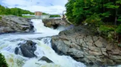
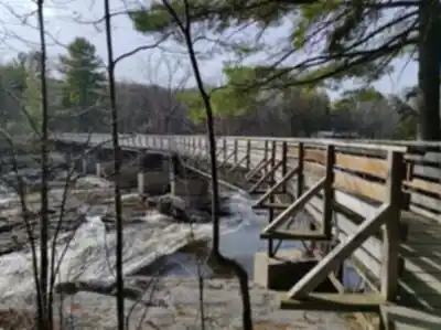
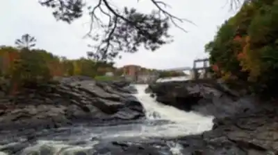
Available trails
| Trails | Distance | Elevation | Duration | Difficulty | GPX |
|---|---|---|---|---|---|
| 11.17 km | 589 m | 3h30 | GPX | ||
| 0.5 km | 15min | Beginner | |||
| 1.1 km | 15min | Beginner | |||
| 3 km | 40min | Beginner | |||
| 0.4 km | 15min | Beginner | |||
| 0.4 km | 15min | Beginner | |||
| 0.5 km | 15min | Beginner | |||
| 0.6 km | 15min | Beginner | |||
| 1.1 km | 15min | Beginner | |||
| 1 km | 0 m | 15min | Beginner | ||
| 5 km | 80 m | 1h30 | Beginner | ||
| 4.3 km | 80 m | 1h | Intermediate |
Trail description
{
"change": "Add clarification about multiple trail options with different difficulty levels",
"action": "In the 'Trail network and what to expect' section, add: 'While the main 18.3 km network is rated Easy with 80 m elevation gain, the park also features additional trail options with varying distances and intensity levels, allowing visitors to choose routes suited to their preferences.'"
}
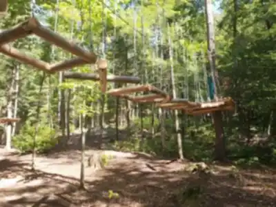
Services and amenities
This information may vary by season.
Recommended gear for this trail


Ready to go?
Everything you need to know before you goStarting Point
To access the hiking trails, head to the main entrance of the park. The primary trailhead is located at 100 Chemin de la Rivière Batiscan, Saint-Narcisse, QC G0X 2Y0. There are parking facilities available at this location for visitors.
When?
Tuesday: 9:00 AM – 6:00 PM
Wednesday: 9:00 AM – 6:00 PM
Thursday: 9:00 AM – 6:00 PM
Friday: 9:00 AM – 6:00 PM
Saturday: 9:00 AM – 6:00 PM
Sunday: 8:30 AM – 8:30 PM
How much?
- Hiking shoes Essential
- → Salomon Elixir Tour Mid WP · 203.38 $
- Layered clothing Essential
- Rain jacket Essential
- Trekking poles
- → Black Diamond Trail Ergo Cork · 69.99 $
- Headlamp
- → Petzl Actik Core 625 · 103.95 $
FAQ - Frequently asked questions
Everything you need to knowTuesday: 9:00 AM – 6:00 PM
Wednesday: 9:00 AM – 6:00 PM
Thursday: 9:00 AM – 6:00 PM
Friday: 9:00 AM – 6:00 PM
Saturday: 9:00 AM – 6:00 PM
Sunday: 8:30 AM – 8:30 PM
The Essential Hiking Checklist
Everything you need for your next hike. Bilingual, printable, 1 page.
Download the free checklistSimilar hikes nearby
Discover other trails you might enjoy

Aux berges du lac Castor
Mauricie

Domaine de la forêt perdue
Mauricie

Réserve Faunique Mastigouche
Mauricie

Parc-L'île-Melville
Mauricie

Chute du Diable
Mauricie

Aire Nature Grandes-piles
Mauricie
Hiking near Quebec City
40 trails to explore ~96 km away
We work hard to provide the most up-to-date and error-free data possible. If something seems incorrect, let us know! Your contribution helps the whole community.
Hikers' opinions