


Ready to explore Sentier Pédestre Culturel De Mont-Carmel? Here's everything you need to know before you go!
Discover the trail


Trail description
The Sentier Pédestre Culturel de Mont-Carmel is a genuinely satisfying short hike in the Mauricie region that does something most easy trails don't bother with: it gives you real context for what you're walking through. At 4 kilometers with 200 meters of elevation gain, it sits in that sweet spot where you feel like you've actually done something without needing to block off your entire day.
The cultural angle here isn't just a marketing label. Interpretive panels are placed throughout the route to tell the story of Mont-Carmel's settlement history, traditional land use, and the relationship between the people who lived here and the landscape around them. The signage is informative without turning the whole thing into a classroom exercise — you can read as much or as little as you want and still have a great walk either way.
Terrain and Trail Feel
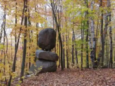
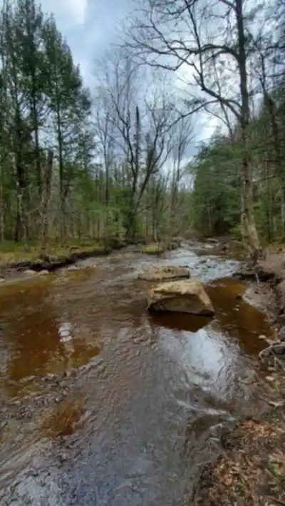
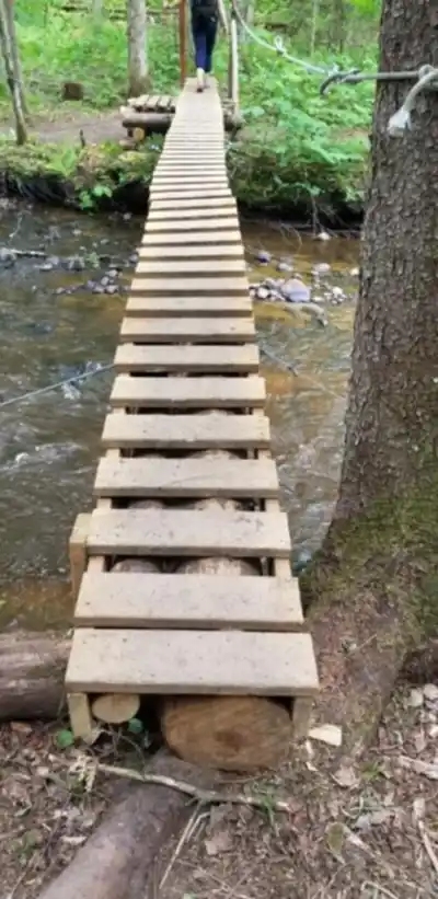
The trail moves through mixed forest typical of central Quebec, where mature hardwoods form a solid canopy overhead. The path itself is well-maintained dirt with wooden boardwalks over the wetter sections, so standard hiking shoes are perfectly adequate — no need for heavy boots. The 200 meters of elevation gain is distributed gradually across the full 4 kilometers, which means there are no sudden steep pitches to catch you off guard. The grade stays comfortable throughout, making conversation easy and the pace relaxed.
About halfway through, the forest opens up into clearings that give you views across the surrounding hills and valleys. These aren't dramatic alpine panoramas, but they're genuinely pleasant — the kind of quiet, rolling landscape that defines this part of Mauricie. The clearings also make natural rest stops if you're hiking with kids or just want to take a few minutes to sit with the view.
The trail is well-marked throughout, so navigation is straightforward. You can focus on the experience rather than keeping track of where you're going.
The Cultural Component
What makes this trail worth seeking out specifically — rather than just any easy loop in the region — is how the cultural interpretation is woven into the route. The path follows corridors that have been used for generations, and the interpretive elements help you read the landscape differently. You start noticing things you'd otherwise walk right past: how the forest composition reflects past land use, how the topography influenced where people settled, what the terrain tells you about seasonal patterns of hunting and gathering in this area.
The signage strikes a balance that's harder to achieve than it looks. It adds depth without slowing you down or making the hike feel like an obligation. For visitors who want to understand Mauricie beyond its lakes and wilderness areas, this trail offers a different kind of entry point.
Who This Trail Works For
The easy difficulty rating is accurate. Families with children who are comfortable walking for an hour and a half will do fine here. Beginner hikers looking for an introduction to trails in Quebec will find the terrain approachable and the signage reassuring. It also works well as a warm-up hike if you're spending several days in Mauricie and want something low-key between bigger outings.
The estimated time of around 1h30 is reasonable for most hikers at a comfortable pace, with time to stop and read the interpretive panels. If you move quickly and skip the signage, you'll finish faster. If you're taking photos or hiking with young kids, budget a bit more.
What to Bring
Given the length and easy terrain, you don't need to overpack. Bring water and a light snack — the clearings midway through make good spots to take a break. Standard hiking shoes or trail runners are sufficient. The wooden boardwalks can get slippery when wet, so if you're heading out after rain, watch your footing on those sections.
Seasonal Notes
The forest canopy keeps the trail comfortable on warm summer days. Fall is a strong season for this hike — the mixed hardwoods put on a solid color display that makes the already pleasant route feel more dramatic. Spring brings new growth and wildflowers along the path. The boardwalks and forest floor can be muddy during spring melt or after heavy rain, so checking conditions beforehand is worth the effort.
The Essential Hiking Checklist
Everything you need for your next hike. Bilingual, printable, 1 page.
Get your free hiking checklistRecommended gear for this trail
As an Amazon Associate I earn from qualifying purchases.


Ready to go?
Everything you need to know before you goStarting Point
The Sentier Pédestre Culturel De Mont-Carmel has a trailhead that can be accessed by heading to the parking lot located at 3800 Rue Principale, Saint-Mathieu-du-Parc, QC G0X 1N0. This is the primary access point for the hiking trails in the area.
When?
How much?
As an Amazon Associate I earn from qualifying purchases.
Affiliate links — LGPO may earn a commission at no extra cost to you.
- Hiking shoes Essential
- → Salomon Elixir Tour Mid WP · 203.38 $
- Layered clothing Essential
- Rain jacket Essential
- Trekking poles
- → Black Diamond Trail Ergo Cork · 69.99 $
- Headlamp
- → Petzl Actik Core 625 · 103.95 $
FAQ - Frequently asked questions
Everything you need to knowSimilar hikes nearby
Discover other trails you might enjoy

Aux berges du lac Castor
Mauricie

Domaine de la forêt perdue
Mauricie

Parc De La Rivière Batiscan
Mauricie

Réserve Faunique Mastigouche
Mauricie

Parc-L'île-Melville
Mauricie

Chute du Diable
Mauricie
Hiking near Laval
97 trails to explore ~120 km away
We work hard to provide the most up-to-date and error-free data possible. If something seems incorrect, let us know! Your contribution helps the whole community.
Hikers' opinions
Be the first to review!
No hiker has shared their experience yet. Share your impressions and help other hikers!