

Ready to explore Parc National des Grands Jardins? Here's everything you need to know before you go!
Discover the trail
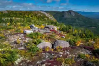
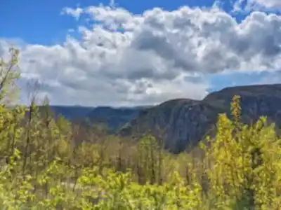
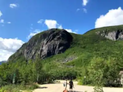
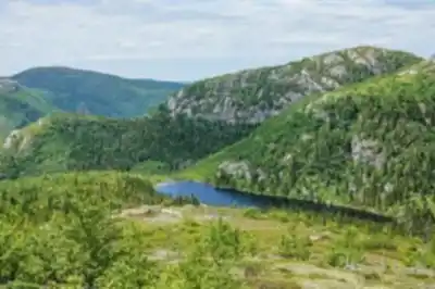
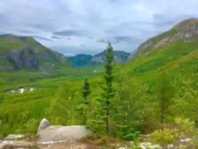
5
community photos
Available trails
| Trails | Distance | Elevation | Duration | Difficulty | GPX |
|---|---|---|---|---|---|
| 11 km | 2h30 | Beginner | |||
| 1.8 km | 24min | Beginner | |||
| 1.6 km | 21min | Beginner | |||
| 6.8 km | 1h30 | Beginner | |||
| 2.3 km | 250 m | 54min | Intermediate | ||
| 1.7 km | 23min | Intermediate | |||
| 17 km | 4h | Intermediate | |||
| 2.5 km | 33min | Intermediate | |||
| 4.3 km | 480 m | 2h | Advanced | ||
| 4 km | 53min | Advanced |
Click a trail to see it on the map
Trail description
Désolé, nous n'avons pas de description pour cet endroit.
Soyez le premier à partager plus d'informations sur cet endroit.
Soyez le premier à partager plus d'informations sur cet endroit.
Services and amenities
Baggage
Rental center
Belvedere
Toilet
Picnic table
Bridge
Reception
Parking
Shelter
Refuge
Winter camping
Rustic camping
Camping
Accessible for people with reduced mobility
Interpretation Center
This information may vary by season.
Recommended gear for this trail
LGPO Pick

Salomon
Elixir Tour Mid WP
Waterproof mid-height boot ideal for rocky terrain
203.38 $


Affiliate links — LGPO may earn a commission at no extra cost to you.
Ready to go?
Everything you need to know before you goWhen?
Opening hours
No information
Varies by season
Best season
Fall
Spectacular colors
Best time
Early morning
Less crowded
Weather (next days)
Loading
How much?
Entry fees
Adult
$ 8.9
Child
—
What to bring?
Gear
- Hiking shoes Essential
- → Salomon Elixir Tour Mid WP · 203.38 $
- Layered clothing Essential
- Rain jacket Essential
- Trekking poles
- → Black Diamond Trail Ergo Cork · 69.99 $
- Headlamp
- → Petzl Actik Core 625 · 103.95 $
Water & food
2L minimum
No water point on the trail
Bring energy snacks for a 4h+ hike
Good to know
Park rules
Dogs allowed
Safety
Download the GPX before you go
Limited cellular coverage on the trail
Slippery after rain
Be careful on rocky sections
In an emergency
Emergency
911
Parking GPS
47.6651, -70.6273
Center
800 665-6527
FAQ - Frequently asked questions
Everything you need to knowEasy
480.00 m
980.00 m
2h30
Yes
No
8.90 $
Yes
Yes, the main trail is rated as Easy difficulty, making it accessible for beginners and those new to hiking. The 3.2 km distance and 2h30 estimated duration provide a manageable introduction to the park's natural features.
Yes, dogs are allowed on this trail. Please ensure your dog is under control and verify current pet policies with the park before your visit.
The trail features 480 m of elevation gain over the 3.2 km distance. While rated Easy, this elevation change should be considered when planning your hike and assessing your fitness level.
Yes, the park offers multiple facilities including an Interpretation Center, reception pavilion, picnic tables, toilets, shelters, and a refuge. The site is also accessible for people with reduced mobility, and various camping options are available.
No, parking is not free at this location. There is a fee to park at the park. Please budget accordingly for your visit.
Didn't find your answer?
Free
1 pages
The Essential Hiking Checklist
Everything you need for your next hike. Bilingual, printable, 1 page.
Download the free checklistSimilar hikes nearby
Discover other trails you might enjoy

Favorite
🐕
Dog allowed
Mont Du Lac Des Cygnes
Charlevoix
4.3 KM
2h30
480 m
Beginner
4.8
(17)

Favorite
🐕
Dog allowed
Parc National Des Hautes-gorges-de-la-rivière-malbaie
Charlevoix
11.3 KM
4h30
700 m
Advanced
4.8
(16)

Favorite
🐕
Dog allowed
Mount Morrios
Charlevoix
3.2 KM
2h30
637 M
Beginner
4.5
(24)

Sentiers Pédestres Les Éboulements
Charlevoix
160 km
41h
1200 m
Advanced
5.0
(10)

Sentier Des Caps De Charlevoix
Charlevoix
74.9 KM
20h30
800 M
Beginner
4.8
(29)

🐕
Dog allowed
Mont du Dôme
Charlevoix
175.7 KM
1h45
400 m
Beginner
4.6
(38)
Top 10 best hiking in Charlevoix
Our ranking based on hiker reviews
Hiking near Quebec City
40 trails to explore ~104 km away
Did you spot an error?
We work hard to provide the most up-to-date and error-free data possible. If something seems incorrect, let us know! Your contribution helps the whole community.
Hikers' opinions