Hiking Arbraska Laflèche - panoramic view
--°C
Loading...
See forecast →

Hiking in Arbraska Laflèche: trails, map and practical info

Outaouais • Quebec

4.7 Appreciated by 20 hikers
François Dumaine
By François DumaineContributor since 2016Updated 20/06/2026
Difficulty
Easy
Distance
8 km
Elevation
100 m
Duration
2h30
Max altitude
1,105 m

An easy 8.2 km adventure trail in Quebec's Outaouais region featuring treetop aerial courses and access to Laflèche Cave, the largest visited cave in the Canadian Shield. 100 m elevation gain through dense woodlands near Chelsea.

Recommended for :
Beginners

Ready to explore Arbraska Laflèche? Here's everything you need to know before you go!

Discover the trail

Trail description

{
"section_more_than_hiking": "

More than hiking: aerial courses and Laflèche Cave

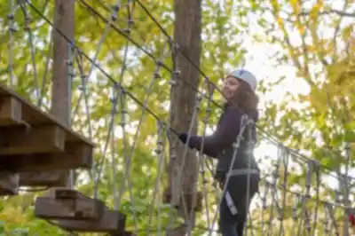
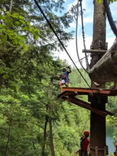
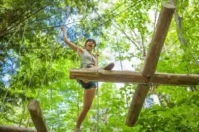
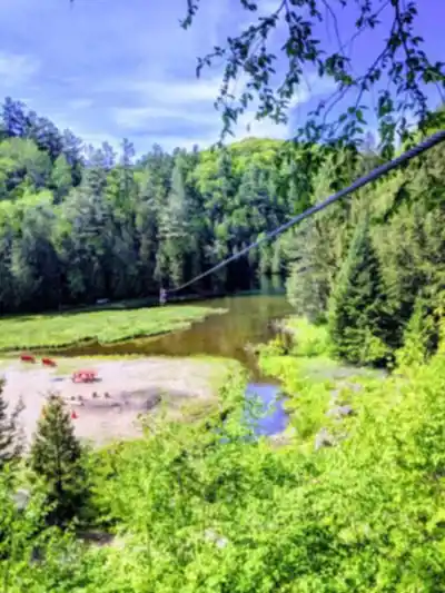
While hiking is a key draw at Arbraska Laflèche, it's also a place where you can build a full day outdoors without needing to leave the property. In addition to the trails, there are aerial courses that run up in the treetops. They add a completely different perspective on the forest—less about steady walking and more about moving through the canopy and testing your comfort with height and obstacles.

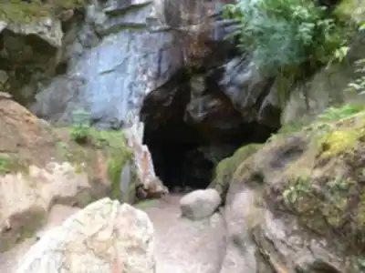
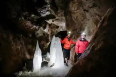
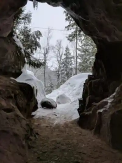
Another standout feature is Laflèche Cave, a notable underground cave system. Visiting the cave gives you a totally different kind of nature experience than the trails: instead of open woods and daylight, you're shifting into an underground environment with its own atmosphere and sense of scale. If you're planning a visit, it's worth thinking about how you want to balance the day—some people prefer to hike first and then head to the cave, while others like to start underground and finish with a walk in the forest.

"
}

Recommended gear for this trail

LGPO Pick
Elixir Tour Mid WP
Salomon
Elixir Tour Mid WP
4.5 (2847 reviews)
Waterproof mid-height boot ideal for rocky terrain
203.38 $
See price
Daylite Plus 20L
Osprey
Daylite Plus 20L
4.7 (3215 reviews)
Lightweight and versatile for day hikes
109.99 $
See price
Most Popular
Wide Mouth 1L
Nalgene
Wide Mouth 1L
4.8 (12540 reviews)
Unbreakable and BPA-free — a hiking essential
23.11 $
See price
Best Value
Trail Ergo Cork
Black Diamond
Trail Ergo Cork
4.4 (1456 reviews)
Comfortable cork grip for long ascents
69.99 $
See price
Actik Core 625
Petzl
Actik Core 625
4.6 (1893 reviews)
USB rechargeable with 600 lumens for early starts
103.95 $
See price
Affiliate links — LGPO may earn a commission at no extra cost to you.

Ready to go?

Everything you need to know before you go

Where?

Address
255 Rte Principale, Val-des-Monts, QC J8N 4B7, Canada
GPS coordinates
45.6423208, -75.7924601
Phone
(877) 886-5500

Starting Point

To get to the arbraska laflèche trails, you must go to the municipality of Chelsea, in the Outaouais. From there, go to the Lac-des-Deux-Montagnes Road, and follow the signs to the trails.

When?

Opening hours
From sunrise to sunset
Varies by season
Best season
Fall
Spectacular colors
Best time
Early morning
Less crowded
Weather (next days)
Loading

How much?

Entry fees
Adult
Not available
Child
What to bring?
Gear
Download the PDF checklist
Water & food
2L minimum
No water point on the trail
Bring energy snacks for a 4h+ hike
Good to know
Park rules
No dogs
Safety
Download the GPX before you go
Limited cellular coverage on the trail
Slippery after rain
Be careful on rocky sections
In an emergency
Emergency
911
Parking GPS
45.6423208, -75.7924601
Center
(877) 886-5500

Hikers' opinions

4.7
7 Reviews
SR
Sophie R.
Sep 25, 2023
While the scenery at Arbraska Laflèche was lovely, I found the trail a bit too short for my liking. The 8.2 km distance was manageable, but I wished for a longer trek to truly immerse myself in nature. The paths were well-marked, but it got busy during the weekend. A nice fall hike nonetheless, with colorful foliage everywhere.
MT
Mike T.
Jul 15, 2023
I went for an evening hike at Arbraska Laflèche and it was absolutely stunning. The lighting just before sunset enhanced the natural beauty of the trails. I spotted a few deer in the woods, which made the experience even more enjoyable. The moderate nature of the hike made it ideal for a relaxed evening with friends. Highly recommend bringing a camera!
EP
Emma P.
May 10, 2023
I enjoyed hiking the Arbraska Laflèche trails on a beautiful spring day. The wildflowers were starting to bloom, adding vibrant colors to the path. The gentle elevation made it easy for us as a family, and we appreciated the well-maintained trails. It was a perfect outing with the kids, although I do wish there had been more spots to rest along the way.
NH
Normand Hird
Oct 21, 2015
Another beautifull
RJ
Ronald J. Johnson
Jun 25, 2015
My favorite place.

FAQ - Frequently asked questions

Everything you need to know
Easy
100.00 M
1105.00 M
2h30
No
No
The Arbraska Laflèche trail is rated as Easy difficulty, making it accessible for most hikers. With only 100m of elevation gain over 8.2km, it's a relatively gentle hike suitable for beginners.
The Arbraska Laflèche trail is 8.2 kilometers long. The hiking time will vary depending on your pace and stops along the way.
No, dogs are not allowed on the Arbraska Laflèche trail. You'll need to make alternative arrangements for your pets when visiting this trail.
No, parking is not free at Arbraska Laflèche. There are parking fees associated with visiting this trail location.
The Arbraska Laflèche trails are open from sunrise to sunset. Check current conditions and any seasonal variations before your visit.
Didn't find your answer?
Free 1 pages

The Essential Hiking Checklist

Everything you need for your next hike. Bilingual, printable, 1 page.

Download the free checklist
Top 10 best hiking in Outaouais
Our ranking based on hiker reviews

Hiking near Gatineau

48 trails to explore ~20 km away

View trails
Did you spot an error?

We work hard to provide the most up-to-date and error-free data possible. If something seems incorrect, let us know!

Update : June 2026