

Ready to explore Frye Mountain, Maine? Here's everything you need to know before you go!
Discover the trail
Trail description
Description
Frye Mountain stands as one of Maine's most accessible yet rewarding hiking destinations, offering a surprisingly diverse outdoor experience within the expansive 5,240-acre Frye Mountain Wildlife Management Area in Waldo County. This former military training site from World War II has transformed into a peaceful wilderness retreat that attracts hikers seeking both natural beauty and historical intrigue.
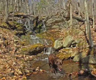
The mountain's trail system winds through a varied landscape that showcases the best of Maine's terrain. You'll begin your hike through dense mixed forests dominated by towering pines, maples, and birches that create a natural canopy overhead. The forest floor is typically carpeted with fallen leaves and pine needles, creating soft footing that makes for comfortable walking. As you progress, the trail opens into expansive fields and meadows that provide welcome breaks from the forest cover and offer different perspectives of the surrounding countryside.
Trail Experience and Terrain
The hiking experience at Frye Mountain caters to various skill levels through its network of interconnected trails. The terrain presents a mix of gentle slopes that ease you into the hike, followed by more challenging inclines that will get your heart rate up without being overwhelming. The 347-meter elevation gain is distributed gradually across the 1-kilometer route, making this an ideal choice for beginners looking to build confidence or experienced hikers wanting a shorter adventure.
The trail surface varies throughout your journey, from well-packed dirt paths through the forested sections to slightly rockier terrain as you gain elevation. During wet conditions, some sections can become muddy, particularly in the lower elevations where water tends to collect. The varied terrain keeps the hike interesting, with each section offering something different to experience and navigate.
Wildlife and Natural Features
Frye Mountain serves as home to an impressive array of Maine wildlife, making every hike a potential wildlife viewing opportunity. White-tailed deer are commonly spotted throughout the area, particularly in the early morning and late afternoon hours when they venture into the open fields to feed. Wild turkeys frequently cross the trails, and their distinctive calls often echo through the forest.
The real prize for wildlife enthusiasts is the occasional moose sighting. These magnificent creatures sometimes appear in the more remote sections of the wildlife management area, particularly near water sources or in the larger clearings. While moose encounters are never guaranteed, the possibility adds an element of excitement to every visit.
The diverse habitat created by the mix of forest and open areas supports numerous bird species as well. You might hear the drumming of woodpeckers, the calls of various songbirds, or catch glimpses of raptors soaring overhead. The changing seasons bring different wildlife activity, with spring offering the best opportunities for observing young animals and fall providing excellent conditions for spotting deer and other mammals preparing for winter.
Historical Elements
What sets Frye Mountain apart from many other hiking destinations is its fascinating military history. During World War II, this area served as a training site, and remnants of that era still dot the landscape. As you explore the trails, you'll encounter concrete foundations, old roadways, and other structural remains that offer glimpses into the mountain's past life as a bustling military facility.
These historical features are scattered throughout the area, turning your hike into an informal treasure hunt as you discover pieces of history along the way. The contrast between the peaceful natural setting and these reminders of wartime activity creates a unique atmosphere that adds depth to the outdoor experience. Take time to examine these remnants respectfully, as they represent an important chapter in both local and national history.
Planning Your Visit
The 3 to 4-hour duration estimate for exploring Frye Mountain allows plenty of time to fully experience what the area has to offer. This timeframe accounts for a leisurely pace that includes stops for wildlife observation, historical exploration, and simply enjoying the peaceful surroundings. The mountain's tranquil atmosphere makes it an ideal location for bringing along a picnic lunch to enjoy at one of the scenic spots along the trail.
Several areas along the route provide excellent spots for taking breaks, whether you want to sit quietly and listen to the sounds of nature or spread out a blanket for a proper meal. The open fields offer particularly nice picnic locations with views across the landscape, while forest clearings provide more intimate settings surrounded by trees.
Proper preparation enhances both safety and enjoyment during your visit. Sturdy hiking boots are essential, as the varied terrain and potential for muddy conditions require good traction and ankle support. Bringing plenty of water is crucial, especially during warmer months or if you plan to spend the full 3 to 4 hours exploring the area.
Checking trail conditions before your visit helps ensure you're prepared for current circumstances. Weather, seasonal changes, and maintenance activities can all affect trail conditions, so a quick check with local resources or recent visitor reports can provide valuable information for planning your gear and expectations.
Safety considerations include informing someone of your hiking plans, particularly if you're venturing out alone. While Frye Mountain is generally well-traveled and safe, having someone aware of your intended route and expected return time is always a wise precaution. The wildlife management area's size means that some sections can be quite remote, making basic safety planning important for any outdoor adventure.
Recommended gear for this trail


Ready to go?
Everything you need to know before you goStarting Point
To access the hiking trails, you can start at one of the following trailheads:
Frye Mountain Trailhead: Located on Walker Ridge Road, Montville, ME 04941. There is a small parking area available near the trailhead.
Frye Mountain Wildlife Management Area: Accessible from Route 220, with parking available at the designated lot near the entrance to the management area.
Ensure to check local maps for precise directions and any updates on parking availability or trail conditions before your visit.
When?
How much?
- Hiking shoes Essential
- → Salomon Elixir Tour Mid WP · 203.38 $
- Layered clothing Essential
- Rain jacket Essential
- Trekking poles
- → Black Diamond Trail Ergo Cork · 69.99 $
- Headlamp
- → Petzl Actik Core 625 · 103.95 $
FAQ - Frequently asked questions
Everything you need to knowThe Essential Hiking Checklist
Everything you need for your next hike. Bilingual, printable, 1 page.
Download the free checklistSimilar hikes nearby
Discover other trails you might enjoy

A Trail McGaffney Mountain Trail
Kennebec Valley
Hidden Valley Nature Center
Kennebec Valley
Mt Pisgah
Kennebec Valley
Hatchet Mountain Preserve
Kennebec Valley
Moxie Falls Trailhead & Parking
Kennebec Valley
Pleasant lake Preserve
Kennebec Valley
Hiking near Bangor
0 trails to explore ~50 km away
We work hard to provide the most up-to-date and error-free data possible. If something seems incorrect, let us know! Your contribution helps the whole community.
Hikers' opinions