

Ready to explore Henry Hudson Trail County Park.? Here's everything you need to know before you go!
Discover the trail
Trail description
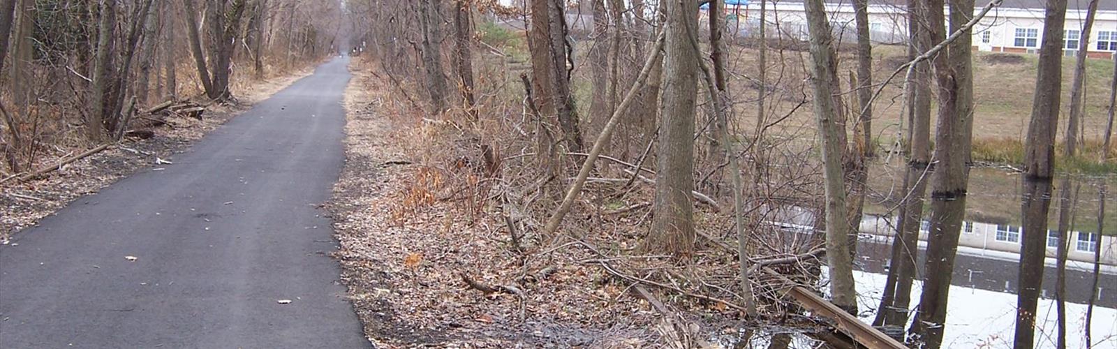
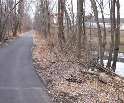
The Henry Hudson Trail County Park takes a former railroad corridor and turns it into one of Central New Jersey's most accessible and rewarding outdoor destinations. Stretching 24 kilometers through a variety of landscapes, this rail-trail is flat, well-maintained, and genuinely welcoming to hikers, cyclists, and walkers of all fitness levels. The nearly nonexistent elevation change — just 10 meters across the entire route — means you can focus entirely on what's around you rather than what's under your feet.
What makes this trail stand out in the region is the range of environments it passes through. You start inland, moving through suburban woodlands and wetland edges, and gradually the landscape shifts toward the coast as Raritan Bay comes into view. That transition — from tree canopy to salt air and open water — is the trail's defining experience, and it happens gradually enough that you actually feel it unfold.
Two Sections, Two Different Moods
The trail breaks naturally into two distinct segments, and they feel quite different from each other.
The northern section, running from Aberdeen to Atlantic Highlands, is where the trail earns its reputation. As you move toward the coast, the vegetation changes, the air picks up a salt edge, and eventually you get expansive views over Raritan Bay. On a clear day, the water stretches out in a way that feels genuinely surprising for a trail in this part of New Jersey. The coastal towns along this stretch — Aberdeen, Keyport, Keansburg, and Atlantic Highlands — are easy to dip into for a break, a coffee, or a meal. They add a real sense of place to the outing rather than just serving as endpoints.
The southern section, from Freehold to Marlboro, has a completely different character. Here the trail runs through more enclosed, wooded terrain with a denser tree canopy overhead. It's quieter, more shaded, and better suited to anyone looking for a more contemplative walk away from coastal crowds. The agricultural areas that appear along this stretch give you a glimpse of a more rural Central New Jersey that's easy to overlook from the highway.
Wildlife and Natural Variety
The trail's linear path through multiple habitat types makes it genuinely interesting for anyone paying attention to the natural world. In the wooded inland sections, you'll encounter the kinds of woodland birds typical of New Jersey's mixed forests. As you move toward the coast, the species shift — waterfowl and shorebirds become more common, and the plant communities change to reflect the salt influence near the bay. The wetland areas along the route support their own distinct communities and are worth slowing down for.
Spring and fall are particularly active periods along the corridor, when migratory birds move through and the vegetation is either coming into full leaf or turning color. Summer brings the full density of coastal and woodland plant life, while the open sections near the bay stay breezy and comfortable even on warm days.
Railroad History Along the Route
The trail follows a railroad bed that once carried trains through this part of New Jersey, and that history hasn't been entirely erased. Interpretive signs at various points along the route explain how the railroad shaped the communities it passed through and how the corridor has been repurposed for recreational use. It's a good example of adaptive reuse that benefits both the people who live nearby and the wildlife that now uses the corridor as a travel route.
The transformation from active rail line to public trail is part of a broader movement across North America, but the Henry Hudson Trail does it well — the infrastructure feels intentional and the historical context is genuinely informative rather than just decorative.
Planning Your Visit
With 24 kilometers of trail available, most visitors will want to pick a section rather than attempting the full length in a single outing. The estimated time for a complete end-to-end walk is around six hours, which is a solid full-day commitment. More commonly, people choose a segment based on what they want to see — coastal views and town access on the northern end, or quieter woodland walking on the southern end.
Multiple parking areas are distributed along the route, which makes it easy to plan a point-to-point outing with a car shuttle, or simply to access whichever section interests you most. Restrooms are available at several points along the trail, and picnic areas give you places to stop and eat without having to carry everything back to the trailhead. The paved surface works well for both pedestrians and cyclists, though on weekends and during good weather the trail sees meaningful bike traffic, so staying aware of your surroundings is worth keeping in mind.
The flat terrain and accessible surface make this one of the more family-friendly options in Central New Jersey, and the variety of entry points means you can tailor the distance to whatever works for your group on a given day.
The Essential Hiking Checklist
Everything you need for your next hike. Bilingual, printable, 1 page.
Get your free hiking checklistRecommended gear for this trail
As an Amazon Associate I earn from qualifying purchases.


Ready to go?
Everything you need to know before you goStarting Point
The Henry Hudson Trail County Park is located in the town of Harrison, New Jersey. To get to the park, take the New Jersey Turnpike to exit 15W and follow the signs for Route 280 West. Take Route 280 West to the first exit (Route 24 North) and take Route 24 North to the Harrison/East Newark exit. At the end of the exit ramp, make a left turn onto Frank E. Rodgers Boulevard and follow the road until it ends at the park entrance.
When?
How much?
As an Amazon Associate I earn from qualifying purchases.
Affiliate links — LGPO may earn a commission at no extra cost to you.
- Hiking shoes Essential
- → Salomon Elixir Tour Mid WP · 203.38 $
- Layered clothing Essential
- Rain jacket Essential
- Trekking poles
- → Black Diamond Trail Ergo Cork · 69.99 $
- Headlamp
- → Petzl Actik Core 625 · 103.95 $
FAQ - Frequently asked questions
Everything you need to knowSimilar hikes nearby
Discover other trails you might enjoy
Dorbrook Recreation Area
Central New Jersey
Thompson Park Monroe
Central New Jersey
Holmdel Park
Central New Jersey

Hamilton Veterans Park
Central New Jersey
Nomahegan Park
Central New Jersey
Rosedale Park
Central New Jersey
Hiking near Jersey City
0 trails to explore ~32 km away
We work hard to provide the most up-to-date and error-free data possible. If something seems incorrect, let us know! Your contribution helps the whole community.
Hikers' opinions
Be the first to review!
No hiker has shared their experience yet. Share your impressions and help other hikers!