

Ready to explore South Mountain Reservation? Here's everything you need to know before you go!
Discover the trail
Trail description
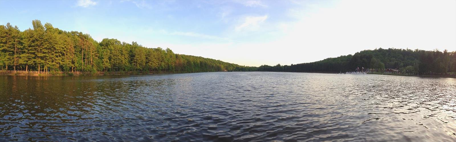
South Mountain Reservation covers 2,110 acres of Essex County, making it one of the largest and most rewarding natural areas in Northern New Jersey. It sits close enough to the surrounding urban centers that you can be on trail within minutes of leaving the city, yet the moment you step into the hardwood forest, the noise fades and the experience feels genuinely removed from everything around it. That contrast is a big part of what keeps people coming back.
The reservation sits within the Watchung Mountains, and the geology shapes everything about how the terrain feels underfoot. The landscape shifts between dense forest, rocky outcroppings, wetland edges, and stream corridors, giving each section of trail its own character. With 80 kilometers of trails spread across the preserve and only about 150 meters of elevation change throughout, the network leans accessible rather than punishing — but there's enough variety in terrain and distance to keep experienced hikers engaged.
Trail Network
The trail system here is extensive and well-maintained, which means you have real options depending on how much time and energy you're working with. The Lenape Trail is the reservation's signature route, running through the heart of the preserve and connecting the major ecosystems and landmarks along the way. It's a good backbone for planning a longer outing, and it carries some historical weight as well — the trail passes through land with deep ties to both Native American history and the colonial period.
Beyond the Lenape Trail, the network branches into paths that range from wide, smooth corridors suitable for trail running or family walks to narrower, rockier sections that demand more attention. The elevation changes are moderate throughout — nothing technical, but enough to give your legs something to work against and reward you with occasional elevated views over the surrounding landscape. Rocky sections can get slippery when wet, so footwear with decent grip is worth thinking about before you head out.
Hemlock Falls and Water Features
Hemlock Falls is the reservation's most recognizable landmark, and it earns the attention. The waterfall drops over a rocky ledge surrounded by hemlock trees that keep the area cool and shaded even in midsummer. After a good rain, the flow picks up significantly and the falls become genuinely dramatic. The hike to reach them involves enough varied terrain that the destination feels earned, which adds to the payoff when you get there.
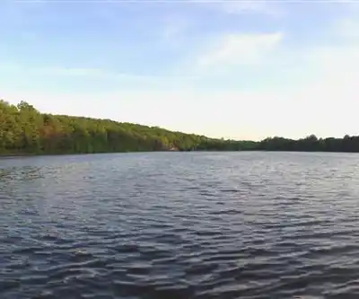
Water is a consistent presence throughout the reservation. Streams run alongside many of the trails, and several ponds dot the landscape, providing both scenic rest stops and habitat for local wildlife. The sound of moving water follows you through a good portion of the trail network, which does a lot to set the mood on a long hike.
Wildlife and Natural Character
The hardwood forest is dominated by oaks, maples, and hickories, with a canopy dense enough in summer to keep the trails noticeably cooler than the surrounding area. Spring brings wildflowers through the understory, and fall turns the whole reservation into a legitimate foliage destination — the color display here competes with anything in the broader region.
The size of the preserve matters for wildlife. The 2,110 acres support functional corridors that allow larger mammals to move through, and deer and fox sightings are common. The mix of wetlands, mature forest, and rocky habitat creates distinct microenvironments that support different species, and birdwatching is productive throughout the year. Migrating species use the ponds and wetland areas as stopover points, while the mature forest provides nesting habitat for year-round residents.
Facilities and Nearby Attractions
The reservation has designated picnic areas positioned to take advantage of the scenery, making it practical for families or groups who want to extend their visit beyond the hike itself. The facilities are well-placed and don't feel like afterthoughts.
The reservation's location also puts it within easy reach of Turtle Back Zoo and Codey Arena, which makes it a natural anchor for a full-day outing with kids. You can combine a morning on the trails with an afternoon at the zoo without much logistical effort, which is a genuine advantage for families trying to satisfy different interests in a single trip.
Seasonal Conditions
Spring is when Hemlock Falls is at its best, fed by snowmelt and rain, and the wildflower bloom through the understory is worth timing a visit around. The trails can be muddy through April and into May, so expect soft ground and some wet crossings. Summer brings full canopy cover that keeps the trails cooler than you'd expect given the humidity in the region — longer hikes are manageable if you start early. Fall is peak season for good reason; the foliage across the Watchung hardwoods is exceptional, and the trails see more traffic as a result. Winter opens up views that the canopy hides the rest of the year, though icy conditions on rocky sections and stream crossings require extra caution.
Access and Planning
Multiple entry points around the reservation's perimeter distribute traffic well and give you flexibility in how you approach the trail network. This is useful both for first-time visitors who want to start near a specific landmark like Hemlock Falls, and for regulars who like to vary their starting point to keep things fresh. The trail intersections throughout the preserve make it easy to adjust your route on the fly — cut things short if the weather turns, or add distance if you're feeling good. With 80 kilometers of trail to work with, you're unlikely to run out of new ground to cover anytime soon.
The Essential Hiking Checklist
Everything you need for your next hike. Bilingual, printable, 1 page.
Get your free hiking checklistRecommended gear for this trail
As an Amazon Associate I earn from qualifying purchases.


Ready to go?
Everything you need to know before you goStarting Point
The easiest way to get to the start of the trails at the south mountain reservation is to take the Garden State Parkway to exit 153 and then take Route 124 south. The entrance to the reservation will be on your right.
When?
How much?
As an Amazon Associate I earn from qualifying purchases.
Affiliate links — LGPO may earn a commission at no extra cost to you.
- Hiking shoes Essential
- → Salomon Elixir Tour Mid WP · 203.38 $
- Layered clothing Essential
- Rain jacket Essential
- Trekking poles
- → Black Diamond Trail Ergo Cork · 69.99 $
- Headlamp
- → Petzl Actik Core 625 · 103.95 $
FAQ - Frequently asked questions
Everything you need to knowSimilar hikes nearby
Discover other trails you might enjoy
Watchung white purple trails
Northern New Jersey

Mt Cecchino
Northern New Jersey
Van Slyke Castle
Northern New Jersey
Loantaka Park
Northern New Jersey
Hacklebarney Hiking Trail
Northern New Jersey
Ramapo Mountain State Forest
Northern New Jersey
Hiking near Newark
0 trails to explore ~10 km away
We work hard to provide the most up-to-date and error-free data possible. If something seems incorrect, let us know! Your contribution helps the whole community.
Hikers' opinions
Be the first to review!
No hiker has shared their experience yet. Share your impressions and help other hikers!