

Ready to explore Trans Canada Trail? Here's everything you need to know before you go!
Discover the trail
Trail description
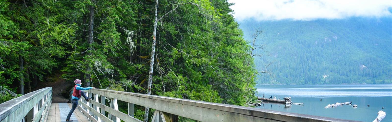
The Trans-Canada Trail through Alberta North is one of those routes that puts the sheer scale of Canada into perspective. This section connects communities, landscapes, and ecosystems across a part of Alberta that many hikers overlook in favour of the more heavily trafficked mountain corridors to the south. If you're looking for a trail experience that feels genuinely expansive — where the horizon stretches out and the pace of the land sets the rhythm — this stretch delivers.
What Is the Trans-Canada Trail?
The Trans-Canada Trail, also known as The Great Trail, is the world's longest recreational trail network, linking communities from coast to coast to coast across Canada. The Alberta North segment is part of that larger connected system, meaning that what you're walking, cycling, or snowshoeing is literally tied to trails running all the way to the Atlantic, Pacific, and Arctic coasts. That context alone gives the experience a different weight than your average out-and-back.
In this northern Alberta corridor, the trail takes on a character shaped by the boreal landscape — wide skies, mixed forest, river valleys, and the kind of quiet that's harder to find the further south you go. It's not a trail built around dramatic elevation gain or technical terrain. It's built around distance, connection, and the particular beauty of northern Alberta's natural environment.
The Terrain and Landscape
Northern Alberta's version of the Trans-Canada Trail moves through terrain that's distinctly boreal in character. Expect stretches of spruce and aspen forest, open meadow sections, and areas where the trail follows river corridors or skirts wetlands. The land here is flatter and more expansive than the Rocky Mountain foothills, which means the experience is less about climbing and more about covering ground and absorbing the environment around you.
Wildlife is a genuine part of hiking in this region. Northern Alberta supports populations of moose, black bear, white-tailed deer, and a wide range of bird species — particularly during migration seasons when the wetlands and river systems become active staging areas. Keep your eyes open and make noise on forested sections, especially in areas with dense undergrowth.
The trail surface varies depending on which segment you're accessing. Some sections follow former rail corridors, giving you a wide, relatively level path with good sight lines. Others are more natural surface trail, where conditions can shift with the seasons and recent weather. Checking local trail conditions before heading out is always a good call in this part of the province.
How to Approach This Trail
Because the Trans-Canada Trail is a network rather than a single defined loop or point-to-point route, how you experience it in Alberta North depends largely on where you access it and how far you intend to go. Day hikers can pick an access point, head out for a few hours, and return the same way. Those with more time — and the logistics to support it — can use the trail as a multi-day or even multi-week corridor, moving between communities along the route.
For most visitors, the practical approach is to identify a local trailhead or community access point, plan a comfortable out-and-back or a short loop if one is available nearby, and treat the experience as a window into the larger trail system rather than an attempt to cover the whole thing in one go. The trail is designed to be used in sections, and each section has its own character.
Seasons and Conditions
Northern Alberta has a climate that shapes trail use significantly across the year. Summer brings long days, warm temperatures, and the full green of the boreal forest — this is peak season for most users. Spring and fall offer cooler hiking with fewer people on the trail, though spring in particular can mean soft, muddy conditions in lower-lying sections and along river corridors.
Winter transforms the trail entirely. In many sections, the Trans-Canada Trail in Alberta North becomes a snowshoe or cross-country ski route, and the boreal forest takes on a completely different atmosphere under snow. If you're visiting in winter, check whether the specific section you're targeting is maintained for winter use and what conditions are like before you go.
Bugs are a real factor in late spring and early summer across northern Alberta. Mosquitoes and blackflies can be intense, particularly near water. Bring appropriate repellent and consider head nets if you're planning longer stretches during peak bug season.
Practical Information
- Trail type: The Trans-Canada Trail is a multi-use corridor — hiking, cycling, and in winter, snowshoeing and skiing are all common depending on the section.
- Access: Multiple community access points exist along the Alberta North corridor. Research the specific trailhead closest to your starting point before heading out.
- Wayfinding: The Trans-Canada Trail uses a consistent national signage system with the trail's maple leaf logo. Signage quality can vary by section, so downloading offline maps or the official Great Trail app is a smart move.
- Leave No Trace: This trail passes through sensitive boreal ecosystems. Pack out everything you bring in, stay on the designated trail surface, and give wildlife plenty of space.
- Dogs: Check local regulations for the specific section you're accessing, as rules around dogs on-leash can vary depending on land management jurisdiction along the route.
What Makes This Section Worth Your Time
The Trans-Canada Trail in Alberta North doesn't compete with the postcard scenery of Banff or Jasper, and it doesn't try to. What it offers instead is something quieter and arguably more honest — a chance to move through a landscape that most people drive past without stopping, to understand the scale of northern Alberta on foot, and to feel connected to a trail system that spans an entire country. For hikers who value that kind of experience over summit selfies and crowded parking lots, this section of the Great Trail is genuinely worth the trip.
The Essential Hiking Checklist
Everything you need for your next hike. Bilingual, printable, 1 page.
Get your free hiking checklistRecommended gear for this trail
As an Amazon Associate I earn from qualifying purchases.


Ready to go?
Everything you need to know before you goWhen?
How much?
As an Amazon Associate I earn from qualifying purchases.
Affiliate links — LGPO may earn a commission at no extra cost to you.
- Hiking shoes Essential
- → Salomon Elixir Tour Mid WP · 203.38 $
- Layered clothing Essential
- Rain jacket Essential
- Trekking poles
- → Black Diamond Trail Ergo Cork · 69.99 $
- Headlamp
- → Petzl Actik Core 625 · 103.95 $
FAQ - Frequently asked questions
Everything you need to knowSimilar hikes nearby
Discover other trails you might enjoy
Hawrelak Park
Edmonton & Area

Buena Vista Park
Edmonton & Area
Astotin Lake
Edmonton & Area
Constable Chelsey Robinson Day Use Park
Edmonton & Area
Telford Lake Boardwalk
Edmonton & Area
Telford Lake
Edmonton & Area
Hiking near Edmonton
42 trails to explore ~8 km away
We work hard to provide the most up-to-date and error-free data possible. If something seems incorrect, let us know! Your contribution helps the whole community.
Hikers' opinions
Be the first to review!
No hiker has shared their experience yet. Share your impressions and help other hikers!