

Ready to explore Spruce Woods Provincial Park? Here's everything you need to know before you go!
Discover the trail
Trail description
Spruce Woods Provincial Park stands out as one of Manitoba's most geographically diverse destinations, where prairie grasslands meet boreal forest and—most surprisingly—genuine sand dunes create a desert landscape in the heart of the Canadian prairies. This 269-square-kilometer park delivers experiences you simply won't find elsewhere in the province, making it worth the drive whether you're coming from Winnipeg, Brandon, or points beyond.
The Spirit Sands Experience
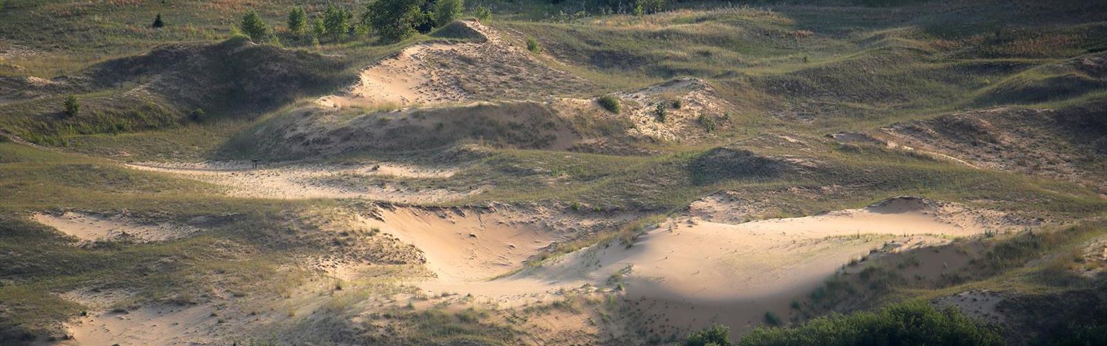
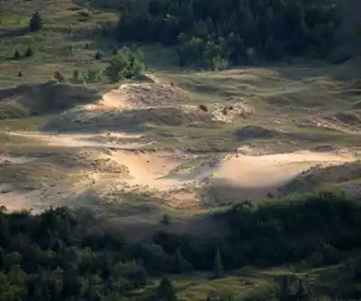
The park's crown jewel is the Spirit Sands, a 4-square-kilometer stretch of active sand dunes that rise up to 30 meters high. These aren't just small sandy patches—they're legitimate dunes that shift with the wind and create an otherworldly hiking experience. The sand stays surprisingly firm underfoot during most conditions, though it can get quite hot in summer sun. Walking through the dunes feels genuinely surreal, especially when you crest a ridge and see nothing but rolling sand in every direction, with the Manitoba prairie stretching beyond.
The contrast hits you immediately as you transition from typical boreal forest into this sandy ecosystem. Specialized plants like pincushion cacti and prairie sage dot the landscape, adapted to the dry conditions and sandy soil. The dunes support their own microclimate—noticeably warmer and drier than the surrounding forest, with different bird species and even some reptiles you won't encounter in the wooded areas.
Navigating the Spirit Sands requires some preparation since there are no marked trails through the dunes themselves. The sand walking demands more energy than regular trail hiking, and the lack of shade means sun protection becomes crucial. Many hikers find the experience meditative, with the soft sound of wind across sand and the vast open views creating a sense of solitude that's rare in Manitoba's typically forested landscapes.
Trail Network and Terrain
The park maintains over 40 kilometers of well-marked trails that showcase its diverse ecosystems. Trail conditions are generally excellent, with clear signage and regular maintenance making navigation straightforward even for newcomers to the area. The variety in terrain keeps things interesting—you'll encounter everything from soft forest floor to rocky creek crossings to sandy approaches near the dunes.
The Epinette Creek Trail offers the longest hiking experience, winding through dense spruce and aspen forests where the canopy creates a cool, shaded environment even on hot days. This trail follows the creek for much of its length, providing water views and the chance to spot deer, foxes, and various woodland birds. The path surface varies from packed earth to occasional rocky sections, with some gentle elevation changes that keep the walk interesting without being strenuous. Creek crossings add variety to the hike, though they're typically manageable with standard hiking boots.
For a shorter but equally rewarding hike, the Devil's Punch Bowl Trail leads to one of the park's most photographed features—a striking blue-green pond fed by underground springs. The water maintains its vivid color year-round, created by minerals in the spring water and the pond's depth. The trail to reach it passes through mixed forest and offers several viewpoints where you can see both the pond and the surrounding landscape. The area around the pond provides excellent spots for rest breaks or picnicking, with natural seating on fallen logs and rocks.
Multiple connecting trails allow you to create longer or shorter routes depending on your energy level and available time. The trail system is designed so you can easily combine different sections—for instance, linking the Spirit Sands exploration with a forest walk or creek-side hike. This flexibility makes the park work well for groups with varying fitness levels or interests.
Wildlife and Ecosystem Diversity
The park's ecosystem diversity translates into exceptional wildlife viewing opportunities across its different habitats. The grassland areas support species like Sprague's pipit and other prairie birds that are increasingly rare in Manitoba. These open areas come alive during migration periods when various songbirds use the park as a stopover point.
In the forested sections, you're likely to encounter white-tailed deer, especially during early morning or evening hikes. Red foxes, though more elusive, leave tracks throughout the park and are occasionally spotted by patient observers. The mixed habitat also supports smaller mammals like ground squirrels and various bat species that emerge at dusk.
Spring visits reveal the park at its most colorful, when prairie crocuses emerge as some of the first wildflowers, followed by waves of other native blooms throughout the grassland areas. The timing varies with weather conditions, but late April through June typically offers the best wildflower displays. The contrast between the blooming prairie areas and the still-dormant forest sections creates striking visual variety during spring hikes.
The Assiniboine River forms the park's northern boundary, adding another ecosystem element and providing habitat for waterfowl and other riparian species. While most hiking trails don't directly follow the river, several offer glimpses of it through the trees, and the river's presence influences the moisture levels and plant communities throughout the northern sections of the park.
Facilities and Practical Considerations
The park accommodates both basic camping and those wanting more amenities. Basic campsites scattered throughout the park place you directly among the towering spruce trees that give the park its name, offering a genuine wilderness camping experience with minimal facilities. These sites work well for hikers who want to wake up surrounded by forest and have immediate access to trail networks.
The Kiche Manitou Campground provides a more developed option with electrical hookups and shower facilities, making it suitable for RVs or families wanting convenient amenities while still enjoying the natural setting. The campground's location provides easy access to major trails while maintaining the forested atmosphere that defines much of the park.
Day-use areas include picnic facilities and washrooms, strategically located near popular trail access points. The facilities are well-maintained and adequate for most visitor needs, though it's wise to bring extra water for longer hikes, especially when exploring the Spirit Sands where shade is limited and the sandy terrain increases exertion levels.
Seasonal Considerations and Planning
The park offers rewarding experiences across multiple seasons, though each brings different considerations for hikers. Summer provides the warmest weather for camping and the longest daylight hours, but the Spirit Sands can become quite hot during midday, making early morning or evening visits more comfortable. The forest trails remain pleasant even during summer heat thanks to the canopy cover.
Spring and fall offer cooler temperatures that make hiking more comfortable, with fall adding spectacular foliage colors in the forested areas. The mixed forest creates a longer color season than pure deciduous areas, with different species changing at different times. Winter transforms the park entirely, though trail access becomes more challenging and requires different preparation.
Water availability varies significantly by location within the park. While Epinette Creek and the Devil's Punch Bowl provide natural water features, it's essential to bring adequate drinking water for all hikes. The Spirit Sands area, in particular, offers no natural water sources and can be surprisingly demanding due to the sand walking and exposure to sun and wind.
The park's location in south-central Manitoba makes it accessible as either a day trip from major centers or as a destination for longer stays. The variety of ecosystems and trail options means you can easily spend multiple days exploring without repeating experiences, making it an ideal base for extended outdoor adventures in this unique corner of the prairies.
The Essential Hiking Checklist
Everything you need for your next hike. Bilingual, printable, 1 page.
Get your free hiking checklistRecommended gear for this trail
As an Amazon Associate I earn from qualifying purchases.


Ready to go?
Everything you need to know before you goStarting Point
The easiest way to get to the start of the trails at the spruce woods provincial park is to take Highway 5 from Winnipeg and turn off at the spruce woods provincial park turnoff.
When?
How much?
As an Amazon Associate I earn from qualifying purchases.
Affiliate links — LGPO may earn a commission at no extra cost to you.
- Hiking shoes Essential
- → Salomon Elixir Tour Mid WP · 203.38 $
- Layered clothing Essential
- Rain jacket Essential
- Trekking poles
- → Black Diamond Trail Ergo Cork · 69.99 $
- Headlamp
- → Petzl Actik Core 625 · 103.95 $
FAQ - Frequently asked questions
Everything you need to knowSimilar hikes nearby
Discover other trails you might enjoy

Hiking near Brandon
5 trails to explore ~53 km away
We work hard to provide the most up-to-date and error-free data possible. If something seems incorrect, let us know! Your contribution helps the whole community.
Hikers' opinions
Be the first to review!
No hiker has shared their experience yet. Share your impressions and help other hikers!