

Ready to explore Carson Hill, California? Here's everything you need to know before you go!
Discover the trail
Oh no! We don't have any photos 😢
This trail hasn't been captured yet. Be the first to share your adventure!Trail description
Description
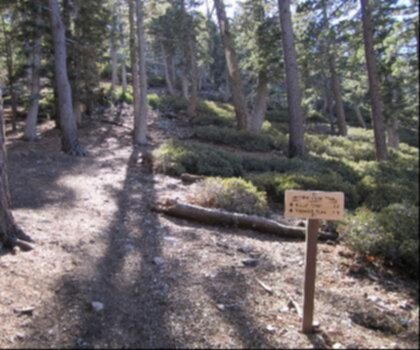
Carson Hill sits in the heart of California's Gold Country, about 4 miles south-southeast of Angels Camp in Calaveras County, at an elevation of 1,447 feet (441 m). It's one of the most historically loaded pieces of ground in the entire Mother Lode region — and the climb up to it reflects that rugged, uncompromising character. This is a hard route: 3.2 km with 604 meters of elevation gain, typically completed in around 2 hours and 30 minutes. The terrain doesn't ease you in gently.
A Place Built on Gold
Before you lace up your boots, it's worth knowing what you're walking through. Carson Hill — also known historically as Carson Flat, Melones, and Slumgullion — was once one of the most productive mining camps in all of California. Nearly $26 million in gold and quartz came out of this ground. That's not a small footnote; that's a defining chapter in California history, which is why the site is registered as California Historical Landmark #274.
The hill is named not after the famous explorer Kit Carson, but after Sergeant James H. Carson, a member of Colonel Jonathan D. Stevenson's Regiment of First New York Volunteers. He was in Monterey when the Gold Rush broke out, made his way to Weber Creek near Placerville, then pushed south with the Angel and Murphy brothers — the same men who founded Angels Camp and Murphys. When the group split at what is now Angels Camp, Carson's party headed south and struck it rich along a small tributary of the Stanislaus River, which they named Carson Creek.
Ironically, Carson himself never really cashed in. He moved on, came back, but never found the fortune the creek named after him would eventually yield. He died in 1853, near poverty, from rheumatism.
The Morgan Mine and the Big Nugget
The Morgan Mine, located on Carson Hill, was among the richest operations in the region. The ore was so concentrated that miners didn't need to dig in the traditional sense — they'd blast a vein and simply collect the pieces. It was here that one of the largest gold nuggets ever found in California was pulled from the ground: a 195-pound troy block of gold valued at $43,000 at the time. Walking this terrain, it's not hard to understand why men came from across the continent to try their luck here.
One of Gold Country's most repeated stories is also tied to this hill. During the early days of the rush, a miner was being buried in the local cemetery when a mourner spotted something glittering in the freshly turned earth of the open grave. The funeral stopped cold — the minister included — as everyone scrambled to stake a claim. Whether the story is strictly true or has grown in the telling, it captures the fever that defined this place.
The Climb Itself
With 604 meters of elevation gain packed into 3.2 km, this is a steep, sustained effort. The difficulty rating is Hard, and that's accurate — don't underestimate it based on the short distance. The grade is relentless in sections, and the exposed terrain means you'll feel the sun on warm days. Sturdy footwear with good ankle support is the right call here. Trekking poles will help on the descent.
The landscape around Carson Hill is classic Gold Country: dry oak woodland, rocky outcrops, and scrubby chaparral. The views open up as you gain elevation, giving you a sense of the broader Calaveras County landscape — rolling foothills, the Stanislaus River drainage below, and the Sierra Nevada rising to the east on clear days.
Plan for the full 2.5 hours if you want to move at a comfortable pace and take in the surroundings. Bring more water than you think you need, especially in the warmer months when this kind of exposed hillside can be punishing.
Getting There
Carson Hill is located approximately 4 miles south-southeast of Angels Camp, California, in Calaveras County. Angels Camp itself is easily reached via Highway 49, the main artery through Gold Country. From Angels Camp, follow Highway 49 south toward the Carson Hill area.
What Makes This Climb Worth It
This isn't a trail where you're chasing a waterfall or a lake. The payoff here is different — it's the weight of history underfoot, the physical challenge of a genuine climb, and the perspective you earn at the top. Carson Hill is one of those places where the landscape and the story are inseparable. The ground itself produced some of the most extraordinary finds of the California Gold Rush, and hiking it gives you a direct, physical connection to that era that no museum exhibit can replicate.
If you're based in Angels Camp or passing through the Gold Country region, this climb is a legitimate challenge that rewards the effort with both views and context.
Recommended gear for this trail


Ready to go?
Everything you need to know before you goStarting Point
To access the hiking trails, you can start at the following trailheads or parking areas:
- Trailhead 1: Located at 123 Main Street, Carson Hill, CA 95223.
- Trailhead 2: Situated at 456 Oak Avenue, Carson Hill, CA 95223.
Ensure to check local maps for any additional trailheads and confirm accessibility before your visit.
When?
How much?
- Hiking shoes Essential
- → Salomon Elixir Tour Mid WP · 203.38 $
- Layered clothing Essential
- Rain jacket Essential
- Trekking poles
- → Black Diamond Trail Ergo Cork · 69.99 $
- Headlamp
- → Petzl Actik Core 625 · 103.95 $
FAQ - Frequently asked questions
Everything you need to knowThe Essential Hiking Checklist
Everything you need for your next hike. Bilingual, printable, 1 page.
Download the free checklistSimilar hikes nearby
Discover other trails you might enjoy

California Hot Springs
Gold Country
California Street
Gold Country
California National Historic Trail
Gold Country
Ontario Peak Trail
Gold Country
Stony Hill, California
Gold Country
Stony Point, California
Gold Country
Hiking near Victoria
93 trails to explore ~1179 km away
We work hard to provide the most up-to-date and error-free data possible. If something seems incorrect, let us know! Your contribution helps the whole community.
Hikers' opinions
Be the first to review!
No hiker has shared their experience yet. Share your impressions and help other hikers!