

Ready to explore Little Bigelow Mountain, Maine? Here's everything you need to know before you go!
Discover the trail

Trail description
{
"opening_paragraph": "
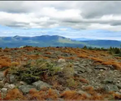
Little Bigelow Mountain sits within the protected boundaries of the Bigelow Preserve Public Reserved Land. It's part of the broader Bigelow Range — a stretch of rugged peaks that defines this corner of the state — and earns its reputation as one of the most satisfying hikes in the region. At approximately 6.2 miles round trip, the hike typically takes 5 to 6 hours to complete and delivers exactly the kind of payoff you're working toward: wide-open granite ledges, sweeping views over Flagstaff Lake, and that particular satisfaction of earning your summit the hard way.
","difficulty_update": "
The moderate to hard difficulty rating is honest. The combination of sustained climbing, rocky terrain, and significant elevation gain adds up over the 6.2 mile distance. Come prepared for a real effort.
","time_reference_update": "The 5 to 6 hour estimated time reflects a solid, focused effort — this isn't a casual afternoon walk, but it's a hike that most people with reasonable fitness and trail experience can complete in a day without feeling wrecked at the end."
}
Recommended gear for this trail


Ready to go?
Everything you need to know before you goStarting Point
To access the hiking trails, head to the trailhead located at the end of East Flagstaff Road. From Route 27 in Carrabassett Valley, turn onto Stratton Brook Pond Road and continue until you reach East Flagstaff Road. Follow this road to the parking area near the trailhead. There are no alternative trailheads for this location.
When?
How much?
- Hiking shoes Essential
- → Salomon Elixir Tour Mid WP · 203.38 $
- Layered clothing Essential
- Rain jacket Essential
- Trekking poles
- → Black Diamond Trail Ergo Cork · 69.99 $
- Headlamp
- → Petzl Actik Core 625 · 103.95 $
FAQ - Frequently asked questions
Everything you need to knowThe Essential Hiking Checklist
Everything you need for your next hike. Bilingual, printable, 1 page.
Download the free checklistSimilar hikes nearby
Discover other trails you might enjoy

Long Mountain
Western Mountains
Pleasant Mountain
Western Mountains
Witt's End Trail
Western Mountains
Tumbledown Mountain
Western Mountains
Bear Mountain Inn + Barn Maine
Western Mountains
Bald Pate Mountain
Western Mountains
Hiking near Bangor
0 trails to explore ~119 km away
We work hard to provide the most up-to-date and error-free data possible. If something seems incorrect, let us know! Your contribution helps the whole community.
Hikers' opinions