


Ready to explore Beartown State Forest? Here's everything you need to know before you go!
Discover the trail

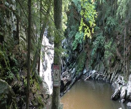
Photos: Tony Webster from Minneapolis, Minnesota, United States — CC BY-SA 2.0 (Wikimedia Commons)
Trail description
Beartown State Forest covers 12,000 acres of rugged wilderness in the heart of the Berkshires, and it earns its place as one of Massachusetts' most rewarding forest destinations. The combination of serious trail terrain, a beautiful mountain pond, and genuine wildlife habitat makes it a place worth returning to across seasons — not just a one-time checkbox on a hiking list.
Trail Network and What to Expect Underfoot
The trail system here covers 13 kilometers with about 305 meters of elevation gain, and most hikers budget around 4 hours and 30 minutes for a full outing. That said, very few people try to cover everything in a single push — the forest is better explored in sections, letting you match the terrain to your energy and goals for the day.
Two distinct trail experiences define Beartown. The Appalachian Trail cuts through the more demanding sections of the property, delivering rocky climbs, ridge walks, and the kind of uneven footing that keeps you engaged and honest. These stretches move through dense hardwood forest where the canopy closes overhead and the light filters down in a way that feels genuinely removed from the outside world. The trail markers are consistent and reliable, but carrying a map is still a smart call if you plan to follow the AT beyond the state forest boundaries.
The Benedict Pond Loop Trail offers a completely different character. It stays relatively flat as it traces the shoreline of the forest's central pond, passing through mixed forest where tall pines transition into wetland edges. The footing here is much more forgiving — mostly smooth, needle-covered ground — making it a solid option when you want mileage without the scramble. The contrast between these two trail types is one of Beartown's real strengths: you can push hard on the AT sections and then decompress on the pond loop, all within the same visit.
Benedict Pond
Benedict Pond is the visual and recreational anchor of the forest. The water is clear and cool, staying refreshing even through summer heat, and the sandy bottom with its gradual depth makes it genuinely family-friendly for swimming. After a few hours on the Appalachian Trail sections, dropping into that water feels well-earned.
Paddlers get a lot out of the pond as well. The calm surface is well-suited to kayaking and canoeing, with quiet coves around the perimeter worth exploring at a slow pace. Early morning is the best time to be on the water — the surface goes glassy, the treeline reflects perfectly, and the wildlife activity along the shore picks up noticeably. It's one of those moments that's hard to replicate later in the day once the wind comes up and other visitors arrive.
Wildlife and Natural Features
The forest lives up to its name. Black bears do inhabit these woods, though daytime sightings are relatively uncommon. White-tailed deer are a much more regular presence, especially in clearings during early morning and evening. The bird life here is genuinely diverse — chickadees, nuthatches, and various hawk species are reliable finds, while pileated woodpeckers show up often enough to make them a realistic target for birders rather than a lucky accident.
The edges of Benedict Pond are the most productive spot for wildlife observation. The transition zone between forest and open water concentrates activity, and the pond's outlet stream draws birds throughout the day. If you're willing to sit quietly for fifteen minutes, you'll almost always see something worth watching.
The forest canopy is classic New England mountain hardwood — sugar maple, yellow birch, and American beech dominate, with the understory filling in with mountain laurel that blooms heavily in late spring. Ferns carpet the forest floor wherever the canopy opens enough to let light through, and the overall plant community gives the forest a layered, textured feel that changes noticeably as you move between the drier ridge terrain and the wetter areas near the pond.
Seasonal Conditions
Summer is the full-package season at Beartown — hiking, swimming, and paddling all running simultaneously. The canopy keeps temperatures manageable even on hot days, but bug pressure near the pond and in wetter sections of the forest can be significant from late spring through early summer. Bring bug spray and don't underestimate it.
Fall is when the forest draws its biggest crowds, and the reason is obvious. The mixed hardwood canopy produces a foliage display that reflects directly into Benedict Pond on calm days, creating the kind of scene that justifies the drive from anywhere in the region. Cooler temperatures also make the longer Appalachian Trail sections more comfortable, and the visibility from the higher elevation points improves considerably once the humidity drops.
Winter shifts the forest into cross-country skiing and snowshoeing territory. Beartown's elevation and northern exposure help it hold snow longer than many other spots in the Berkshires, which extends the useful winter season. Animal tracks become easy to read in the snow, and the quieter conditions make winter one of the better times for wildlife observation and photography.
Getting There and Planning Your Visit
The forest sits between Great Barrington and Stockbridge, which puts it within easy reach whether you're based in the Berkshires or making a day trip from the Boston or Albany areas. The main parking area handles busy weekend volumes reasonably well, and the trailhead signage is clear enough that first-time visitors can orient themselves without much difficulty.
For summer visits, pack more water than you think you need — especially if you're planning to spend time on the Appalachian Trail sections — and bring swimwear if Benedict Pond is part of your plan. Winter visitors should come prepared for potentially icy conditions on the trails and check snow conditions before heading out if skiing or snowshoeing is the goal.
Beartown State Forest rewards visitors who take the time to explore beyond the pond loop — the deeper you push into the AT sections, the more the forest opens up and delivers the kind of quiet, demanding terrain that makes a hike feel genuinely worthwhile.
The Essential Hiking Checklist
Everything you need for your next hike. Bilingual, printable, 1 page.
Get your free hiking checklistRecommended gear for this trail
As an Amazon Associate I earn from qualifying purchases.


Ready to go?
Everything you need to know before you goStarting Point
To access the hiking trails, you can start at one of several trailheads. The main parking area is located at 69 Blue Hill Road, Monterey, MA 01245. Another option is the trailhead near Benedict Pond, accessible via Benedict Pond Road in Monterey. Both locations provide convenient access to the trail network.
When?
How much?
As an Amazon Associate I earn from qualifying purchases.
Affiliate links — LGPO may earn a commission at no extra cost to you.
- Hiking shoes Essential
- → Salomon Elixir Tour Mid WP · 203.38 $
- Layered clothing Essential
- Rain jacket Essential
- Trekking poles
- → Black Diamond Trail Ergo Cork · 69.99 $
- Headlamp
- → Petzl Actik Core 625 · 103.95 $
FAQ - Frequently asked questions
Everything you need to knowSimilar hikes nearby
Discover other trails you might enjoy
Monument Mountain
The Berkshires
Ashuwillticook Rail Trail
The Berkshires

Thousand Acre Swamp
The Berkshires
Lake Williams State Park
The Berkshires
Mount Greylock State Reservation
The Berkshires
Wahconah Falls State Park
The Berkshires
Hiking near Springfield
0 trails to explore ~59 km away
We work hard to provide the most up-to-date and error-free data possible. If something seems incorrect, let us know! Your contribution helps the whole community.
Hikers' opinions
Be the first to review!
No hiker has shared their experience yet. Share your impressions and help other hikers!