

Ready to explore Jackie Jones Mountain, New York? Here's everything you need to know before you go!
Discover the trail
Trail description
Description
Jackie Jones Mountain is a straightforward and rewarding hike in the Hudson Valley region of New York, offering a solid introduction to the area's forested ridgelines without demanding too much from your legs. At 3.2 km with 213 m of elevation gain, it's rated Easy and typically takes around 1 hour 30 minutes to complete — making it a great option for families, newer hikers, or anyone looking for a quick escape into the woods without committing to a full-day adventure.
The Trail Experience
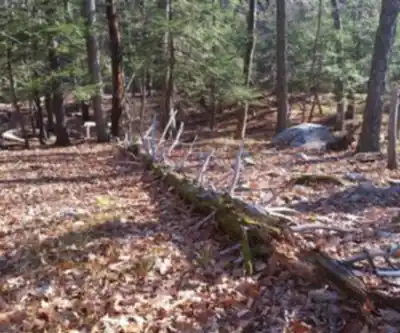
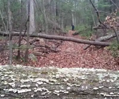
The climb to Jackie Jones Mountain is gradual and manageable. The elevation gain is steady rather than steep, which means you're working just enough to feel it in your legs without ever hitting a section that feels punishing. The trail moves through mixed hardwood forest typical of the Hudson Valley — oak, maple, and birch dominate the canopy, and the understory fills in nicely through spring and summer. Underfoot, the terrain is mostly packed dirt and rock, the kind of surface that's forgiving on the knees and doesn't require technical footwear.
As you gain elevation, the forest opens up in places and gives you a sense of the ridge you're climbing. The summit area rewards the effort with views that reflect what makes the Hudson Valley such a compelling place to hike — rolling hills, forested slopes, and the kind of quiet that's hard to find close to a major metro area.
Who It's Good For
This is a trail that works well for a wide range of hikers. Families with kids who are comfortable on uneven terrain will find the distance and elevation gain very manageable. Trail runners looking for a quick morning loop will appreciate the efficient layout. And if you're newer to hiking and building up your confidence on the trail, Jackie Jones Mountain gives you a real summit experience without overcommitting.
The 1h30 estimated duration is realistic for a moderate pace with some time at the top. If you move quickly, you can do it in under an hour. If you're taking your time, stopping to look around, or hiking with young kids, budget a bit more.
Getting There
Jackie Jones Mountain is located in the Hudson Valley, New York. The area is accessible by car, and the trailhead connects you directly to the route without a long approach. As with most Hudson Valley trailheads, arriving earlier in the day on weekends is a smart move — parking areas at popular spots in the region fill up faster than you'd expect, especially from late spring through fall.
What to Bring
- Water: Even on a short hike like this, bring more than you think you need, especially on warm days.
- Footwear: Trail runners or light hiking boots are more than enough for this terrain.
- Layers: The Hudson Valley can be breezy at elevation, even when it's warm at the trailhead.
- Navigation: Download an offline map before you go — cell service in forested areas of the Hudson Valley can be unreliable.
A Good Fit in the Hudson Valley
The Hudson Valley has no shortage of hiking options, from the more demanding peaks of the Catskills to the gentler riverside trails along the Hudson. Jackie Jones Mountain sits comfortably in the middle of that spectrum — it's not a casual flat walk, but it's also not going to leave you wrecked the next day. It's the kind of hike you can do on a weekday morning, be back in time for lunch, and still feel like you actually got outside and moved.
For anyone building a list of Hudson Valley hikes or looking for a reliable, low-stress option that still delivers a genuine trail experience, Jackie Jones Mountain is worth adding to the rotation.
Recommended gear for this trail


Ready to go?
Everything you need to know before you goStarting Point
To access the hiking trails, you can start at the trailhead located near the parking area on Seven Lakes Drive. The specific address for this parking lot is 800 Kanawauke Road, Stony Point, NY 10980. This location provides convenient access to the trails leading up the mountain.
When?
How much?
- Hiking shoes Essential
- → Salomon Elixir Tour Mid WP · 203.38 $
- Layered clothing Essential
- Rain jacket Essential
- Trekking poles
- → Black Diamond Trail Ergo Cork · 69.99 $
- Headlamp
- → Petzl Actik Core 625 · 103.95 $
FAQ - Frequently asked questions
Everything you need to knowThe Essential Hiking Checklist
Everything you need for your next hike. Bilingual, printable, 1 page.
Download the free checklistSimilar hikes nearby
Discover other trails you might enjoy

West Mountain
Hudson Valley
Witches Hole
Hudson Valley
Appalachian Trail
Hudson Valley
Little Dam Lake
Hudson Valley
Raven's Rock
Hudson Valley
Sterling Forest Fire Tower
Hudson Valley
Hiking near Poughkeepsie
0 trails to explore ~54 km away
We work hard to provide the most up-to-date and error-free data possible. If something seems incorrect, let us know! Your contribution helps the whole community.
Hikers' opinions