

Ready to explore Sugarloaf Mountain, New York? Here's everything you need to know before you go!
Discover the trail
Trail description
{
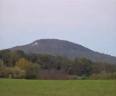
"opening_paragraph": "Sugarloaf Mountain rises from the heart of the Catskill Mountains in New York's Catskill State Park, offering hikers a rewarding challenge with panoramic views that stretch across rolling peaks and valleys. This 10.14-kilometer loop trail gains 457 meters of elevation over moderate to strenuous terrain via the Pecoy Notch Trail and Mink Hollow Trail, making it accessible to hikers with some experience while still providing enough challenge to feel accomplished at the summit. The mountain is part of the Indian Head Wilderness and the Devil's Path range, situated between Plateau Mountain and Twin Mountain.",
"trail_connections": "Sugarloaf Mountain's location within the Catskill trail network opens up possibilities for extended adventures. The Devil's Path hiking trail traverses the summit ridge of Sugarloaf and connects with the Long Path, a 357-mile long-distance hiking trail through southeastern New York. The Pecoy Notch Trail and Mink Hollow Trail form the primary loop, with most hikers preferring a clockwise direction. The eastern side features a 600-foot elevation climb over steep and difficult terrain, while the western side presents a 1,000-foot elevation climb over similarly challenging ground."
}
Recommended gear for this trail


Ready to go?
Everything you need to know before you goStarting Point
To access the hiking trails, you can start at the main trailhead located at the end of Roaring Brook Road in the town of Garrison. The parking area is available there for visitors. Another option is to begin your hike from the Breakneck Ridge trailhead, which is accessible from Route 9D near Cold Spring. Both locations provide convenient access to the trails and have designated parking areas.
When?
How much?
- Hiking shoes Essential
- → Salomon Elixir Tour Mid WP · 203.38 $
- Layered clothing Essential
- Rain jacket Essential
- Trekking poles
- → Black Diamond Trail Ergo Cork · 69.99 $
- Headlamp
- → Petzl Actik Core 625 · 103.95 $
FAQ - Frequently asked questions
Everything you need to knowThe Essential Hiking Checklist
Everything you need for your next hike. Bilingual, printable, 1 page.
Download the free checklistSimilar hikes nearby
Discover other trails you might enjoy

West Mountain
Hudson Valley
Witches Hole
Hudson Valley
Appalachian Trail
Hudson Valley
Little Dam Lake
Hudson Valley
Raven's Rock
Hudson Valley
Sterling Forest Fire Tower
Hudson Valley
Hiking near Poughkeepsie
0 trails to explore ~51 km away
We work hard to provide the most up-to-date and error-free data possible. If something seems incorrect, let us know! Your contribution helps the whole community.
Hikers' opinions