

Ready to explore Black Mountain, Wyoming? Here's everything you need to know before you go!
Discover the trail
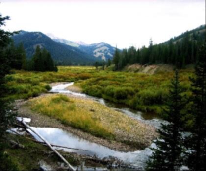
Oh no! We don't have any photos 😢
This trail hasn't been captured yet. Be the first to share your adventure!Trail description
Désolé, nous n'avons pas de description pour cet endroit.
Soyez le premier à partager plus d'informations sur cet endroit.
Soyez le premier à partager plus d'informations sur cet endroit.
Recommended gear for this trail
LGPO Pick

Salomon
Elixir Tour Mid WP
Waterproof mid-height boot ideal for rocky terrain
203.38 $


Affiliate links — LGPO may earn a commission at no extra cost to you.
Ready to go?
Everything you need to know before you goWhen?
Opening hours
No information
Varies by season
Best season
Fall
Spectacular colors
Best time
Early morning
Less crowded
Weather (next days)
Loading
How much?
Entry fees
Adult
Not available
Child
—
What to bring?
Gear
- Hiking shoes Essential
- → Salomon Elixir Tour Mid WP · 203.38 $
- Layered clothing Essential
- Rain jacket Essential
- Trekking poles
- → Black Diamond Trail Ergo Cork · 69.99 $
- Headlamp
- → Petzl Actik Core 625 · 103.95 $
Water & food
2L minimum
No water point on the trail
Bring energy snacks for a 4h+ hike
Good to know
Park rules
No dogs
Safety
Download the GPX before you go
Limited cellular coverage on the trail
Slippery after rain
Be careful on rocky sections
In an emergency
Emergency
911
Parking GPS
42.311677, -105.376498
Center
Not available
FAQ - Frequently asked questions
Everything you need to knowVery hard
332.53 M
No
No
The trail is 1.0 mile point-to-point with approximately 225 meters (739 feet) of elevation gain. The final 300 yards are hiking-only; the rest is motorized.
Rated Difficult. The elevation ranges from 8,648 feet at the trailhead to 9,387 feet at the summit.
A high-clearance 4WD vehicle is recommended, especially during wet conditions. The motorized portion is open to vehicles 50 inches or less in width.
The Black Mountain Fire Lookout was constructed in the 1930s by the Civilian Conservation Corps (CCC).
Near Sheridan, Wyoming, in the Bighorn National Forest area. The trail begins at Forest System Road (FSR) 222.
No reliable water sources exist on the mountain. Carry all water you need from the trailhead.
Didn't find your answer?
Free
1 pages
The Essential Hiking Checklist
Everything you need for your next hike. Bilingual, printable, 1 page.
Download the free checklistSimilar hikes nearby
Discover other trails you might enjoy
Wyoming Range Trail
Cheyenne & Southeast
Beginner
3.5
(4)

West Thumb Geyser Basin
Cheyenne & Southeast
10 KM
2h50
304 m
Intermediate
Grand Teton National Park
Cheyenne & Southeast
John D. Rockefeller Jr. Memorial Parkway
Cheyenne & Southeast
11 KM
0.25 hour
Turquoise Lake
Cheyenne & Southeast
44 KM
Madison River
Cheyenne & Southeast
31 KM
Top 10 best hiking in Cheyenne & Southeast
Our ranking based on hiker reviews
Hiking near Regina
4 trails to explore ~906 km away
Did you spot an error?
We work hard to provide the most up-to-date and error-free data possible. If something seems incorrect, let us know! Your contribution helps the whole community.
Hikers' opinions