

Ready to explore Wyoming Range Trail? Here's everything you need to know before you go!
Discover the trail
Oh no! We don't have any photos 😢
This trail hasn't been captured yet. Be the first to share your adventure!Trail description
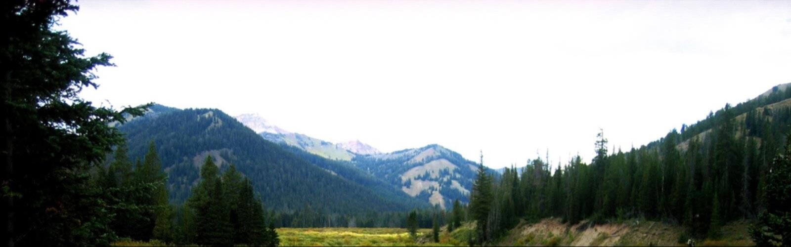
The Wyoming Range Trail is one of those long-distance routes that reminds you why Wyoming has such a devoted community of backcountry hikers. Cutting through the Wyoming Range in the western part of the state, this trail takes you deep into a landscape defined by sweeping ridgelines, open meadows, dense conifer forests, and the kind of solitude that's getting harder to find in the American West.
The Terrain
The Wyoming Range itself is a rugged subrange of the Rocky Mountains, and the trail that bears its name reflects that character fully. Expect significant elevation changes as the route moves through varied terrain — from forested drainages and creek bottoms to exposed high-country ridges with wide-open views in every direction. The landscape shifts noticeably as you gain elevation: spruce and fir give way to open alpine-style terrain where the sky feels enormous and the wind has nothing to stop it.
The trail passes through portions of the Bridger-Teton National Forest, which means the land is managed for multiple uses, but the backcountry sections feel genuinely wild. Stream crossings are part of the experience, and depending on the season, some of them require careful footing or wet feet — plan accordingly.
What Makes This Trail Stand Out
What sets the Wyoming Range Trail apart from many long-distance routes in the region is its relative obscurity. This isn't a trail that shows up on every bucket list or gets crowded on summer weekends. If you're looking for a multi-day route where you can go an entire day without seeing another person, this delivers. The trade-off is that you need to come prepared — trail signage can be inconsistent in places, and you'll want a good map and the navigation skills to use it.
The wildlife presence here is real and worth noting. The Wyoming Range is known habitat for elk, mule deer, black bear, and moose, particularly in the meadow corridors and near water sources. Pronghorn are common at lower elevations. This is also grizzly bear country in some sections, so bear awareness and proper food storage aren't optional — they're standard practice.
Access and Logistics
The Wyoming Range Trail has multiple access points along its length, which gives hikers flexibility in how they approach it. Whether you're planning a point-to-point through-hike, a multi-day out-and-back, or a shorter day section, the route can accommodate different trip styles. That said, the logistics of a point-to-point require a vehicle shuttle or some creative planning, since the trailheads are spread out across a large area.
Road access to trailheads typically involves forest roads that may require a high-clearance vehicle, especially earlier in the season when conditions are rougher. Check current road conditions with the Bridger-Teton National Forest before heading out — what looks passable on a map isn't always passable in practice after spring snowmelt or a wet summer.
When to Go
The high country in the Wyoming Range is typically accessible from mid-summer through early fall. Snow can linger well into June at higher elevations, and early season travel often means wet, muddy conditions on lower trails. The window from late July through September tends to offer the most reliable conditions, with August being peak season for wildflowers in the meadows. Fall brings dramatic color changes and cooler temperatures — it's a favorite time for experienced hikers who want fewer people and don't mind the possibility of early snow.
Afternoon thunderstorms are common throughout the summer months. Starting early and being off exposed ridgelines by early afternoon is standard practice in this part of Wyoming.
Gear and Preparation
This is a backcountry trail, not a developed park path. Come with the gear and mindset to match:
- Navigation: Carry a detailed topo map and compass, or a GPS device with downloaded maps. Cell service is essentially nonexistent along most of the route.
- Water: Water sources are generally available along the trail, but always treat or filter before drinking.
- Bear safety: A bear canister or approved hanging system is essential for overnight trips. Carry bear spray and know how to use it.
- Weather gear: Conditions can change fast at elevation. A waterproof layer and insulation are non-negotiable even in summer.
- Self-sufficiency: Rescue response times in this area are long. First aid knowledge and a communication device (satellite messenger) are strongly recommended for multi-day trips.
Camping
Dispersed camping is permitted within the Bridger-Teton National Forest, following Leave No Trace principles. Camp at least 200 feet from water sources, trails, and other campers. There are no developed campgrounds along the trail itself, so you're setting up wherever the terrain and regulations allow. This is part of the appeal — you're not sharing a campground loop with a dozen other parties.
Dogs and Other Users
Dogs are generally permitted in the Bridger-Teton National Forest, but given the wildlife density in this area — including bears and moose — keeping dogs under control and on leash near water sources and in dense cover is a smart call, not just a courtesy. An off-leash dog that spooks a moose or runs toward a bear can create a dangerous situation quickly.
The Wyoming Range Trail sees some equestrian use as well, particularly in the lower and mid-elevation sections. If you encounter horse parties on the trail, step to the downhill side and give them room to pass — it's standard backcountry etiquette and keeps everyone safe.
The Bottom Line
The Wyoming Range Trail rewards hikers who do their homework and come prepared for genuine backcountry travel. It's not a trail that holds your hand, but that's exactly what makes it worth the effort — you earn every mile, and the landscape gives back in full.
The Essential Hiking Checklist
Everything you need for your next hike. Bilingual, printable, 1 page.
Get your free hiking checklistRecommended gear for this trail
As an Amazon Associate I earn from qualifying purchases.


Ready to go?
Everything you need to know before you goWhen?
How much?
As an Amazon Associate I earn from qualifying purchases.
Affiliate links — LGPO may earn a commission at no extra cost to you.
- Hiking shoes Essential
- → Salomon Elixir Tour Mid WP · 203.38 $
- Layered clothing Essential
- Rain jacket Essential
- Trekking poles
- → Black Diamond Trail Ergo Cork · 69.99 $
- Headlamp
- → Petzl Actik Core 625 · 103.95 $
FAQ - Frequently asked questions
Everything you need to knowSimilar hikes nearby
Discover other trails you might enjoy

Hiking near Calgary
120 trails to explore ~954 km away
We work hard to provide the most up-to-date and error-free data possible. If something seems incorrect, let us know! Your contribution helps the whole community.
Hikers' opinions
Be the first to review!
No hiker has shared their experience yet. Share your impressions and help other hikers!