
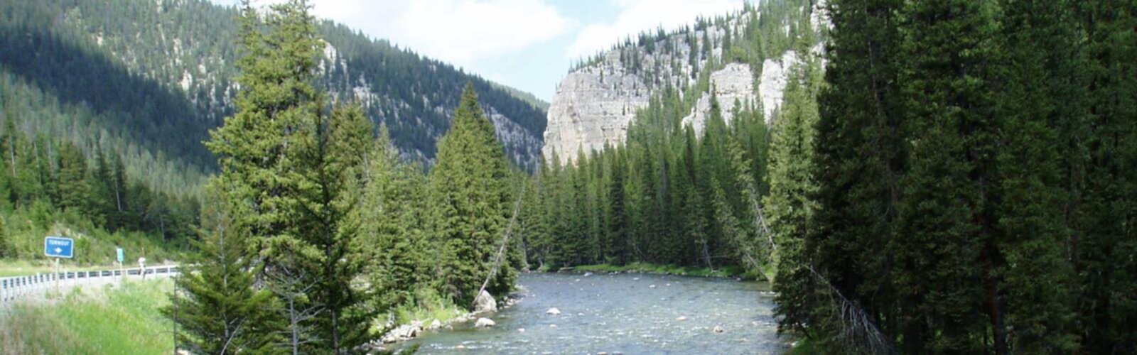

Ready to explore Gallatin River Wyoming border to the Missouri River? Here's everything you need to know before you go!
Discover the trail
Oh no! We don't have any photos 😢
This trail hasn't been captured yet. Be the first to share your adventure!Trail description
The Gallatin River from Wyoming Border to the Missouri River represents one of Montana's most significant waterways, flowing northward through diverse landscapes before joining the Missouri River system. This expansive river corridor offers multiple access points and recreational opportunities along its journey through southwestern Montana.
River Character and Flow
The Gallatin begins its journey at the Wyoming border and maintains a dynamic character as it flows north. The river transitions from mountain-fed headwaters to a more mature waterway as it approaches its confluence with the Missouri River. Along this stretch, the Gallatin cuts through varied terrain, creating different experiences for outdoor enthusiasts depending on which section they choose to explore.
The upper sections near the Wyoming border tend to be more mountainous and fast-flowing, while the lower reaches become broader and more meandering as they approach the Missouri River confluence. This variation in character means visitors can find everything from rushing mountain water to calmer, more reflective stretches depending on their preferences and skill level.
Access Points and Navigation
Multiple access points exist along the Gallatin's route from the Wyoming border to the Missouri River. These range from developed boat launches to informal pull-offs where anglers and paddlers can reach the water. The accessibility varies significantly depending on the specific location, with some areas requiring short walks from parking areas while others offer direct vehicle access to the water's edge.
Road access generally follows the river corridor, though the proximity of roads to the water varies. Some sections flow close to major transportation routes, while others wind through more remote areas where the river feels more isolated from human development.
Wildlife and Natural Features
The Gallatin River corridor supports diverse wildlife populations throughout its length. Riparian vegetation along the banks provides habitat for numerous bird species, while the river itself supports various fish populations that attract both wildlife and anglers. Deer, elk, and other large mammals frequently use the river corridor, particularly in the more remote sections away from heavy human activity.
The surrounding landscape changes character along the river's route, transitioning from mountainous terrain near the Wyoming border to more rolling hills and eventually flatter terrain as it approaches the Missouri River. This variety in topography creates different viewing opportunities and experiences for visitors exploring different sections of the river.
Recreational Opportunities
Fishing represents one of the primary draws along the Gallatin River corridor. The river supports populations of trout and other species, with different sections offering varying fishing experiences. Some areas are better suited for wade fishing, while others accommodate float fishing or bank fishing depending on water depth and current conditions.
Paddling opportunities exist along portions of the river, though conditions vary significantly depending on water levels, season, and specific location. Some sections offer gentle floating suitable for beginners, while others present more challenging conditions that require advanced skills and proper equipment.
Wildlife viewing and photography opportunities abound throughout the corridor, particularly during early morning and evening hours when animals are most active. The varied habitats along the river's route support different species, making it worthwhile to explore multiple sections for diverse viewing experiences.
Seasonal Considerations
The Gallatin River experiences significant seasonal variation that affects both access and recreational opportunities. Spring typically brings higher water levels from snowmelt, creating more challenging conditions for some activities while enhancing others. Summer generally offers the most stable conditions and easiest access, though water levels may drop during dry periods.
Fall can provide excellent conditions with stable flows and fewer crowds, plus the added benefit of changing foliage along the riparian corridor. Winter access becomes more limited, though some hardy visitors continue to use the area for activities suited to cold weather conditions.
Planning Your Visit
Given the extensive nature of the Gallatin River from Wyoming border to Missouri River confluence, planning becomes crucial for making the most of your visit. Different sections offer different experiences, so identifying your primary interests helps determine which areas to focus on.
Water levels and conditions can change rapidly, particularly during spring runoff or after significant precipitation events. Checking current conditions before heading out ensures both safety and enjoyment, especially for water-based activities.
The length of the river corridor means that travel time between different sections can be significant. Planning your route and allowing adequate time for travel between access points prevents rushed experiences and allows for spontaneous exploration when interesting opportunities arise.
Local regulations may vary along different sections of the river, particularly regarding fishing licenses, access permissions, and seasonal restrictions. Familiarizing yourself with applicable rules for your chosen section ensures compliance and helps protect the resource for future visitors.
The Essential Hiking Checklist
Everything you need for your next hike. Bilingual, printable, 1 page.
Get your free hiking checklistRecommended gear for this trail
As an Amazon Associate I earn from qualifying purchases.


Ready to go?
Everything you need to know before you goWhen?
How much?
As an Amazon Associate I earn from qualifying purchases.
Affiliate links — LGPO may earn a commission at no extra cost to you.
- Hiking shoes Essential
- → Salomon Elixir Tour Mid WP · 203.38 $
- Layered clothing Essential
- Rain jacket Essential
- Trekking poles
- → Black Diamond Trail Ergo Cork · 69.99 $
- Headlamp
- → Petzl Actik Core 625 · 103.95 $
FAQ - Frequently asked questions
Everything you need to knowHiking near Calgary
120 trails to explore ~916 km away
We work hard to provide the most up-to-date and error-free data possible. If something seems incorrect, let us know! Your contribution helps the whole community.
Hikers' opinions
Be the first to review!
No hiker has shared their experience yet. Share your impressions and help other hikers!