

Ready to explore Bear Creek? Here's everything you need to know before you go!
Discover the trail
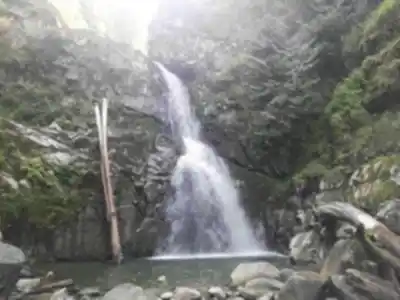
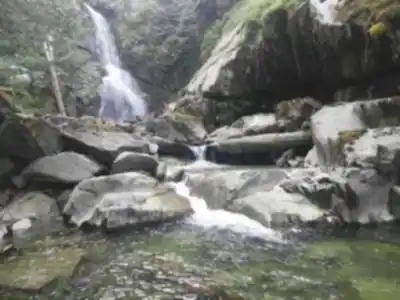
Trail description
Rest Stops Along the Route
The trail offers several natural stopping points at viewpoints and stream crossings where you may want to rest. The most-used stopping area sits roughly 8 kilometers in, where a large clearing opens up panoramic mountain views. This is a good checkpoint for assessing how you're feeling before committing to the upper section.
Picnic spots are scattered throughout the Bear Creek area, from intimate streamside clearings to larger meadows. None have formal facilities, so pack out everything you bring in. There are no washroom facilities anywhere along the trail — plan accordingly before you leave the trailhead.
Recommended gear for this trail


Ready to go?
Everything you need to know before you goStarting Point
The bear creek trails are located in the town of Harrison Hot Springs, British Columbia. To get to the start of the trails, take Highway 1 to exit 135 and follow the signs to Harrison Hot Springs. Once in town, drive along Main Street until you reach the end of the road. The trailhead is located at the end of the street.
When?
How much?
- Hiking shoes Essential
- → Salomon Elixir Tour Mid WP · 203.38 $
- Layered clothing Essential
- Rain jacket Essential
- Trekking poles
- → Black Diamond Trail Ergo Cork · 69.99 $
- Headlamp
- → Petzl Actik Core 625 · 103.95 $
FAQ - Frequently asked questions
Everything you need to knowThe Essential Hiking Checklist
Everything you need for your next hike. Bilingual, printable, 1 page.
Download the free checklistSimilar hikes nearby
Discover other trails you might enjoy

Bridle Path
Vancouver Coast Mountains
Flora Lake
Vancouver Coast Mountains

Alouette Mountain
Vancouver Coast Mountains

Williamson Lake
Vancouver Coast Mountains
Brandywine Mountain
Vancouver Coast Mountains

Coliseum Mountain
Vancouver Coast Mountains
Hiking near Vancouver
235 trails to explore ~102 km away
We work hard to provide the most up-to-date and error-free data possible. If something seems incorrect, let us know! Your contribution helps the whole community.
Hikers' opinions