

Ready to explore Lindeman Lake? Here's everything you need to know before you go!
Discover the trail
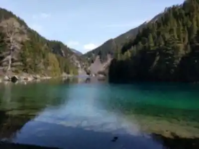
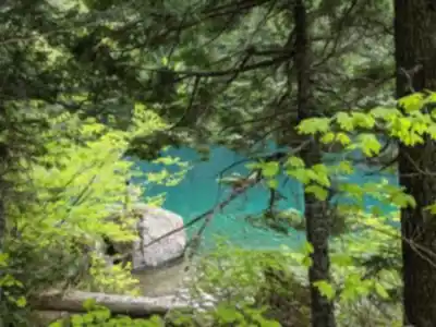
Trail description
{
"elevation_gain_correction": "The current text states '350 meters of elevation gain' throughout. Web sources show conflicting data: AllTrails (most authoritative) reports 218m, Outdoor Family reports 238m, and only one source (Let's Go Play Outside) mentions 350m. Recommendation: Revise to '218-238 meters of elevation gain' or use AllTrails' official 218m figure.",
"difficulty_correction": "Change 'Easy climbing' language to acknowledge 'steep' and 'moderately difficult' character. The final section toward the lake is noted as 'pretty steep' in AllTrails source.",
"hazard_addition": "Add paragraph before 'Extended Options' section: '
Trail Hazards & Considerations
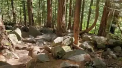
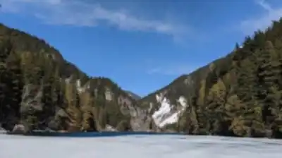
While the trail is well-marked in most sections, trail markers around the peak junction and near the lake can be difficult to find. Downloading offline maps is recommended for navigation. The final section of trail toward the lake is notably steep compared to the rest of the route. Snow can persist into late spring, and in winter months, crampons may be helpful for safe passage. The trail can remain wet and muddy throughout the year due to the dense forest canopy and regular precipitation.
'","swim_clarification": "Current text implies lake is swimmable in summer for 'most visitors.' Verify this is accurate - sources mention swimming but do not emphasize it."
}
Recommended gear for this trail


Ready to go?
Everything you need to know before you goStarting Point
To reach the trailhead for the hiking trails, head towards Chilliwack Lake Road. From there, continue driving until you reach the Post Creek Parking Lot, which is located near the start of the trail. The address for this parking area is approximately 40 kilometers southeast of Chilliwack, along Chilliwack Lake Road. This is the primary access point for the trails in this area.
When?
How much?
- Hiking shoes Essential
- → Salomon Elixir Tour Mid WP · 203.38 $
- Layered clothing Essential
- Rain jacket Essential
- Trekking poles
- → Black Diamond Trail Ergo Cork · 69.99 $
- Headlamp
- → Petzl Actik Core 625 · 103.95 $
FAQ - Frequently asked questions
Everything you need to knowThe Essential Hiking Checklist
Everything you need for your next hike. Bilingual, printable, 1 page.
Download the free checklistSimilar hikes nearby
Discover other trails you might enjoy

Bridle Path
Vancouver Coast Mountains
Flora Lake
Vancouver Coast Mountains

Alouette Mountain
Vancouver Coast Mountains

Williamson Lake
Vancouver Coast Mountains
Brandywine Mountain
Vancouver Coast Mountains

Coliseum Mountain
Vancouver Coast Mountains
Hiking near Vancouver
235 trails to explore ~123 km away
We work hard to provide the most up-to-date and error-free data possible. If something seems incorrect, let us know! Your contribution helps the whole community.
Hikers' opinions