

Ready to explore Manning Park? Here's everything you need to know before you go!
Discover the trail

Trail description
Description
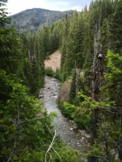
Manning Park sits in British Columbia's Cascade Mountains, roughly three hours east of Vancouver, where the Coast Mountains transition into the drier interior. The park covers over 70,000 hectares of subalpine and alpine terrain, and its position along Highway 3 makes it one of the most accessible wilderness destinations in the province. Whether you're after a quick lakeside walk or a multi-day backcountry traverse, the park delivers without requiring a float plane or a grueling approach.
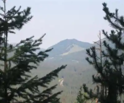
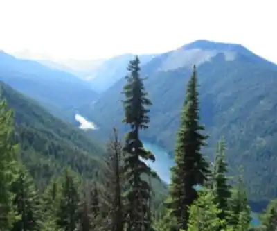
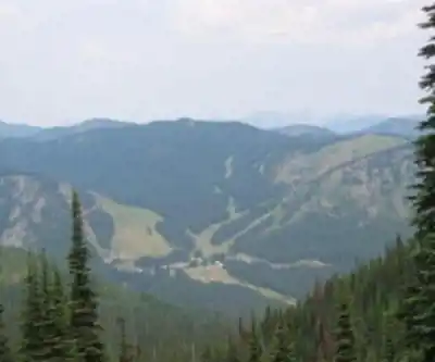
Elevation in the park ranges from around 1,200 meters near the main facilities up to over 2,000 meters on the surrounding peaks. That vertical spread creates genuinely distinct ecosystems within a short distance of each other. Down low, you're moving through dense stands of Douglas fir and lodgepole pine. Climb higher and the trees thin out, giving way to open subalpine meadows, small tarns, and eventually exposed ridgelines with unobstructed views in every direction. It's the kind of place where a single day of hiking can feel like visiting multiple landscapes.
Trail Network
The trail network here spans 80 kilometers with 1,790 meters of cumulative elevation gain across the system, and it genuinely covers the full spectrum of difficulty. Families with young kids, casual walkers, and experienced backcountry hikers all find routes that suit them, often launching from the same trailhead areas.
The Heather Trail is the park's signature route and one of the finest high-elevation hikes in British Columbia. It winds through expansive wildflower meadows that, during peak bloom from mid-July through August, are blanketed in lupine, paintbrush, and dozens of other alpine species. The trail has multiple access points, so you can tailor the distance to your day—short out-and-back trips work well, or you can string together longer sections for a full backcountry experience with overnight camping.
The Lightning Lake Loop offers a completely different experience. This easy circuit follows the shoreline of a clear mountain lake, with a trail surface that works well for families and anyone looking for a relaxed outing. The lake reflects the surrounding forest and peaks throughout the day, and the route stays gentle enough that you can actually pay attention to what's around you rather than watching your footing the whole time.
Beyond these two well-known routes, the park holds a solid network of trails leading to hidden lakes, ridge viewpoints, and remote valleys that see far fewer visitors. Many of these paths connect to each other, which means experienced hikers can piece together custom routes ranging from half-day loops to week-long wilderness trips without retracing their steps.
Wildlife and Natural Features
Manning Park supports a wide range of wildlife across its varied habitats. Black bears are a regular presence throughout the park, especially during late summer when berry crops are at their peak. Mule deer are common in meadows and along forest edges, and mountain goats occasionally appear on the higher rocky terrain and cliff faces.
The park hosts over 200 bird species, which makes it a serious destination for birdwatchers. Gray jays and Clark's nutcrackers are reliable companions in the high country, while the lakes and wetlands attract waterfowl and songbirds. Golden eagles and various hawks work the thermals above the open meadows and ridgelines.
In the alpine zones, hoary marmots, pikas, and ground squirrels are a constant presence—their calls carry across the meadows and serve as a reliable soundtrack to any high-elevation hike. The park's plant communities include rare and endemic species adapted to the mountain environment, with certain areas designated as ecological reserves specifically to protect these ecosystems.
Seasons and Conditions
Summer is peak season, with the wildflower displays from mid-July through August drawing visitors from across the province. Most high-elevation trails are accessible and conditions are comfortable for camping, though weather at this elevation can shift quickly—warm and sunny mornings can turn cool and wet by afternoon, so layered clothing and rain gear are worth carrying regardless of the forecast.
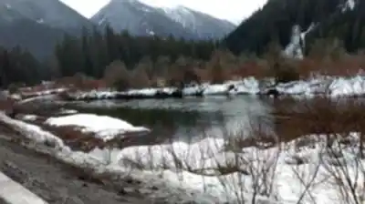
Spring arrives gradually. Lower trails typically open in May, while higher routes can stay snow-covered into July. It's a good time to see the park coming back to life—snowmelt feeds rushing streams, vegetation emerges fast, and wildlife is active after a long winter.
Fall brings one of the more underrated experiences in the park. Alpine larches turn golden and deciduous shrubs go red and orange, while crisp, clear days deliver exceptional visibility across the peaks. Crowds thin out noticeably compared to summer, and the light is excellent for photography.
Winter shifts the park's focus entirely. Manning Park maintains groomed cross-country ski trails at varying difficulty levels, and Lightning Lake becomes a hub for snow-based activities, its frozen surface framed by snow-covered forest. Backcountry skiers and snowshoers have access to extensive terrain beyond the groomed network.
Facilities and Access
Accommodation options within the park range from backcountry campsites to developed campgrounds with washrooms, picnic tables, and fire pits, through to rustic cabins and a full lodge for those who want more comfort after a long day on the trails. The cabins are particularly practical during shoulder seasons when camping is less appealing.
Day-use facilities include picnic areas, washrooms, and an information center where staff can provide current trail conditions, weather updates, and wildlife activity reports. Maps and interpretive displays are available, and the staff are genuinely useful for getting personalized recommendations based on your experience level and what you're looking for.
The park is accessed via Highway 3, which connects it to Vancouver and the Lower Mainland. The drive takes roughly three hours from Vancouver on well-maintained highways. Winter driving conditions can require snow tires or chains, and it's worth checking road conditions before heading out during the colder months. Most high-country trailheads are reached directly from the main park road, which keeps approach times short and maximizes time on the trail.
Recommended gear for this trail


Ready to go?
Everything you need to know before you goStarting Point
The start of the trails at manning park can be accessed from the east entrance or the west entrance.
When?
How much?
- Hiking shoes Essential
- → Salomon Elixir Tour Mid WP · 203.38 $
- Layered clothing Essential
- Rain jacket Essential
- Trekking poles
- → Black Diamond Trail Ergo Cork · 69.99 $
- Headlamp
- → Petzl Actik Core 625 · 103.95 $
FAQ - Frequently asked questions
Everything you need to knowThe Essential Hiking Checklist
Everything you need for your next hike. Bilingual, printable, 1 page.
Download the free checklistSimilar hikes nearby
Discover other trails you might enjoy

Bridle Path
Vancouver Coast Mountains
Flora Lake
Vancouver Coast Mountains

Alouette Mountain
Vancouver Coast Mountains

Williamson Lake
Vancouver Coast Mountains
Brandywine Mountain
Vancouver Coast Mountains

Coliseum Mountain
Vancouver Coast Mountains
Hiking near Kelowna
45 trails to explore ~131 km away
We work hard to provide the most up-to-date and error-free data possible. If something seems incorrect, let us know! Your contribution helps the whole community.
Hikers' opinions