

Ready to explore Sasamat Lake? Here's everything you need to know before you go!
Discover the trail
Trail description
Description
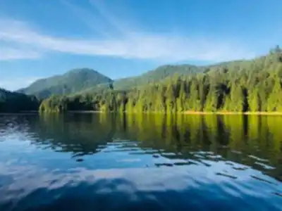
Sasamat Lake sits tucked into the Vancouver Coast Mountains, close enough to Vancouver to make it a realistic day trip but far enough removed that the city noise fades quickly once you step out of the car. The lake draws a steady mix of hikers, swimmers, and paddlers looking for accessible outdoor recreation without the crowds that pile up at more well-known destinations. Clear water, a forested shoreline, and a relaxed atmosphere make it easy to understand why people keep coming back.
What genuinely sets Sasamat Lake apart is how well it balances convenience with a real sense of place. You can be standing on the trail within an hour of leaving downtown Vancouver, yet the surrounding Douglas fir and cedar forest feels genuinely removed from urban life. The lake's character stays intact thanks to its location within protected watershed lands, which keeps development off the shoreline and preserves the natural setting that makes the place worth visiting.
The Lake Loop Trail
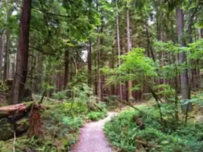
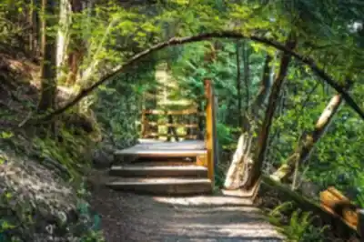
The main draw for hikers is the Sasamat Lake Loop Trail, a gentle circuit that follows the shoreline around the entire lake. At 2 kilometers with only 40 meters of elevation gain, this is a genuinely flat and accessible route — the kind of trail where the challenge comes from resisting the urge to stop every few minutes rather than from any physical demand. Expect to spend around 45 minutes on the loop at a comfortable pace, though most people stretch that out considerably once they start noticing the details.
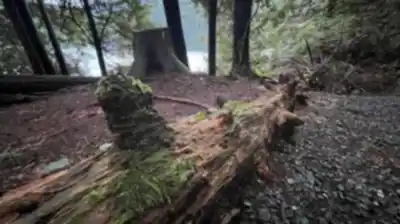
The trail surface shifts as you go, moving between packed earth and wooden boardwalks where the path crosses marshy areas and small creek inlets. The south side of the lake takes you through mature second-growth forest where oversized stumps are a quiet reminder of the old-growth trees that once dominated this landscape. The north shore opens up with better views across the water and a few rocky outcrops that work well as rest stops or spots to watch the light shift on the surface. In spring and early summer, the forest floor fills in with trilliums, bleeding hearts, and ferns that thrive in the moist coastal climate.
The trail is well-maintained and genuinely family-friendly. Young kids handle it without trouble, and the relatively short distance means you can take your time without worrying about energy levels on the way back.
Challenging Options Nearby
If the lake loop leaves you wanting more elevation, the Diez Vistas Trail offers a completely different kind of day. This demanding route climbs steeply from the Sasamat Lake area to deliver panoramic views of Indian Arm and Burrard Inlet. The name refers to the multiple viewpoints along the way, each one revealing a different angle on the coastal mountains and waterways that define this part of British Columbia. The trail requires solid fitness and proper footwear — the terrain is rocky and the elevation gain is significant — but the views at the top make the effort worthwhile. On clear days, you can see across to the North Shore mountains and down the full length of Indian Arm.
Water Activities
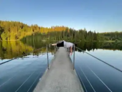
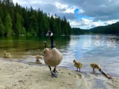
Sasamat Lake is as much a water destination as a hiking one. White Pine Beach on the eastern shore is the main swimming area, with a sandy bottom and designated zones that make it comfortable for families. The lake stays cool even during the warmest stretches of summer, which keeps the swimming refreshing rather than tepid. The beach area has picnic tables and basic facilities, making it easy to build a full day around a combination of hiking and time on the water.
Kayaking and paddleboarding have become increasingly popular here, and the lake's protected, calm surface makes it well-suited for both. From the water, the surrounding forest and mountains read differently than they do from the trail — it's worth getting out on the lake if you have the chance. Early morning sessions tend to reward you with flat, reflective water and a quieter shoreline.
Wildlife and Natural Features
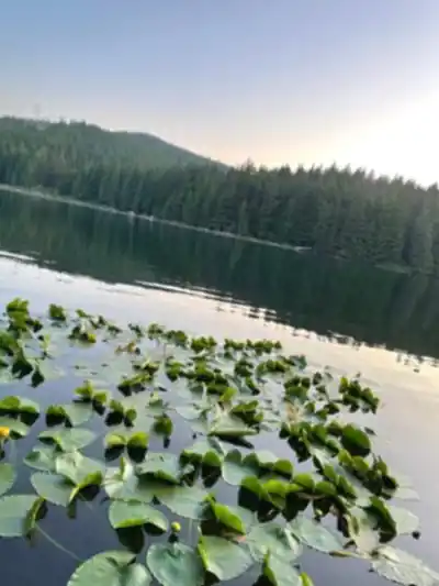
The ecosystem around Sasamat Lake supports the kind of wildlife you'd expect from a healthy coastal mountain environment. Black bears move through the area occasionally, particularly during berry season, though sightings are relatively uncommon given the regular human presence. More reliably, you'll spot Steller's jays, varied thrushes, and several woodpecker species working through the mature forest. The lake's clear, shallow edges give you a direct look at the underwater habitat — aquatic plants, small fish, and amphibians are visible without any special effort near the shoreline.
Practical Considerations
Parking fills up fast on summer weekends and holidays. Getting there before 10 AM makes a real difference. The access road is narrow in places, so pay attention when meeting oncoming traffic — it's not a road to drive distracted.
The trail is accessible year-round. Winter visits are quieter and the snow-covered forest has its own appeal, though you'll want appropriate footwear for icy or snowy sections. Swimming is off the table for most people in colder months, but the loop trail stays walkable.
Because Sasamat Lake sits within protected watershed lands, Leave No Trace principles matter more here than at many other destinations. Pack out everything you bring in, stay on designated trails, and keep the shoreline clean — the lake's pristine condition is directly tied to how visitors treat it.
Recommended gear for this trail


Ready to go?
Everything you need to know before you goStarting Point
To access the hiking trails, head to White Pine Beach parking lot. The address is 4000 Bedwell Bay Road, Belcarra, BC V3H 4P6. This is the main starting point for the trails in the area.
When?
How much?
- Hiking shoes Essential
- → Salomon Elixir Tour Mid WP · 203.38 $
- Layered clothing Essential
- Rain jacket Essential
- Trekking poles
- → Black Diamond Trail Ergo Cork · 69.99 $
- Headlamp
- → Petzl Actik Core 625 · 103.95 $
FAQ - Frequently asked questions
Everything you need to knowThe Essential Hiking Checklist
Everything you need for your next hike. Bilingual, printable, 1 page.
Download the free checklistSimilar hikes nearby
Discover other trails you might enjoy

Bridle Path
Vancouver Coast Mountains
Flora Lake
Vancouver Coast Mountains

Alouette Mountain
Vancouver Coast Mountains

Williamson Lake
Vancouver Coast Mountains
Brandywine Mountain
Vancouver Coast Mountains

Coliseum Mountain
Vancouver Coast Mountains
Hiking near Vancouver
235 trails to explore ~17 km away
We work hard to provide the most up-to-date and error-free data possible. If something seems incorrect, let us know! Your contribution helps the whole community.
Hikers' opinions