

Ready to explore Tunnel Bluffs? Here's everything you need to know before you go!
Discover the trail
Available trails
| Trails | Distance | Elevation | Duration | Difficulty | GPX |
|---|---|---|---|---|---|
| 4.03 km | 710 m | 2h | GPX |
Trail description
The Trail Experience
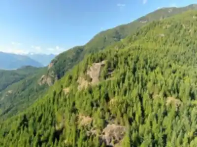
The 6 to 8-kilometer round-trip journey to Tunnel Bluffs gains approximately 600 meters of elevation as it winds through the characteristic ecosystems of the Coast Mountains. The trail is well-marked throughout, following established paths that have been developed and maintained over years of regular use.
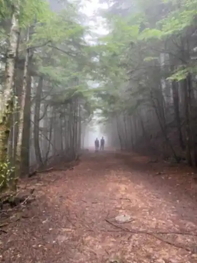
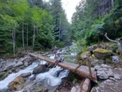
The hike begins with a steep initial section featuring a rocky service road with sharp elevation gain. Once this incline levels out, the second section becomes more pleasant, passing through a wide swath of forest, over log bridges, and eventually reaching the final stretch to the viewpoint.
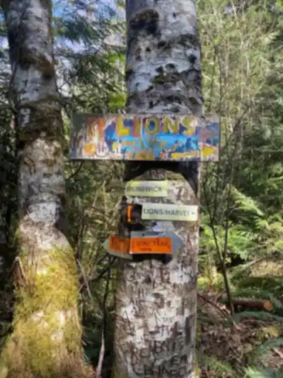
Your ascent climbs steeply from Lions Bay, briefly following the Mount Brunswick Trail before branching off onto an old logging road toward the viewpoint. The understory reveals the lush growth that thrives in this climate—ferns, salmonberry, and devil's club line the trail in many sections. As you climb higher, the forest composition gradually shifts, and occasional clearings begin to offer tantalizing glimpses of Howe Sound's waters far below.
The terrain underfoot varies from packed earth to rocky sections, with some root networks and occasional loose stones that require attention, especially on the descent. The varied terrain and steep sections call for sturdy hiking boots with good traction.
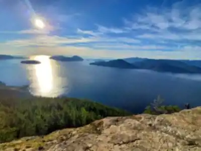
The Summit Reward
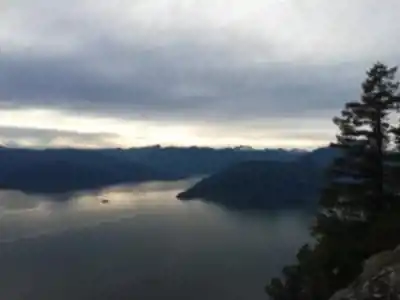
On a sunny day, the incredible view from Tunnel Bluffs looks out towards Bowen Island and the Sunshine Coast, as well as south to Horseshoe Bay and along the Sea To Sky Highway. The summit provides an unobstructed viewpoint above Howe Sound, its deep waters reflecting the sky and surrounding peaks.
The summit area provides enough space for groups to spread out comfortably. The rocky bluff formation creates natural seating areas where hikers can rest and take in the scenery. This is prime territory for photography, whether you're capturing the sweeping landscape or looking for more intimate compositions of the mountain and water elements.
Planning Your Visit
Timing your hike can significantly impact your experience on Tunnel Bluffs. The hike is popular and we recommend doing this hike during off-peak times. Starting early in the day, particularly on weekdays, helps you avoid the crowds that this popular trail attracts. Avoid this hike on weekends during the summer due to limited parking near the trailhead.
As a lower elevation hike, Tunnel Bluffs is snow-free for much of the year and can usually be hiked early in the spring and late into the fall.
Water requirements are significant given the elevation gain and length of the hike. Carrying adequate water is wise, especially during warmer months or if you plan to spend extended time at the summit.
Weather conditions in the Coast Mountains can shift rapidly, and the summit's exposed position makes it particularly susceptible to wind and changing visibility. Checking current forecasts and being prepared for conditions different from what you experience at the trailhead is essential.
The area's popularity means that Leave No Trace principles are particularly important here—pack out all waste, stay on established trails, and be considerate of other hikers sharing this remarkable viewpoint.
Recommended gear for this trail


Ready to go?
Everything you need to know before you goStarting Point
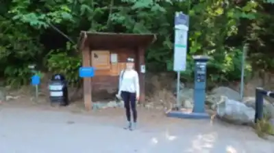
The tunnel bluffs are located in the community of Lions Bay, British Columbia. To get to the start of the trails, take the Lions Bay exit off Highway 99 and drive up the hill. The trailhead is located at the end of Mount Gardner Road.
When?
How much?
- Hiking shoes Essential
- → Salomon Elixir Tour Mid WP · 203.38 $
- Layered clothing Essential
- Rain jacket Essential
- Trekking poles
- → Black Diamond Trail Ergo Cork · 69.99 $
- Headlamp
- → Petzl Actik Core 625 · 103.95 $
FAQ - Frequently asked questions
Everything you need to knowThe Essential Hiking Checklist
Everything you need for your next hike. Bilingual, printable, 1 page.
Download the free checklistSimilar hikes nearby
Discover other trails you might enjoy

Bridle Path
Vancouver Coast Mountains
Flora Lake
Vancouver Coast Mountains

Alouette Mountain
Vancouver Coast Mountains

Williamson Lake
Vancouver Coast Mountains
Brandywine Mountain
Vancouver Coast Mountains

Coliseum Mountain
Vancouver Coast Mountains
Hiking near Squamish
211 trails to explore ~24 km away
We work hard to provide the most up-to-date and error-free data possible. If something seems incorrect, let us know! Your contribution helps the whole community.
Hikers' opinions