

Ready to explore Whyte Lake Trailhead? Here's everything you need to know before you go!
Discover the trail
Trail description
{
"opening_paragraph": "
The Whyte Lake Trail is one of the most rewarding short hikes on the North Shore of West Vancouver. At 6 km round trip with 238 metres of elevation gain, it hits a sweet spot — enough trail to feel like a real outing, short enough to fit into a half-day. The destination is a quiet, forest-ringed lake that genuinely feels removed from the city, even though you're less than an hour from downtown Vancouver.
","parking_section": "
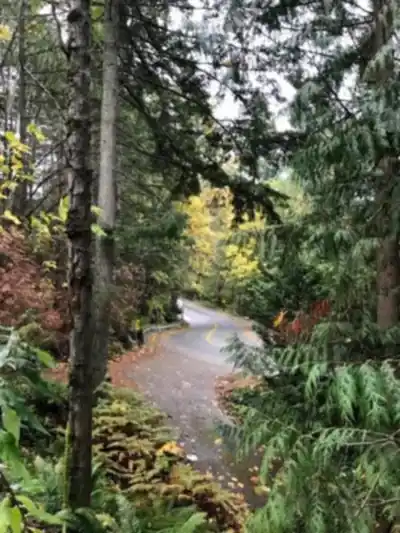
The trailhead is accessed from Nelson Canyon Park parking lot in West Vancouver, which serves as the main staging area. Public parking at the trailhead is limited and fills up quickly in good weather — it's wise to have an alternate plan if you're visiting on a popular weekend. From downtown Vancouver, expect a drive of roughly 30 to 45 minutes depending on traffic. That proximity makes this trail a legitimate option for after-work hikes during summer's longer days, not just a weekend commitment.
","trail_character": "
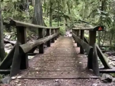
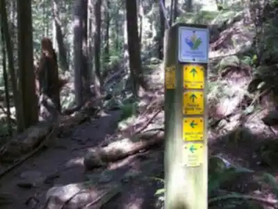
The trail is rated Moderate, and that feels accurate. The path climbs steadily through dense coastal rainforest, gaining elevation at a consistent pace without any technical sections or scrambling. The grade is manageable throughout — you'll feel the 238 metres of gain, but it never becomes a slog. Most hikers complete the full out-and-back in around 2 hours, though the lake is worth lingering at if your schedule allows.
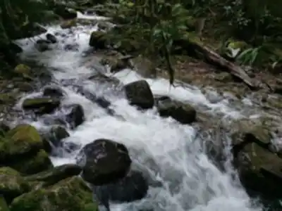
The trail follows Nelson Creek for much of the route, with the sound and presence of water adding to the hiking experience. The forest features impressive old-growth Douglas fir and western red cedar trees, creating a dense canopy overhead. The trail surface is well-maintained, though the forest environment keeps things damp. Even during dry stretches, the canopy holds moisture, and the trail can stay slick — particularly where fallen leaves accumulate on any steeper pitches. Sturdy hiking shoes with decent grip are the right call here.
","lake_section": "
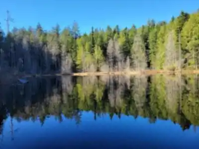
The lake is the payoff, and it delivers. Whyte Lake sits in a natural bowl enclosed by dense forest, which gives it an intimate, tucked-away feel. The lake features a quaint wooden dock and 300 m of boardwalk, providing proper access to the water's edge. On calm days, the water acts as a clean mirror for the surrounding trees and sky. The lake is cool year-round, fed by mountain runoff and springs, and is suitable for swimming during warmer months. Several benches are positioned along the shoreline, giving you a proper place to sit and decompress.
"}
Recommended gear for this trail


Ready to go?
Everything you need to know before you goStarting Point
The whyte lake trailhead is located in the community of Pemberton, British Columbia. To get there, take Highway 99 north from Vancouver to Pemberton. Turn left onto Portage Road and drive for about 5 km until you reach the trailhead parking lot on the right.
When?
How much?
- Hiking shoes Essential
- → Salomon Elixir Tour Mid WP · 203.38 $
- Layered clothing Essential
- Rain jacket Essential
- Trekking poles
- → Black Diamond Trail Ergo Cork · 69.99 $
- Headlamp
- → Petzl Actik Core 625 · 103.95 $
FAQ - Frequently asked questions
Everything you need to knowThe Essential Hiking Checklist
Everything you need for your next hike. Bilingual, printable, 1 page.
Download the free checklistSimilar hikes nearby
Discover other trails you might enjoy

Bridle Path
Vancouver Coast Mountains
Flora Lake
Vancouver Coast Mountains

Alouette Mountain
Vancouver Coast Mountains

Williamson Lake
Vancouver Coast Mountains
Brandywine Mountain
Vancouver Coast Mountains

Coliseum Mountain
Vancouver Coast Mountains
Hiking near Vancouver
235 trails to explore ~13 km away
We work hard to provide the most up-to-date and error-free data possible. If something seems incorrect, let us know! Your contribution helps the whole community.
Hikers' opinions