

Ready to explore Lac de l'Endre? Here's everything you need to know before you go!
Discover the trail
Trail description
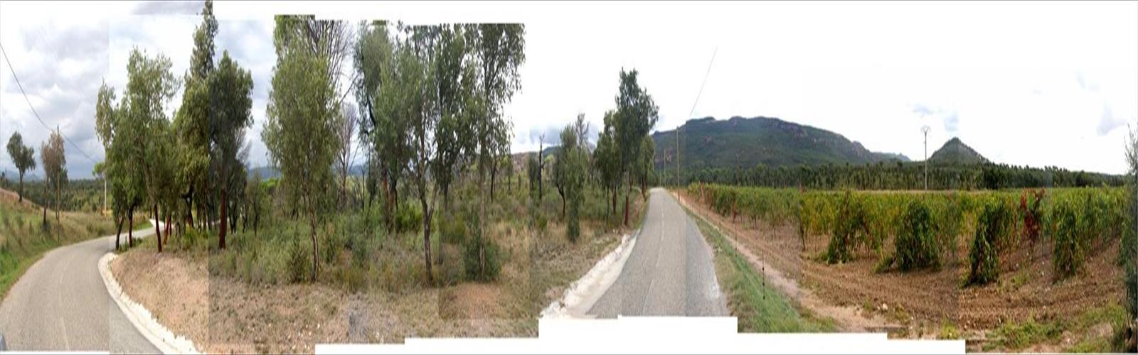
Lac de l'Endre is one of those destinations in the Var that earns its reputation quietly — no crowds, no fanfare, just a genuinely beautiful mountain lake tucked into the backcountry of Provence-Alpes-Côte d'Azur. At 4.5 km round trip with 200 meters of elevation gain, this is an easy hike that most people can complete in about an hour and a half, yet it delivers the kind of scenery that feels like a real reward.
The trail strikes a nice balance: accessible enough for families and casual hikers, but with enough varied terrain to keep things interesting. You're not just walking a flat path to a viewpoint — you're moving through distinct ecological zones, reading the landscape as it shifts around you, and arriving at a lake that genuinely earns the effort.
What the Trail Feels Like
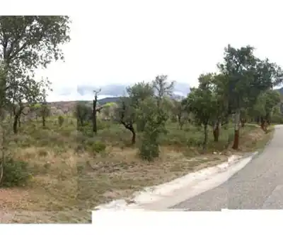
From the trailhead, the path starts on well-maintained dirt and quickly establishes its character. The red rock formations and limestone outcroppings that define so much of the Var's backcountry are present from the start, giving the lower section a warm, textured feel underfoot. The 200-meter elevation gain builds gradually — this isn't a trail that throws everything at you in the first kilometer. The climb is steady and manageable, which is part of why it works well for a wide range of fitness levels.
As you gain elevation, the trail surface changes. The smooth dirt of the lower section gives way to rockier ground, and the final approach to the lake involves some loose scree and occasional boulder fields. Nothing technical, but you'll want to watch your footing. Trekking poles are worth bringing if you have them, especially if conditions are wet.
The vegetation shift is one of the more satisfying parts of this hike. Down low, you're walking through classic Provençal garrigue — aromatic scrubland thick with thyme, rosemary, and lavender. The smell alone is worth the trip on a warm morning. Higher up, Aleppo pines and holm oaks take over, providing real shade and a noticeably cooler atmosphere. These two zones feel genuinely different from each other, and the transition between them gives the hike a natural sense of progression.
The Lake
Lac de l'Endre is the payoff, and it delivers. The water sits surrounded by limestone cliffs and forested slopes, and on calm days the surface acts like a mirror — reflecting the rock faces and tree lines in a way that makes the whole scene feel almost still. The shoreline has flat rocks that work well as natural rest spots, whether you're stopping for lunch, drying out your feet, or just sitting with the view for a while.
The lake's clarity comes partly from the limestone geology of the area. Karst topography dominates this part of the Var, and the limestone acts as a natural filter for groundwater and runoff. The result is water that reads as remarkably clean and clear. That said, treat it before drinking — don't count on it as a potable source without proper filtration.
Wildlife Along the Way
The trail to Lac de l'Endre passes through habitat that supports a solid variety of wildlife. Wild boar tracks show up regularly in muddy sections, particularly near water. Woodpeckers are a consistent presence in the forested stretches — you'll often hear them before you see them. Up higher, keep an eye on the sky: buzzards are common, and golden eagles have been spotted riding thermals above the sun-warmed rock faces. The mix of garrigue, forest, and open rock creates the kind of habitat diversity that makes wildlife sightings genuinely likely rather than just possible.
Seasonal Notes
Spring is a strong choice for this hike. Wildflowers — poppies, cistus, various orchid species — add real color to the lower elevations, and temperatures are comfortable for moving at a relaxed pace. Wet spring conditions can make the rocky sections slippery, so footwear with grip matters more than usual.
Summer hiking here means starting early. The Mediterranean heat builds fast, and exposed sections of the trail offer little relief once the sun is high. The upside: the lake is at its most inviting for a swim, and the water is clear and refreshing after the climb.
Autumn is arguably the most reliable season. Stable weather, comfortable temperatures, and the visual contrast of yellowing deciduous trees against evergreen pines and deep blue water make for excellent conditions. Winter is possible but requires checking forecasts carefully — snow can accumulate at higher elevations, and exposed rock sections become genuinely hazardous when iced over.
Navigation and Trail Marking
The route follows established French hiking trails and is generally well-marked with standard trail blazes on trees and rocks. That said, some sections require attention — don't assume every junction is obvious. Carrying a detailed topographic map or a GPS track is a smart habit on this terrain, particularly if fog or low cloud rolls in near the lake. Visibility can drop quickly at higher elevations, and the rocky sections near the water are not where you want to be guessing at the route.
Stream crossings may be necessary depending on recent rainfall and the time of year. Most can be managed with careful rock-hopping, but waterproof boots make the whole experience more comfortable and give you more options when water levels are higher.
Gear and Practical Notes
- Footwear: Sturdy hiking boots with ankle support are the right call here. The varied terrain — from smooth dirt to loose scree — rewards proper footwear, especially on the approach to the lake.
- Water: Carry everything you need from the start. Water sources along the trail are limited, and the lake water requires treatment before drinking. In summer, bring more than you think you'll need.
- Layers: Even in summer, a light rain jacket and a thin insulating layer are worth the pack weight. Weather in the Var's backcountry can shift, and wind on exposed sections adds a chill factor that catches people off guard.
- Trekking poles: Optional in dry conditions, genuinely useful when it's wet or when navigating the scree near the lake.
The trail to Lac de l'Endre is a solid half-day outing that punches above its weight in terms of scenery and variety — the kind of hike that leaves you feeling like you actually went somewhere.
The Essential Hiking Checklist
Everything you need for your next hike. Bilingual, printable, 1 page.
Get your free hiking checklistRecommended gear for this trail
As an Amazon Associate I earn from qualifying purchases.


Ready to go?
Everything you need to know before you goWhen?
How much?
As an Amazon Associate I earn from qualifying purchases.
Affiliate links — LGPO may earn a commission at no extra cost to you.
- Hiking shoes Essential
- → Salomon Elixir Tour Mid WP · 203.38 $
- Layered clothing Essential
- Rain jacket Essential
- Trekking poles
- → Black Diamond Trail Ergo Cork · 69.99 $
- Headlamp
- → Petzl Actik Core 625 · 103.95 $
FAQ - Frequently asked questions
Everything you need to knowSimilar hikes nearby
Discover other trails you might enjoy
Rocher de Roquebrune
Var
Sentier littoral du Cap Dramont
Var
Gorges du Caramy
Var
Gorges D'ollioules
Var
Gorges du Blavet
Var
Parc naturel régional du Luberon
Var
Hiking near Sydney
22 trails to explore ~5131 km away
We work hard to provide the most up-to-date and error-free data possible. If something seems incorrect, let us know! Your contribution helps the whole community.
Hikers' opinions
Be the first to review!
No hiker has shared their experience yet. Share your impressions and help other hikers!