

Ready to explore Parc naturel régional du Luberon? Here's everything you need to know before you go!
Discover the trail
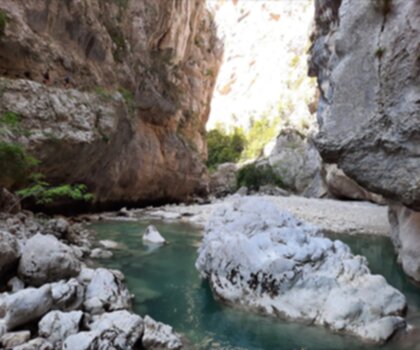
Oh no! We don't have any photos 😢
This trail hasn't been captured yet. Be the first to share your adventure!Trail description
Désolé, nous n'avons pas de description pour cet endroit.
Soyez le premier à partager plus d'informations sur cet endroit.
Soyez le premier à partager plus d'informations sur cet endroit.
Recommended gear for this trail
LGPO Pick

Salomon
Elixir Tour Mid WP
Waterproof mid-height boot ideal for rocky terrain
203.38 $


Affiliate links — LGPO may earn a commission at no extra cost to you.
Ready to go?
Everything you need to know before you goStarting Point
The trailhead for the Luberon Regional Nature Park is in Gordes, Provence-Alpes-Côte d'Azur.
When?
Opening hours
From sunrise to sunset
Varies by season
Best season
Fall
Spectacular colors
Best time
Early morning
Less crowded
Weather (next days)
Loading
How much?
Entry fees
Adult
Not available
Child
—
What to bring?
Gear
- Hiking shoes Essential
- → Salomon Elixir Tour Mid WP · 203.38 $
- Layered clothing Essential
- Rain jacket Essential
- Trekking poles
- → Black Diamond Trail Ergo Cork · 69.99 $
- Headlamp
- → Petzl Actik Core 625 · 103.95 $
Water & food
2L minimum
No water point on the trail
Bring energy snacks for a 4h+ hike
Good to know
Park rules
No dogs
Safety
Download the GPX before you go
Limited cellular coverage on the trail
Slippery after rain
Be careful on rocky sections
In an emergency
Emergency
911
Parking GPS
43.8386092, 5.401464
Center
04 90 04 42 00
FAQ - Frequently asked questions
Everything you need to knowModerate
500.00
1125.00
2h30
No
No
Yes, the trail is rated as Moderate difficulty, making it accessible to hikers with basic experience. The 2h30 duration and 500 m elevation gain are manageable for most beginners in reasonable fitness. However, verify current trail conditions with the park before your visit.
The hike takes approximately 2h30 to complete. This duration accounts for the 500 m elevation gain and the terrain difficulty rated as Moderate.
The trail features 500 m of elevation gain throughout the hike. This moderate ascent is spread across the 2h30 duration of the walk.
Didn't find your answer?
Free
1 pages
The Essential Hiking Checklist
Everything you need for your next hike. Bilingual, printable, 1 page.
Download the free checklistSimilar hikes nearby
Discover other trails you might enjoy

Rocher de Roquebrune
Var
4.5 km
2h30
372 m
Intermediate
4.8
(1)
L'Imbut
Var
6 km
2h30
300 m
Intermediate
4.8
(6)
Sentier littoral du Cap Dramont
Var
6.4 km
2h30
610 m
Advanced
4.7
Gorges du Caramy
Var
6 km
2h30
300 m
Intermediate
4.6
(4)
Gorges D'ollioules
Var
3.5 km
1h45
300 m
Beginner
4.6
(5)
Les Gorges du Toulourenc
Var
8 km
2h30
300 m
Intermediate
4.6
(6)
Top 10 best hiking in Var
Our ranking based on hiker reviews
Hiking near Sydney
22 trails to explore ~5028 km away
Did you spot an error?
We work hard to provide the most up-to-date and error-free data possible. If something seems incorrect, let us know! Your contribution helps the whole community.
Hikers' opinions