

Ready to explore Bloody Mountain, California? Here's everything you need to know before you go!
Discover the trail
Trail description
Description
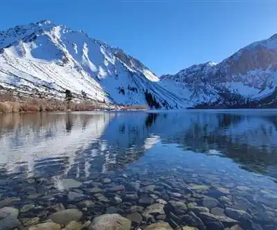
Bloody Mountain tops out at 12,552 feet in California's Eastern Sierra Nevada, and the name alone tends to stop people in their tracks. Don't worry — it's not what you think. The reddish coloration of the mountain's rocky faces is what earned it that striking name, and once you're up there looking at those rust-colored formations against the surrounding Sierra granite, it makes perfect sense. This is one of the more demanding peaks in the region, and it earns that reputation honestly.
What You're Getting Into
The numbers here are serious: 19.3 kilometers of total distance, 3,826 meters of elevation gain, and roughly 10 hours and 45 minutes on the mountain. This isn't a trail you stumble into on a whim. You need solid fitness, real hiking experience, and a genuine respect for high-altitude conditions before you commit to this one.
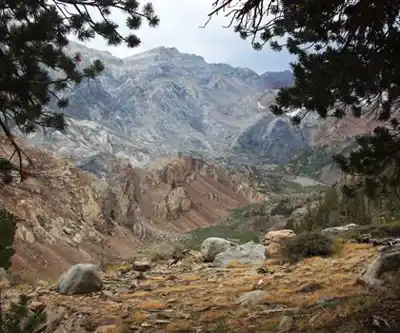
The route starts deceptively mellow. The first stretch from the Convict Lake Trailhead moves through dense conifer forest at a manageable grade, and it's easy to feel confident early on. That changes. As you gain elevation, the terrain shifts — established trail gives way to talus fields, the grade steepens, and loose rock becomes a constant companion. The final push to the summit involves scrambling over granite slabs and picking your way through rocky terrain where the route isn't always obvious. Route-finding skills matter up here.
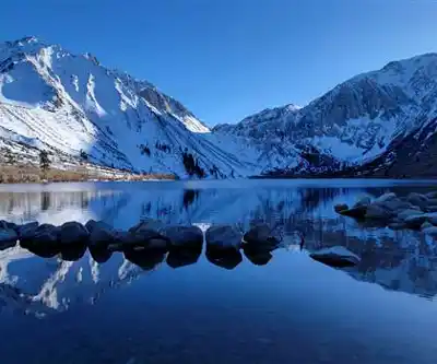
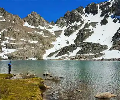
Snow can linger on north-facing slopes and the upper mountain well into summer. Early season attempts may require microspikes or crampons, and in some years, mountaineering skills are genuinely necessary. Even during the prime July-through-September window, conditions can shift fast.
The Terrain and the Views
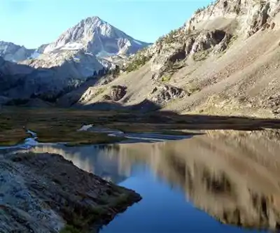
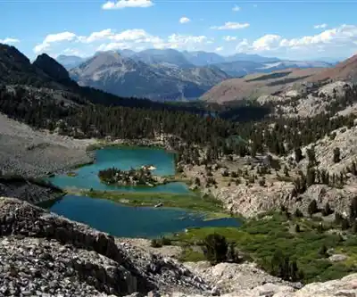
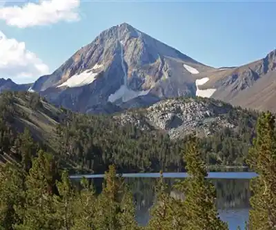
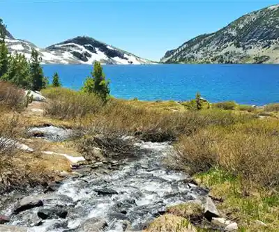
What makes Bloody Mountain worth the effort is the sheer variety of what you move through on the way up. You start in montane forest, break into open alpine meadows, cross boulder fields, and eventually reach exposed ridgeline where the Sierra spreads out in every direction. The Owens Valley drops away thousands of feet to the east. Alpine lakes sit in granite cirques below. The jagged ridgelines of neighboring peaks stretch out as far as you can see.
The mountain's distinctive reddish metamorphic rock becomes increasingly prominent as you approach the summit. It's a genuine visual contrast to the pale granite that dominates most of the Sierra, and it gives Bloody Mountain a character that's hard to miss. These colorful outcrops are part of what makes the upper mountain so photogenic — and so geologically interesting. The layered formations tell a long story about the Sierra's history that's worth paying attention to as you climb.
Wildlife Along the Way
The elevation transition from forest to alpine zone brings a noticeable shift in wildlife. Lower down, deer move through the forest understory and bird activity is steady. Once you're in the alpine zone, yellow-bellied marmots take over — they're everywhere up here, sunning on boulders and sounding off with their sharp whistles when you get too close.
Look up regularly. Golden eagles and red-tailed hawks work the thermals along the high ridges, and spotting one riding the updrafts near the summit is one of those moments that sticks with you. In spring and early summer, the meadows below the alpine zone put on a wildflower show — lupine, Indian paintbrush, and mountain asters filling in the spaces between granite outcrops.
Weather and Timing
Afternoon thunderstorms are a real hazard in the Sierra, and on a route this exposed, lightning is not something to gamble with. An early start isn't just a good idea — it's essential. You want to be off the exposed upper mountain well before early afternoon, which means leaving the trailhead at first light or before.
The stable window runs July through September. Outside that range, snow coverage and weather unpredictability increase significantly. Even within that window, always check current conditions and a detailed forecast before you go. Sierra weather doesn't care about your plans.
Temperature swings from trailhead to summit can be dramatic. A warm morning at the car doesn't tell you much about what it'll feel like on the exposed ridge with wind. Plan for both extremes.
Gear and Preparation
A layering system is non-negotiable. You'll move through enough temperature variation on this climb that having insulating layers and a waterproof shell accessible — not buried at the bottom of your pack — matters. Warm hat and gloves belong in the bag even in July. High-altitude sun is intense; sunscreen and quality sunglasses are part of the kit, not optional extras.
Footwear needs to handle loose rock, potential snow patches, and long descents. Sturdy, broken-in hiking boots with solid ankle support are the right call. Trekking poles earn their weight on the descent, which is long and hard on the knees.
Carry more water than you think you need. The physical output on a climb like this is substantial, and dehydration at altitude compounds quickly. High-calorie food, a headlamp, a basic first aid kit, and an emergency shelter round out the essentials. If there's any chance of snow on the upper mountain, microspikes are worth the extra weight.
Navigation tools matter on the upper mountain where the route becomes less defined. A GPS device or a phone with downloaded offline maps gives you a reliable backup when the trail disappears into talus and you're trying to figure out which way the ridge goes.
Getting There and Logistics
The Convict Lake Trailhead is the standard starting point for Bloody Mountain and sits in the Mammoth Lakes area. Parking and restroom facilities are available, but the lot fills up fast on summer weekends. Arriving early solves two problems at once — you beat the crowd for parking and you get the early start the route demands.
If you're coming from lower elevation, spending a day or two in the Mammoth Lakes area before attempting the climb is a smart move. The altitude gain from sea level to the summit is significant, and acclimatization makes a real difference in how you feel on the upper mountain.
Cell coverage is unreliable to nonexistent for most of the route. Tell someone where you're going and when you expect to be back — this is a serious climb that sees fewer people than the more popular Sierra destinations, and self-reliance is part of the deal out here.
Recommended gear for this trail


Ready to go?
Everything you need to know before you goStarting Point
To access the hiking trails, you can start from several trailheads. One option is to begin at the McGee Creek Trailhead, located at McGee Creek Road, Mammoth Lakes, CA 93546. Another starting point is the Convict Lake Trailhead, found at Convict Lake Road, Mammoth Lakes, CA 93546. Both trailheads offer parking facilities for hikers.
When?
How much?
- Hiking shoes Essential
- → Salomon Elixir Tour Mid WP · 203.38 $
- Layered clothing Essential
- Rain jacket Essential
- Trekking poles
- → Black Diamond Trail Ergo Cork · 69.99 $
- Headlamp
- → Petzl Actik Core 625 · 103.95 $
FAQ - Frequently asked questions
Everything you need to knowThe Essential Hiking Checklist
Everything you need for your next hike. Bilingual, printable, 1 page.
Download the free checklistSimilar hikes nearby
Discover other trails you might enjoy

Mount Hopkins, California
Sierra Nevada
Mount Ingalls, California
Sierra Nevada
Mount Lyell, California
Sierra Nevada
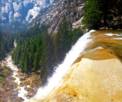
Vernal and Nevada Falls (The Mist) Trail
Sierra Nevada
Chinese Peak, California
Sierra Nevada
Basin Mountain, California
Sierra Nevada
Hiking near Victoria
93 trails to explore ~1260 km away
We work hard to provide the most up-to-date and error-free data possible. If something seems incorrect, let us know! Your contribution helps the whole community.
Hikers' opinions