

Ready to explore glenwood canyon? Here's everything you need to know before you go!
Discover the trail
Oh no! We don't have any photos 😢
This trail hasn't been captured yet. Be the first to share your adventure!Trail description
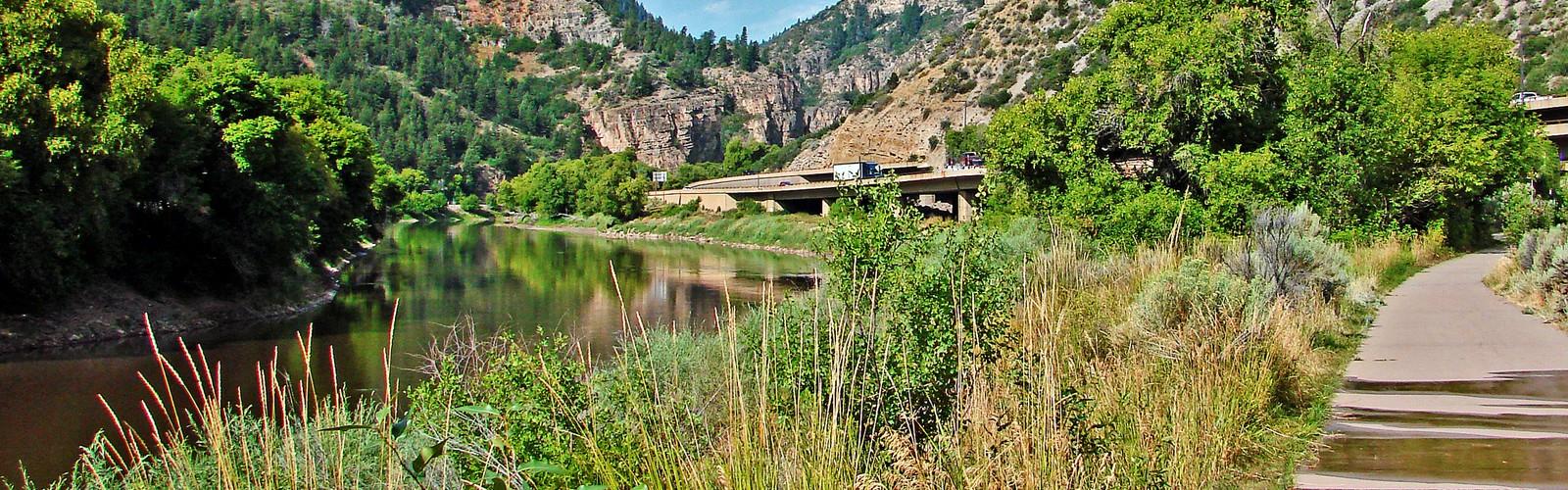
Glenwood Canyon is one of the most dramatic natural corridors in Colorado — a deep, sheer-walled gorge carved by the Colorado River over millions of years. Stretching through the canyon, the paved recreational trail follows the river closely, offering a rare combination of accessibility and raw geological spectacle. Whether you're on foot, on a bike, or just looking to spend time near moving water surrounded by towering limestone walls, Glenwood Canyon delivers something genuinely hard to find elsewhere in the state.
The Canyon Itself
The walls of Glenwood Canyon rise dramatically on both sides, in some places reaching nearly 1,800 feet above the canyon floor. The rock is layered and ancient — Precambrian granite at the base giving way to younger sedimentary formations higher up. The Colorado River runs through the entire length of the canyon, and the sound of it is constant. Depending on the season and snowpack, the river can be a roaring torrent or a steady, clear-green flow. Either way, it's always present.
What makes Glenwood Canyon unusual is the sheer density of infrastructure packed into such a tight space. Interstate 70 runs through the canyon — an engineering feat in itself — along with a railroad line, the river, and the recreational trail, all threading through a corridor that in places is barely wide enough to fit them all. Rather than detracting from the experience, this layering gives the canyon a particular energy. You're walking through a place that humans have been trying to navigate and move through for a very long time.
The Trail
The Glenwood Canyon Recreation Trail is paved and relatively flat, making it one of the more accessible trail experiences in the Colorado mountains. It runs along the Colorado River, passing through tunnels, over bridges, and past rest areas with restrooms and picnic facilities. The trail is shared-use, meaning you'll encounter cyclists, joggers, and walkers — it's a busy corridor, especially on weekends and during summer.
Several side trails branch off from the main path. The Hanging Lake Trail is the most well-known — a steep, rocky climb that leads to a stunning travertine lake perched on a ledge partway up the canyon wall. Access to Hanging Lake now requires a permit, so if that's your destination, plan ahead and book in advance. The Grottos area, near the eastern end of the canyon, offers another worthwhile detour with interesting rock formations and river access.
What to Expect on the Ground
The main trail is genuinely flat and paved, which means it's accessible to a wide range of people — families with strollers, older hikers, and anyone who wants to experience the canyon without a serious climb. That said, the canyon itself is not a gentle place. The walls close in, the river is powerful, and the scale of the geology around you is hard to process at first. Give yourself time to stop and look up.
The tunnels along the trail are a highlight in themselves — short, cool, and carved directly through the rock. They're well-lit and wide enough for foot and bike traffic, but they still feel like a genuine passage through the canyon rather than a detour around it.
Parking is available at several access points along the canyon, including Grizzly Creek, No Name, and Bair Ranch rest areas off I-70. These fill up quickly on summer weekends, particularly for Hanging Lake access. Arriving early — before 9 a.m. — makes a real difference.
Wildlife and Vegetation
The canyon supports a surprising variety of wildlife given how much human activity passes through it. Bighorn sheep are regularly spotted on the canyon walls, often in places that look completely inaccessible. River otters have been documented along the Colorado River here. Raptors — including peregrine falcons — nest in the cliff faces. The riparian zone along the river supports cottonwoods, willows, and box elders, while the drier canyon walls above host pinyon pine and juniper.
The contrast between the lush river corridor and the dry, exposed rock above it is one of the defining visual features of the canyon. In fall, the cottonwoods along the river turn a deep gold that stands out sharply against the grey and rust-colored walls.
Practical Notes
- Hanging Lake permits: Required year-round. Book through the official reservation system well in advance, especially for summer and fall visits.
- Trail surface: The main canyon trail is paved and shared-use. Side trails like Hanging Lake are unpaved and significantly more strenuous.
- Dogs: Dogs are not permitted on the Hanging Lake Trail. Check current regulations for other sections before bringing a dog.
- Bikes: Allowed on the main paved trail. Not permitted on Hanging Lake Trail.
- Restrooms and facilities: Available at the main rest areas along I-70 within the canyon.
- Flash flooding: The canyon is susceptible to flash floods, particularly during afternoon thunderstorms in summer. Pay attention to weather forecasts and any posted warnings.
- Cell service: Limited to nonexistent through much of the canyon. Download maps and trail information before you go.
Getting There
Glenwood Canyon is located along Interstate 70 between Glenwood Springs and Dotsero in western Colorado. The canyon is accessible from multiple rest area exits off I-70. The town of Glenwood Springs sits at the western end of the canyon and offers lodging, food, and services if you're making a longer trip of it.
The canyon is roughly a two-hour drive west of Denver, making it a feasible day trip from the Front Range — though the drive itself, particularly through the canyon on I-70, is worth slowing down for if conditions allow.
The Essential Hiking Checklist
Everything you need for your next hike. Bilingual, printable, 1 page.
Get your free hiking checklistRecommended gear for this trail
As an Amazon Associate I earn from qualifying purchases.


Ready to go?
Everything you need to know before you goWhen?
How much?
As an Amazon Associate I earn from qualifying purchases.
Affiliate links — LGPO may earn a commission at no extra cost to you.
- Hiking shoes Essential
- → Salomon Elixir Tour Mid WP · 203.38 $
- Layered clothing Essential
- Rain jacket Essential
- Trekking poles
- → Black Diamond Trail Ergo Cork · 69.99 $
- Headlamp
- → Petzl Actik Core 625 · 103.95 $
FAQ - Frequently asked questions
Everything you need to knowSimilar hikes nearby
Discover other trails you might enjoy

Colorado River
Rockies Playground

Colorado River Trail
Rockies Playground
Continental Divide National Scenic Trail
Rockies Playground
Continental Divide Trail
Rockies Playground
Red & White Mountain
Rockies Playground
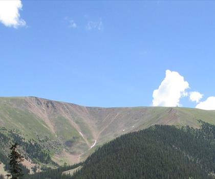
Berthoud pass
Rockies Playground
Hiking near Regina
4 trails to explore ~1225 km away
We work hard to provide the most up-to-date and error-free data possible. If something seems incorrect, let us know! Your contribution helps the whole community.
Hikers' opinions
Be the first to review!
No hiker has shared their experience yet. Share your impressions and help other hikers!