

Ready to explore Berthoud pass? Here's everything you need to know before you go!
Discover the trail
Oh no! We don't have any photos 😢
This trail hasn't been captured yet. Be the first to share your adventure!Trail description
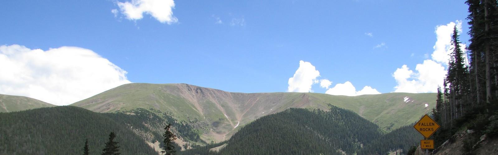
Berthoud Pass sits at one of Colorado's most storied high-mountain crossings, straddling the Continental Divide northwest of Denver. This is genuine alpine terrain — exposed ridgelines, sweeping views in every direction, and the kind of wide-open sky that reminds you why people make the drive up here in the first place. Whether you're coming for a quick summit scramble or a longer ridge walk, Berthoud Pass delivers the high-country experience without requiring a multi-day commitment.
The Terrain
The pass itself sits well above treeline, which means you're stepping into tundra and talus almost immediately. The landscape is dominated by rocky slopes, alpine meadows, and the kind of rugged, wind-sculpted terrain that's characteristic of the Colorado Rockies at elevation. There's no easing into it here — the environment is raw and exposed from the moment you leave the parking area.
The ridgeline running along the Continental Divide offers some of the most rewarding walking in the area. You're literally on the spine of North America, with drainages falling away to both the east and west. On a clear day, the panoramic views stretch across an enormous swath of the Rockies, with peaks layered in every direction as far as you can see.
Trails here tend to follow the natural contours of the ridge rather than switchbacking through dense forest, which gives the hiking a more open, exploratory feel. The footing is rocky in places, and some sections require a bit of route-finding, especially if you're venturing off the more established paths. Trekking poles are genuinely useful on the descent.
What to Expect on the Trail
Because the trailhead starts at such high elevation, even fit hikers feel the altitude here. If you're coming from lower elevations — especially if you drove up the same morning — give yourself time to acclimatize before pushing hard. Headaches and shortness of breath are common for visitors not yet adjusted to the thin air.
The exposed nature of the terrain means weather moves in fast. Afternoon thunderstorms are a real concern during summer months, and the open ridgeline offers zero shelter when lightning starts. Starting early is the standard advice, and it's worth taking seriously at a place like Berthoud Pass. By midday, keep an eye on the sky and be ready to turn around if clouds are building.
Wind is a near-constant companion on the ridge. Even on warm days, the gusts can make it feel significantly colder than the temperature suggests. Layering is essential — a light shell and an insulating layer should be in your pack regardless of how sunny it looks when you leave the car.
Wildlife and Natural Environment
The alpine tundra around Berthoud Pass supports a distinct community of plants and animals adapted to the harsh conditions above treeline. Marmots are a common sight, often spotted sunning themselves on boulders or letting out their distinctive warning calls. Pikas — small, round relatives of rabbits — are also present in the rocky talus fields, though they're easier to hear than to spot.
The wildflower display in midsummer can be impressive across the meadow sections, with a variety of alpine species taking advantage of the short growing season. The tundra vegetation itself is worth paying attention to — the low-growing plants here are remarkably resilient, but also extremely fragile underfoot. Staying on established trails and rocky surfaces helps protect this slow-recovering ecosystem.
Larger wildlife including elk and mule deer are present in the broader area, particularly at dawn and dusk when they move between elevations.
Access and Parking
Berthoud Pass is accessible via US Highway 40, which runs directly over the pass. The highway is well-maintained and the approach is straightforward from either side of the Divide. Parking is available at the pass summit, making this one of the more accessible high-alpine trailheads in the region — you don't need a long approach hike just to reach the good terrain.
The area is managed as part of the Arapaho National Forest. No entrance fee is required to access the trailhead, though some specific recreation areas nearby may have different regulations. It's always worth checking current conditions with the forest service before heading out, particularly early and late in the season when snow can linger on the upper slopes well into what feels like summer.
Seasons and Timing
The window for hiking at Berthoud Pass is shorter than at lower-elevation trailheads. Snow typically closes or significantly complicates access to the upper terrain from late fall through late spring. The prime hiking season runs roughly from early July through September, though this varies year to year depending on snowpack.
Early July often still sees snow patches on north-facing slopes and in sheltered gullies. By August, conditions are generally at their best — trails are clear, wildflowers are out, and the days are long. September brings cooler temperatures and the first hints of fall color in the willows and shrubs below treeline, along with the possibility of early-season snowfall returning to the high country.
Winter and early spring bring a completely different set of users to Berthoud Pass, with backcountry skiers and snowshoers taking advantage of the terrain. If you're visiting outside the summer hiking season, the conditions and appropriate gear requirements change substantially.
Tips Before You Go
- Start early. Afternoon thunderstorms are common and the exposed ridgeline is no place to be when lightning arrives.
- Dress in layers. Wind and temperature can shift quickly at this elevation, even in summer.
- Acclimatize if you can. Spending a night at elevation before tackling the ridge makes a real difference.
- Bring plenty of water. There's no reliable water source at the trailhead, and the dry alpine air accelerates dehydration.
- Protect the tundra. Stay on rock and established trail surfaces to avoid damaging the fragile alpine vegetation.
- Check road and trail conditions. Snow can persist on the upper terrain well into summer, and conditions change quickly in the mountains.
Berthoud Pass is the kind of place that earns its reputation through the quality of the experience rather than any single dramatic feature — it's the combination of easy high-elevation access, genuine alpine terrain, and that unmistakable feeling of standing on the roof of the continent that keeps people coming back.
The Essential Hiking Checklist
Everything you need for your next hike. Bilingual, printable, 1 page.
Get your free hiking checklistRecommended gear for this trail
As an Amazon Associate I earn from qualifying purchases.


Ready to go?
Everything you need to know before you goWhen?
How much?
As an Amazon Associate I earn from qualifying purchases.
Affiliate links — LGPO may earn a commission at no extra cost to you.
- Hiking shoes Essential
- → Salomon Elixir Tour Mid WP · 203.38 $
- Layered clothing Essential
- Rain jacket Essential
- Trekking poles
- → Black Diamond Trail Ergo Cork · 69.99 $
- Headlamp
- → Petzl Actik Core 625 · 103.95 $
FAQ - Frequently asked questions
Everything you need to knowSimilar hikes nearby
Discover other trails you might enjoy

Colorado River
Rockies Playground

Colorado River Trail
Rockies Playground
Continental Divide National Scenic Trail
Rockies Playground
Continental Divide Trail
Rockies Playground
Red & White Mountain
Rockies Playground
Government Trail
Rockies Playground
Hiking near Regina
4 trails to explore ~1187 km away
We work hard to provide the most up-to-date and error-free data possible. If something seems incorrect, let us know! Your contribution helps the whole community.
Hikers' opinions
Be the first to review!
No hiker has shared their experience yet. Share your impressions and help other hikers!